Schloß Brandhof - Hochweichsel (on path 853)
Starting point: Schloß Brandhof (1080 m)
| Latitude/Longitude: | 47,63514°N 15,30228°E |
| |
Route name: on path 853
Walking time: 4 h
Difficulty: easy marked way, easy unmarked way
Elevation gain: 926 m
Elevation difference along the route: 1060 m
Map:
Recommended equipment (summer):
Recommended equipment (winter): ice axe, crampons
Views: 106
 | 1 person like this post |
Access to starting point:
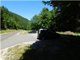
From the border crossing Šentilj we continue driving on the highway towards Gradec / Graz and further towards Linz and Salzburg. We soon leave highway A9 and continue driving slightly right in the direction of Vienna / Wien, proceeding along the expressway S35. Near the settlement Bruck an der Mur, we reach highway S16 and follow it in the direction of Vienna. A little further beyond the tunnel, we leave the highway and take the exit for Kapfenberg, then follow the signs for the mentioned town. We soon reach the main road 116, and from the nearby intersection, we turn slightly right toward the settlements Thörl and Mariazell. In the settlement Thörl we continue on the main road towards Mariazell, then drive over the Seebergsattel mountain pass and continue further. Next follows a descent past the turn-off for Schloß Brandhof; shortly after the bridge over Golkardbach stream, we park in the parking area on the right side of the road.
Route description:
From the parking lot, we first carefully cross the main road and continue along the northern access road towards Schloß Brandhof, but after just a few steps we turn right onto a footpath marked for Graualm, Aflenzer Staritzen and Hochschwab. Next comes a short ascent along a forest path, after which we reach a junction of forest roads. We turn right onto the upper road (the lower one leads back to the main road, while the left one goes to the mansion), which then ascends diagonally to the right. Higher up, we leave the road to the left onto a marked footpath that, a few minutes later, rejoins another forest road. We continue right along it and descend gently to a junction where we return to the road we had left lower down. We continue straight ahead, following the blazes. Just before a fence, a marked path coming from the settlement Gollrad joins us from the right.
We continue straight towards the mountain pasture Graualm. For a short while we still follow the road, then turn left onto a footpath that higher up crosses the forest road several more times. Higher up, during the ascent, a nice view opens towards the settlement Gollrad, and a little further on we return to the road. Next follows a somewhat longer diagonal ascent to the right. At several places a beautiful view opens onto the surrounding mountains. After this panoramic section we cross a pasture fence and quickly reach the mountain pasture Leitenalm, where a few cottages can be seen above the road.
We then traverse a strip of sparse forest, after which the road, running alongside a pasture, brings us to the central part of the mountain pasture Graualm, where the mountain hut Hälterhütte is located.
Before the mountain hut we turn left towards the peak Hochschwab and several other directions, then bypass a smaller mountain hut on the lower left side. Behind it we leave the cart track to the left onto an initially poorly visible footpath, which higher up ascends through a small valley and a few minutes later returns to the cart track. The path ahead continues along the cart track, from which an increasingly beautiful view of the surrounding mountains opens up, and the path gradually transitions from the cart track onto the trail named Prinzensteig. Here the path turns slightly to the right and begins traversing upwards through dwarf pines. When we leave the dwarf pines higher up, the path flattens and we reach a junction where we join trail 855 that starts from the Seebergsattel pass.
We continue right towards Hochschwab and gradually begin to ascend more steeply on a mostly grassy slope.
The path ahead returns to the ridge and then continues with fine views to a junction where the Gamssteig path (and another path from the Seebergsattel pass) joins from the left.
We continue slightly right and move from the ridge onto the grassy slopes of Krautgartenkogel, ascending diagonally across them to a small saddle between Krautgartenkogel (left) and the area called Höllstein (right).
Here the marked path begins to descend diagonally; looking to the right, a beautiful view opens towards Hochweichsel. Lower down we reach the Niedere Scharte saddle, where we leave the marked path that continues towards the Hochschwab summit and instead head right and down towards the Hochweichsel summit.
The turn-off is marked; the onward path is no longer marked but is well-trodden, so in snow-free conditions and good weather there are no orientation problems. We descend for a few more minutes, then enter a small valley from which we start climbing to the left; once we reach the southwest slopes of the mountain the path turns right and then ascends with increasingly beautiful views to the cross on the summit.
Starting point - Leitenalm 1:30, Leitenalm - Graualm 0:15, Graualm - Niedere Scharte 1:55, Niedere Scharte - Hochweichsel 0:35.
The description and photos reflect the conditions in September 2025.

Photos:
 1
1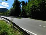 2
2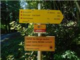 3
3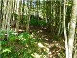 4
4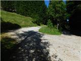 5
5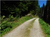 6
6 7
7 8
8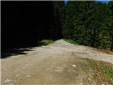 9
9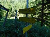 10
10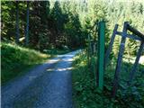 11
11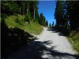 12
12 13
13 14
14 15
15 16
16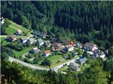 17
17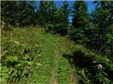 18
18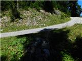 19
19 20
20 21
21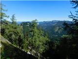 22
22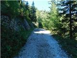 23
23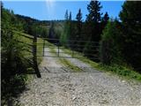 24
24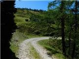 25
25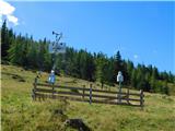 26
26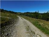 27
27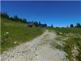 28
28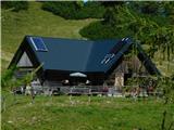 29
29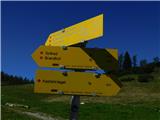 30
30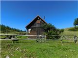 31
31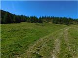 32
32 33
33 34
34 35
35 36
36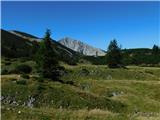 37
37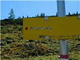 38
38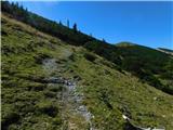 39
39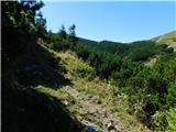 40
40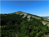 41
41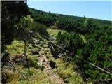 42
42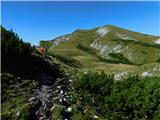 43
43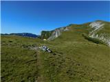 44
44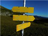 45
45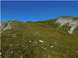 46
46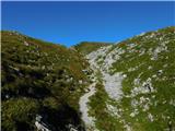 47
47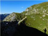 48
48 49
49 50
50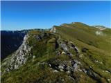 51
51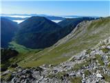 52
52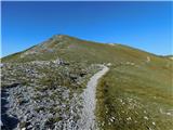 53
53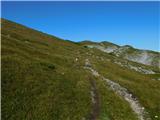 54
54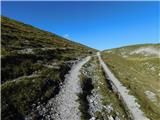 55
55 56
56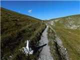 57
57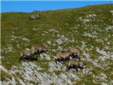 58
58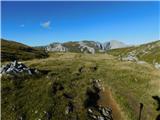 59
59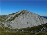 60
60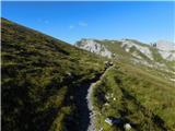 61
61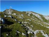 62
62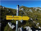 63
63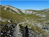 64
64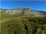 65
65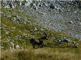 66
66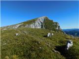 67
67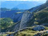 68
68 69
69 70
70 71
71 72
72 73
73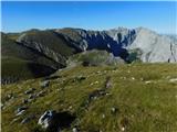 74
74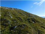 75
75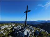 76
76
Discussion about the trip Schloß Brandhof - Hochweichsel (on path 853)
To post a comment you must log in:
If you do not yet have a username, you must first
register.