Sedlo nad Lohačo - Špilnik (lower path)
Starting point: Sedlo nad Lohačo (829 m)
| Latitude/Longitude: | 45,83758°N 14,20469°E |
| |
Route name: lower path
Walking time: 30 min
Difficulty: easy marked way
Elevation gain: 189 m
Elevation difference along the route: 189 m
Map: Snežnik 1:50 000 PZS
Recommended equipment (summer):
Recommended equipment (winter):
Views: 876
 | 1 person like this post |
Access to starting point:
To the starting point, we can drive:
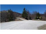
a) From central Slovenia we drive on the highway to the Unec exit, then we go right towards Planina. When we arrive in the settlement, we turn left towards Postojna, then pay attention at the end of the settlement, where signposts direct us right towards Strmci and Predjama. We follow this road straight at the next intersection and quite soon arrive at the Lohača settlement, where we turn right uphill. The asphalt road changes into macadam, and we continue to the saddle, where there are mountaineering signs and a cross. We park nearby.
b) From Primorska we drive to Postojna, where we continue towards Predjama. We drive past the village Zagon, then we turn right towards Studenec and Strmci. We follow this road to the Lohača settlement, where we turn left uphill. The asphalt road changes into macadam, and we continue to the saddle, where there are mountaineering signs and a cross. We park nearby.
Route description:
At the starting point, we turn left in the direction of Sveti Lovrenc. After approximately a minute of walking, where there is a turn-off for the upper path past Lipovec, we continue slightly left on a cart track. We follow it in easy ascent through the forest, where we go right upwards (there the path from the church of Marija Snežna - Strmca joins). We soon get to the saddle between Lipovec and Špilnik, where from the right comes the upper path. We go left and for a short time still continue straight upwards, then the markings and cairns invite us right to the forepeak of Špilnik. We follow the path past a rope fence. Through visible consequences of the ice storm, after a few minutes we ascend to the forepeak, then the path turns towards the north and soon reaches the main peak.
Photos:
 1
1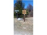 2
2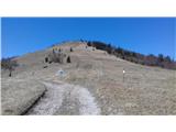 3
3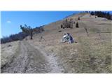 4
4 5
5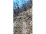 6
6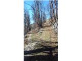 7
7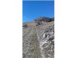 8
8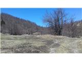 9
9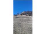 10
10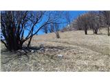 11
11 12
12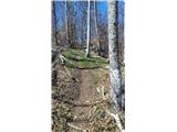 13
13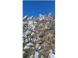 14
14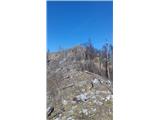 15
15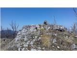 16
16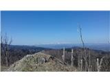 17
17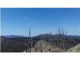 18
18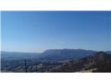 19
19
Discussion about the trip Sedlo nad Lohačo - Špilnik (lower path)
To post a comment you must log in:
If you do not yet have a username, you must first
register.