Seebergsattel - Mieserkogel (on path 855)
Starting point: Seebergsattel (1246 m)
| Latitude/Longitude: | 47,62559°N 15,28256°E |
| |
Route name: on path 855
Walking time: 2 h
Difficulty: easy marked way, easy pathless terrain
Elevation gain: 609 m
Elevation difference along the route: 660 m
Map:
Recommended equipment (summer):
Recommended equipment (winter): ice axe, crampons
Views: 104
 | 1 person like this post |
Access to starting point:
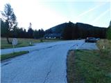
From the border crossing Šentilj we continue driving on the highway towards Gradec / Graz and further towards Linz and Salzburg. We soon leave highway A9 and continue driving slightly right in the direction of Vienna, proceeding along the expressway S35. Near the settlement Bruck an der Mur, we reach highway S16 and follow it in the direction of Vienna. A little further beyond the tunnel, we leave the highway and take the exit for Kapfenberg, then follow the signs for the mentioned town. We soon reach the main road 116, and from the nearby intersection, we turn slightly right toward the settlements Thörl and Mariazzel. In the settlement Thörl we continue along the main road towards Mariazzel, then follow the main road up to the Seebergsattel pass, where on the right side of the road we notice a larger asphalt parking lot.
Route description:
From the parking lot, we first carefully cross the main road, then head slightly left onto the path towards Hochschwab. The path initially ascends through the forest, where we cross a minor road; after passing a pasture fence, we reach the edge of a larger grassy slope.
We continue along the panoramic section and at the junction of cart tracks keep straight ahead (left is the path Gamssteig). From the junction we ascend for a few more minutes along the panoramic cart track; when the track bends more sharply to the right, we turn left onto the footpath that leads back into the forest. A little further ahead the marked path leaves the ridge slightly to the left and moves onto steeper slopes (straight ahead an unmarked trail continues towards the summit of Seeleiten); we traverse these slopes for some time without major changes in elevation. Later the path begins to climb steeply, and because of the steepness extra caution is required, especially when wet or during descent. Next comes the ascent over a steep grassy slope that offers a beautiful view of the mountains above the Seetal valley; higher up the path enters dwarf pine. Higher still the dwarf pine thins out and, after a grassy section, we reach the edge of the plateau where the path forks.
We continue left (right leads to Seeleiten, 5 minutes) and follow the initially gentle path across the plateau-like terrain; later we ascend moderately for a while, and after reaching a small side grassy ridge we make a short descent to a marked junction where the Prinzensteig path joins from the right.
We continue straight towards Hochschwab and gradually begin a steeper ascent up a mostly grassy slope. When the path flattens at the higher elevation, we leave the marked trail to the right towards the nearby grassy summit Mieserkogel, where we first descend easily, then quickly but gently ascend to the nearby peak.
The description and photos reflect the conditions in September 2025.

Photos:
 1
1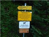 2
2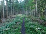 3
3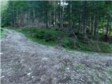 4
4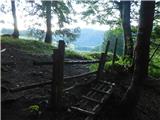 5
5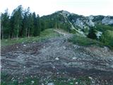 6
6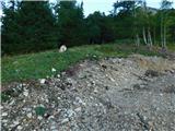 7
7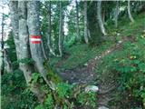 8
8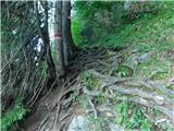 9
9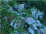 10
10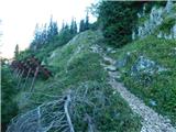 11
11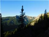 12
12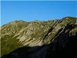 13
13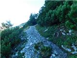 14
14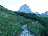 15
15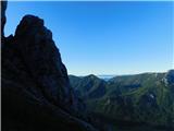 16
16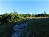 17
17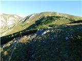 18
18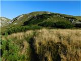 19
19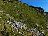 20
20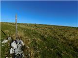 21
21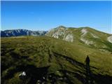 22
22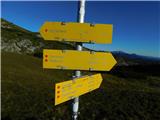 23
23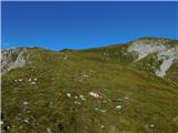 24
24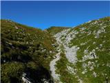 25
25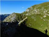 26
26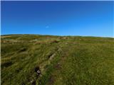 27
27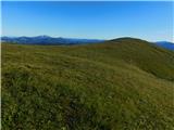 28
28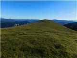 29
29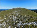 30
30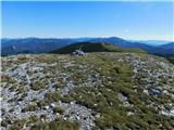 31
31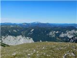 32
32
Discussion about the trip Seebergsattel - Mieserkogel (on path 855)
To post a comment you must log in:
If you do not yet have a username, you must first
register.