Starting point: Seichenbrunn (1668 m)
| Latitude/Longitude: | 46,91536°N 12,77544°E |
| |
Walking time: 5 h
Difficulty: very difficult marked way
Via ferrata: C
Elevation gain: 1538 m
Elevation difference along the route: 1580 m
Map:
Recommended equipment (summer): helmet, self belay set
Recommended equipment (winter): helmet, self belay set, ice axe, crampons
Views: 9.079
 | 4 people like this post |
Access to starting point:
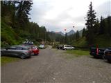
Through the Karawanks Tunnel, we drive to Austria, and then we continue driving towards Spittal and further towards Lienz (a little after Spittal the highway ends). Further, we drive on a relatively nice and wide road through the Drau Valley. A little before Lienz at the roundabout, we continue right towards the places Iselsberg and Winklern. The road starts ascending, and then we have to pay attention because the road soon branches off to the left towards the Debanttal valley (green sign). The road towards the Debanttal valley becomes a macadam road, and later it joins a somewhat nicer road from the place Nußdorf-Debant. When driving through the Debanttal valley, we then follow the signs for the mountain huts Lienzer Hütte and Wangenitzseehütte. We follow the road all the way to the gate where we park on a large parking lot (Parkplatz Seichenbrunn).
Route description:
From the parking lot, we continue on a macadam road which is closed to traffic. Already after a few dozen meters, we come to a marked junction where the path towards the mountain hut Wangenitzseehütte branches off to the right over a bridge. At the junction, we continue straight ahead on the macadam road following the signs »Lienzer Hütte«. Soon after that, an educational path towards the mountain hut Lienzer Hütte also branches off to the right. This path is half an hour longer than by road. We continue further on the macadam road, which runs left of the Debantbach stream. The road gently ascends all the time and crosses a pasture fence several times. In the summer months, livestock grazes along the road. The road then leads us past a small hut at the Gaimbergalm pasture. Further on, we also cross smaller tributaries of the aforementioned Debantbach stream several times. Somewhat higher up, the road brings us to a junction.
To the right, the road leads to the Hofalm pasture, which is only 100 meters away. At the junction, we continue straight ahead on the road towards the Lienzer Hütte hut from which we have an increasingly beautiful view of the peaks above the Debanttal valley. A little before the hut, we come to another marked junction.
This time, a footpath branches off to the left towards the Zettersfeld ski area, but we continue on the road and soon reach the Lienzer Hütte hut from which there is a nice view of the surrounding peaks.
At the hut, we continue left past the children's playground and cross and already after a few dozen meters we reach a marked junction. To the left, the path leads towards the Mirnitzscharte notch and the Alkuser Rotspitze summit, but we continue right following the signs »Glödis Spitz, Hochschober«.
From the junction, the path runs northwest past increasingly sparse trees. Further on, the path ascends along terrain covered with grass and low bushes. Soon we also enter the central part of the Hohe Tauern National Park (Nationalpark Hohe Tauern). The path then brings us to another junction.
Here we leave the path towards the Hochschoberhütte hut and the Hochschober summit and turn right following the signs »Glödis«. From the junction, the path first gently descends, then crosses several streams over small bridges. Further on, we ascend for some time along a trail running left of the Debantbach stream. Later we cross the stream to the right side and continue ascending towards the north. The streams along the path disappear, and the path soon brings us to another junction.
This time, a path branches off to the left towards the Kalser Törl saddle, but we continue right towards the Glödisspitze summit. From the junction, we then walk briefly towards the east on increasingly rocky terrain. The path then turns left again towards the north and ascends diagonally up a steep slope. When the slope becomes less steep, the path turns slightly right and ascends rocky terrain towards the southeast ridge of the Glödisspitze mountain, which we have been able to observe from the path for some time. On the ridge where beautiful views open towards the east, we continue left and soon reach the entrance to the protected section of the path.
The protected path runs the whole time on and along the southeast ridge. For most of the time, the path ascends quite steeply along the steel cable (difficulty up to B). Higher up, the path leads to a suspension bridge, which can also be avoided via an easier path running along the right side of the ridge. If we continue over the bridge, an ascent up a ladder follows, then a short very steep section along the steel cable (difficulty up to C). The paths soon reunite, and the route continues along the well-protected ridge. The protected path is subsequently somewhat less demanding and steep than in the initial section (difficulty up to A/B). We follow the not overly demanding and increasingly panoramic ridge path all the way to the summit, on which stands a cross.
We descend along the ascent path.

Photos:
 1
1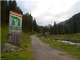 2
2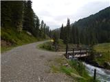 3
3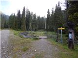 4
4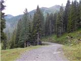 5
5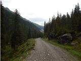 6
6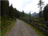 7
7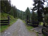 8
8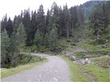 9
9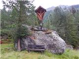 10
10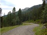 11
11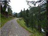 12
12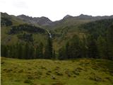 13
13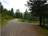 14
14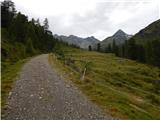 15
15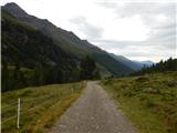 16
16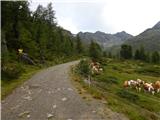 17
17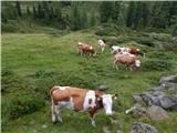 18
18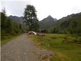 19
19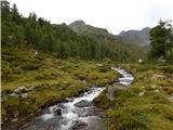 20
20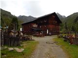 21
21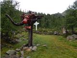 22
22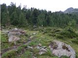 23
23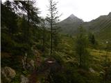 24
24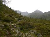 25
25 26
26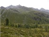 27
27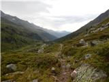 28
28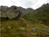 29
29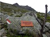 30
30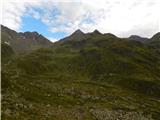 31
31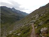 32
32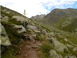 33
33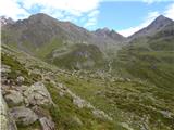 34
34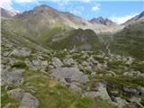 35
35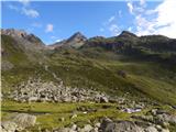 36
36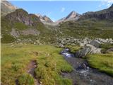 37
37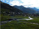 38
38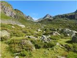 39
39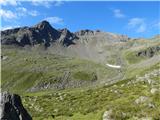 40
40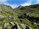 41
41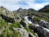 42
42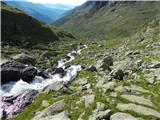 43
43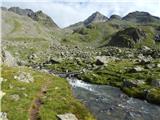 44
44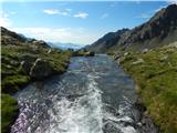 45
45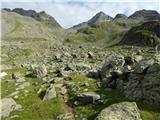 46
46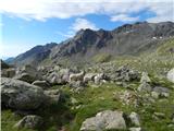 47
47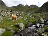 48
48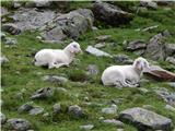 49
49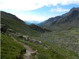 50
50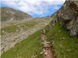 51
51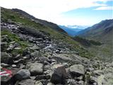 52
52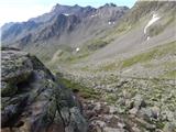 53
53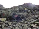 54
54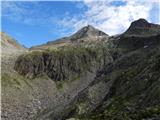 55
55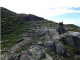 56
56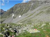 57
57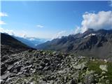 58
58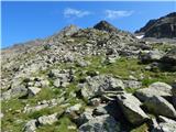 59
59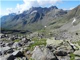 60
60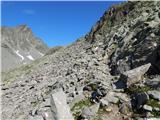 61
61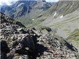 62
62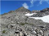 63
63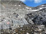 64
64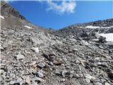 65
65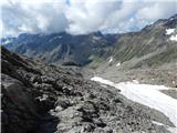 66
66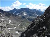 67
67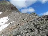 68
68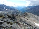 69
69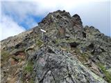 70
70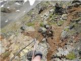 71
71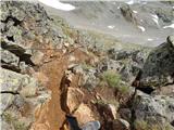 72
72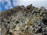 73
73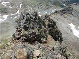 74
74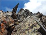 75
75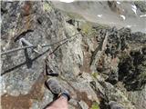 76
76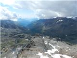 77
77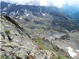 78
78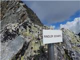 79
79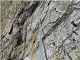 80
80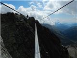 81
81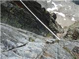 82
82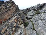 83
83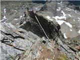 84
84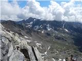 85
85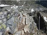 86
86 87
87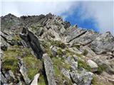 88
88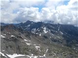 89
89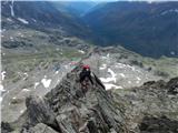 90
90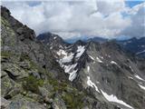 91
91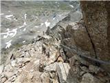 92
92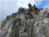 93
93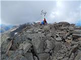 94
94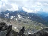 95
95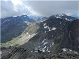 96
96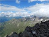 97
97
Discussion about the trip Seichenbrunn - Glödis
|
| Trobec25. 07. 2018 |
Has anyone been here in the last days? Interested in conditions, especially if still any snow.
|
|
|
|
| pohodnik3334. 09. 2023 16:53:03 |
Trip on 2.9.2023, all dry no snow.
This mountain IMO most visited or among most in this narrow group of 3000ers north of Lienz towards Großglockner and deservedly. Very nice ascent, fairly flowing. Valley wonderful, streams beside it too, very nice. Ascent throughout easy-demanding, except last 200 height meters 3000-3200m where chain up to C difficulty as author described. Rock so-so, at least 2 large holds wobbly. Aids flawless.
View superb.
Regards
|
|
|
To post a comment you must log in:
If you do not yet have a username, you must first
register.