Seichenbrunn - Kruckelkopf
Starting point: Seichenbrunn (1668 m)
| Latitude/Longitude: | 46,91536°N 12,77544°E |
| |
Walking time: 4 h 30 min
Difficulty: difficult marked way, difficult pathless terrain
Elevation gain: 1513 m
Elevation difference along the route: 1585 m
Map:
Recommended equipment (summer): helmet, ice axe, crampons
Recommended equipment (winter): helmet, ice axe, crampons
Views: 5.064
 | 4 people like this post |
Access to starting point:
Through the Karawanks Tunnel, we drive to Austria, and then we continue driving towards Spittal and further towards Lienz (the highway ends a little after Spittal). Further, we drive on a relatively nice and wide road through the Drau valley. A little before Lienz at the roundabout, we continue right towards the places Iselsberg and Winklern. The road starts ascending, and then we have to pay attention because the road soon branches off to the left towards the valley Debanttal (green sign). The road towards the valley Debanttal becomes a macadam road, and later it joins a somewhat nicer road from the settlement Nußdorf-Debant. When driving through the valley Debanttal, we then follow the signs for the huts Lienzer Hütte and Wangenitzseehütte. We follow the road all the way to the barrier where we park on the larger parking lot (Parkplatz Seichenbrunn).
Route description:
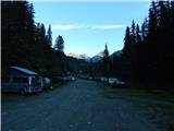
From the parking lot, we continue on a macadam road which is closed to traffic. Already after a few dozen meters, we come to a marked junction where we continue right over a bridge following the signs »Wangenitzseehütte«. Straight on the macadam road leads the path towards the hut Linzer Hütte.
Our path then turns right and ascends over a grassy slope and brings us into the forest. For some time we then walk on a wide path which runs towards the east, and then signposts direct us to the left and the path starts to ascend more steeply. The path here runs mostly on grassy slopes beside increasingly sparse forest. Higher, we then cross a fence and the path brings us to a mountain pasture where livestock grazes in the summer months.
The path here becomes flatter and crosses grassy slopes below the cargo cableway towards the northwest. From the path, we have here a nice view mainly on the mountains above the valley Debanttal. The path from the mountain pasture then turns slightly to the right and starts to ascend more steeply again and brings us to a marked junction.
Left leads the path towards the hut Linzer Hütte, and we continue right towards the hut Wangenitzseehütte. The path from the junction then crosses somewhat steeper slopes below the summit Feldkopf towards the east, and then follows again a somewhat steeper ascent to the notch Untere Seescharte.
On the notch where the view towards the east opens, the path descends slightly and brings us past the high-alpine lakes Kreuzsee and Wangenitzsee to the hut Wangenitzseehütte.
At the hut, we continue towards the northeast following the signs »Petzeck«. After a short ascent, the path brings us to a marked junction where we turn left upwards following the signs »Kruckelkopf«, and straight leads the path towards the summit Petzeck.
From the junction, the path starts to ascend towards the north on an initially still grassy slope. During the ascent we have to pay somewhat more attention to the markings, because the trail is poorly visible. Higher, the path brings us to a rocky slope where we soon come to a junction which is very hard to notice. Straight through the valley leads a marked path towards the notch Perschitzscharte, slightly right upwards a direct path towards the summit Kruckelkopf. Which path to choose depends mainly on the snow conditions. The path from the notch to the summit is considerably steeper, but it also becomes snow-free much earlier.
If we decide to continue on the path towards the notch, the path will lead us on the right side of the valley. During the ascent to the notch we can also in summer cross some snowfield, which is less steep than on the direct path to the summit. Nevertheless, in case of hard snow it is recommended to use an ice axe and crampons.
When we reach the notch Perschitzscharte, we continue right upwards along the ridge. Here we will look in vain for markings, because the path from the notch to the summit is not marked. Occasionally we will notice only a few cairns along the ridge. The ascent along the ridge is otherwise quite steep and is followed by some easy scrambling along the ridge. The ridge then becomes less steep and is followed by an easy ascent to the summit.
The markings which we will notice on the summit should not mislead us, because they do not lead back to the notch Perschitzscharte.
We can descend along the ascent path via the notch Perschitzscharte or along the marked path on the southwestern slopes of the mountain. If we descend along the marked path we must consider that snowfields may still be present on the path late into the summer and that we will very likely need an ice axe and crampons.

Along the route: Untere Seescharte (2533m), Kreuzsee (2483m), Wangenitzsee (2465m),
Wangenitzseehütte (2508m), Perschitzscharte (2979m)
Photos:
 1
1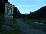 2
2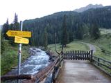 3
3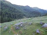 4
4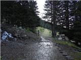 5
5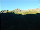 6
6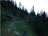 7
7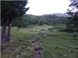 8
8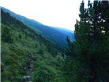 9
9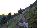 10
10 11
11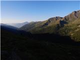 12
12 13
13 14
14 15
15 16
16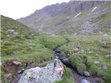 17
17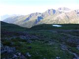 18
18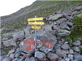 19
19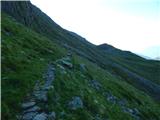 20
20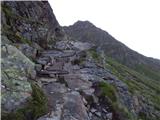 21
21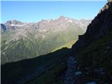 22
22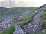 23
23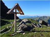 24
24 25
25 26
26 27
27 28
28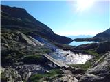 29
29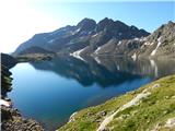 30
30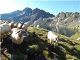 31
31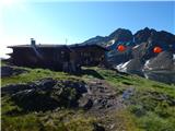 32
32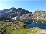 33
33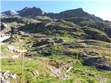 34
34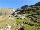 35
35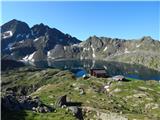 36
36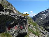 37
37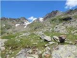 38
38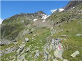 39
39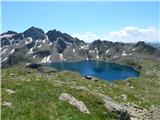 40
40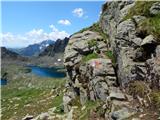 41
41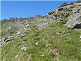 42
42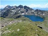 43
43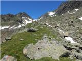 44
44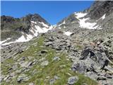 45
45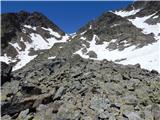 46
46 47
47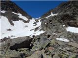 48
48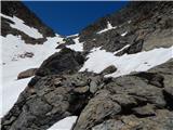 49
49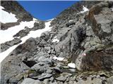 50
50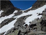 51
51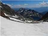 52
52 53
53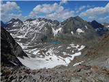 54
54 55
55 56
56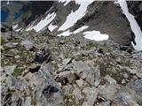 57
57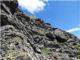 58
58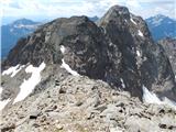 59
59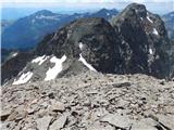 60
60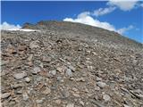 61
61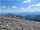 62
62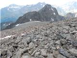 63
63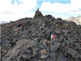 64
64 65
65 66
66 67
67 68
68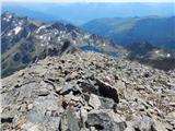 69
69 70
70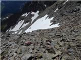 71
71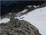 72
72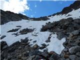 73
73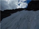 74
74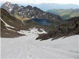 75
75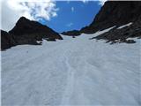 76
76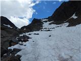 77
77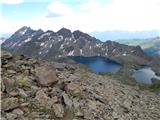 78
78
Discussion about the trip Seichenbrunn - Kruckelkopf
|
| Bandzo27. 09. 2013 |
Last year I was at Petzeck and I have to admit that this path to Wangenitzseehütte is really wonderful! Debental valley too. Great trip and tour!
|
|
|
|
| Janiel744. 07. 2022 20:01:40 |
Nine years without any post, so it's good to have some refreshment. The path on the SW slopes is marked all the way to the top, but this year the path is completely dry already now (the first steep snowfield can be bypassed without major difficulties on the right side). Exceptional viewpoint on the surrounding peaks and also far around. Already during the ascent, you involuntarily turn back again and again and marvel at the beauty of both lakes by the hut. This way I completed the trio of 3000m+ around here besides Petzeck and Hoher Perschitzkopf and climbed my 25th three-thousander 
|
|
|
|
| Robie17. 08. 2023 13:07:23 |
I recommend the route via Nußdorf-Debant, significantly better asphalted road (in the lower part) than the one described from 2013. It is also fully marked, but the markings need renovation. The path is completely dry or small snowfields can be easily bypassed, so no need for ice axe and crampons. Also, the path is not technically demanding.
|
|
|
To post a comment you must log in:
If you do not yet have a username, you must first
register.