Seichenbrunn - Lienzer Hütte
Starting point: Seichenbrunn (1668 m)
| Latitude/Longitude: | 46,91536°N 12,77544°E |
| |
Walking time: 1 h
Difficulty: easy marked way
Elevation gain: 309 m
Elevation difference along the route: 309 m
Map:
Recommended equipment (summer):
Recommended equipment (winter):
Views: 1.100
 | 3 people like this post |
Access to starting point:
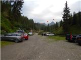
Through the Karawanks Tunnel, we drive to Austria, and then we continue driving towards Spittal and onwards towards Lienz (a little after Spittal the highway ends). Further, we drive on a relatively nice and wide road through the Drau Valley. A little before Lienz at the roundabout, we continue right towards the places Iselsberg and Winklern. The road starts ascending, and then we have to pay attention because the road soon branches off to the left towards the Debanttal valley (green sign). The road towards the Debanttal valley becomes macadam, and later joins a somewhat nicer road from the place Nußdorf-Debant. When driving through the Debanttal valley, we then follow the signs for the huts Lienzer Hütte and Wangenitzseehütte. We follow the road all the way to a barrier where we park on a larger parking lot (Parkplatz Seichenbrunn).
Route description:
From the parking lot, we continue on a macadam road which is closed to traffic. Already after a few dozen meters, we come to a marked junction where right over a bridge the path towards the mountain hut Wangenitzseehütte branches off. At the junction, we continue ahead on a macadam road following the signs »Lienzer Hütte«. Soon after that a learning path branches off to the right towards the mountain hut Lienzer Hütte. This path is half an hour longer than by road. We still continue on a macadam road, which runs left of the stream Debantbach. The road is all the time slightly ascending and a few times crosses a pasture fence. In the summer months livestock grazes by the road. The road then leads us past a smaller cottage by the mountain pasture Gaimbergalm. Further, we also a few times cross smaller tributaries of the already mentioned stream Debantbach. A little higher the road brings us to a crossroad.
To the right leads the road to the mountain pasture Hofalm to which there are only 100 meters. At the crossroad, we still continue straight on the road towards the mountain hut Lienzer Hütte from which we have an increasingly beautiful view of the peaks above the valley Debanttal. Shortly before the hut, we come to another marked junction.
This time a footpath branches off to the left towards the ski area Zettersfeld, and we continue on the road and soon come to the Lienzer Hütte hut from which there is a nice view of the surrounding peaks.

Along the route: Gaimbergalm (1753m)
Photos:
 1
1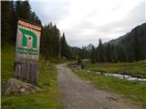 2
2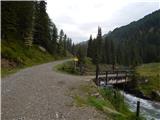 3
3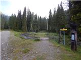 4
4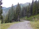 5
5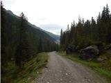 6
6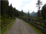 7
7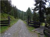 8
8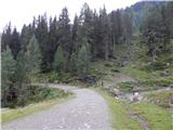 9
9 10
10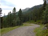 11
11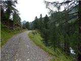 12
12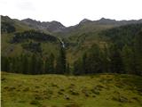 13
13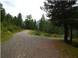 14
14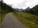 15
15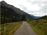 16
16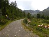 17
17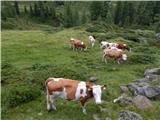 18
18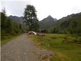 19
19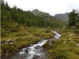 20
20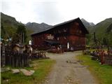 21
21 22
22 23
23
Discussion about the trip Seichenbrunn - Lienzer Hütte
To post a comment you must log in:
If you do not yet have a username, you must first
register.