Selca - Sleme (Površnica)
Starting point: Selca (424 m)
| Latitude/Longitude: | 46,22370°N 14,20450°E |
| |
Walking time: 1 h 35 min
Difficulty: easy unmarked way
Elevation gain: 459 m
Elevation difference along the route: 480 m
Map: Škofjeloško in Cerkljansko hribovje 1:50.000
Recommended equipment (summer):
Recommended equipment (winter): ice axe, crampons
Views: 544
 | 1 person like this post |
Access to starting point:
A) We drive to Škofja Loka, and then we continue driving towards Železniki. When we get to the settlement Selca, we park on the parking lot below the parish church.
B) First, we drive to Železniki, and then we continue driving towards Škofja Loka. When we get to the settlement Selca, we park on the parking lot below the parish church.
Route description:
From the parking lot, we continue on a sidewalk and walk along the road in the direction towards Železniki. Opposite the Mercator Selca store at the pedestrian crossing, we carefully cross the main road, and then behind the store we go right onto the road in the direction of Lajše. When a little ahead the road towards Lajše turns right, we go left onto a side road that leads us past a few more houses and gradually starts to ascend. Behind the last house, a beaten unmarked footpath branches off to the right, which first leads along the edge of the forest and then turns right into the forest through which it ascends on and along the cart track. Higher up, we cross an asphalt road and continue ascending along the best-beaten footpath. After a few minutes, we cross the asphalt road once again, and the path gradually transitions onto a forested ridge, along which we ascend until we reach a hay meadow, from which a beautiful view opens up that reaches all the way to the Alps. On the hay meadow, we continue left, bypass the hayrack on the right side, and a little further ahead we step onto a cart track that ascends diagonally. A little further on, we reach the next hay meadow, which we cross along the far left edge, and the footpath then continues through the forest to the saddle northwest of Lepo brdo.
Here, at a small sign, a short path branches off sharply to the right leading to Lepo brdo, while we continue slightly left and proceed walking along the cart track.
On the saddle, a nice view opens up temporarily, and the path then enters the forest, where from the junction we continue right (straight to Kališe); a few steps further at the fork, we choose the upper left road, from which we go right onto a beaten footpath that begins to ascend steeply through the forest. After a few minutes of steep ascent, we step out of the forest, where the path levels out, and only a good minute of walking separates us from the church of the Holy Cross, which we already see in front of us.
From the church, we continue along the panoramic ridge and then enter the forest, where we proceed along the beaten path, quickly reaching an asphalt road. For a short time, we continue along the asphalt road; when the road turns left, we go straight onto the footpath that continues through the forest. Further on, we cross the slopes of Rožnik, where the path leads us across a hay meadow; when we return to the forest, the path transitions onto the ridge. A little further, we leave the forest and walk across the meadow to the highest point of Sleme or Površnica.
Selca - Holy Cross 1:15, Holy Cross - Sleme 0:20.

Along the route: Sveti Križ nad Selcami (860m)
Photos:
 1
1 2
2 3
3 4
4 5
5 6
6 7
7 8
8 9
9 10
10 11
11 12
12 13
13 14
14 15
15 16
16 17
17 18
18 19
19 20
20 21
21 22
22 23
23 24
24 25
25 26
26 27
27 28
28 29
29 30
30 31
31 32
32 33
33 34
34 35
35 36
36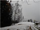 37
37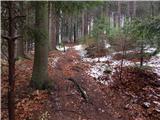 38
38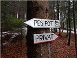 39
39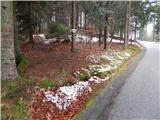 40
40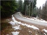 41
41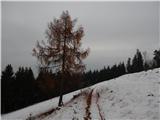 42
42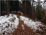 43
43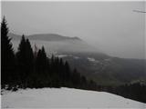 44
44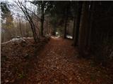 45
45 46
46 47
47
Discussion about the trip Selca - Sleme (Površnica)
To post a comment you must log in:
If you do not yet have a username, you must first
register.