Prelaz Na Žlebeh / Sella Nevea - Punta Plagnis (unmarked mule track)
Starting point: Prelaz Na Žlebeh / Sella Nevea (1188 m)
| Latitude/Longitude: | 46,39080°N 13,47550°E |
| |
Route name: unmarked mule track
Walking time: 4 h 30 min
Difficulty: partly demanding unmarked way
Elevation gain: 1223 m
Elevation difference along the route: 1223 m
Map: Tabacco 019 1:25000 ali Julijske Alpe -Zahodni del (PZS) 1:50000
Recommended equipment (summer): helmet, lamp
Recommended equipment (winter): helmet, ice axe, crampons, lamp
Views: 11.566
 | 3 people like this post |
Access to starting point:
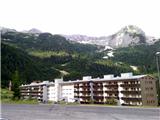
A) Through the border crossing at Rateče we drive to Trbiž/Tarvisio. Just before Trbiž we turn left towards Predel or Bovec and follow the road to the intersection before Rabeljsko jezero. Here we continue right towards the saddle with the nice Slovenian name Na Žlebeh, which the Italians translated to Sella Nevea. On the saddle, we can park on a macadam parking lot below the smaller ski slope on the right, higher side.
B) From Bovec over Predel we descend to the Italian side. Just a little after Rabeljsko jezero at the intersection we continue left towards Sella Nevea/Na Žlebeh.
C) Access is also possible through the Reklanica valley from Kluže/Chiusaforte (a settlement on the road Videm - Trbiž).
Route description:
By the road we will notice several signposts that mark path 625 towards the Corsi hut. We ascend beside the ski slope on a poorly trodden path that brings us to a macadam road ascending on the right side of the ski slope. For some time we then ascend the road, then the blazes direct us left into the forest. After a short ascent we come to a junction, where we continue right on path 625, while left branches off the path towards the pasture Krni dol/Cragnedul and further towards Pecol and the Brazza hut. The path then continues ascending through the forest and crosses the mountain road several times, bringing us to a junction where left branches off another path towards the Brazza hut. At altitude 1610 m we encounter ruins. Here we leave the marked path 625, which continues right towards the saddle Passo degli Scalini (2022 m), and follow the well-trodden path – mule track into the slopes under Špik nad Špranjo/Modeon del Buinz. The unmarked path gently zigzags across grassy slopes, where in summer it is a real paradise for flower lovers and photographers, and usually also many ibex. The mule track brings us right under the 2351 m high Vrh Krnega dola, which the Italians ingeniously translated into Monte Cregnedul, crosses the ridge and beside it past remains of military structures leads to the summit. Right below the summit there is a cavern with a view on Koštrunove špice and Viš, beside it in easy climbing in a few minutes we reach the summit. On it there is a larger cairn. We continue on the mule track to a distinct notch, where from the Škrbina Prednje Špranje appear the blazes of the secured path Ceria Merlone. We follow the path (and wire) left on an exposed ledge, around the summit structure of Špica v Planji, on which we climb over varied terrain. On the summit there is a larger cairn on a concrete base. Both ascents to the summit are one grade harder than walking on the partly ruined mule track.
Starting point – Vrh Krnega dola 4h; Vrh Krnega dola – Špica v Planji 30 min.

Along the route: Planina Krni dol/Casera Cregnedul di sopra (1515m), ruševine (1610m), Vrh Krnega Dola/Monte Cregnedul (2351m)
Photos:
 1
1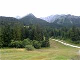 2
2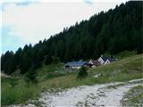 3
3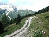 4
4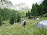 5
5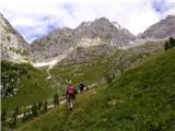 6
6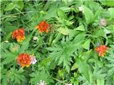 7
7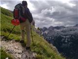 8
8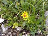 9
9 10
10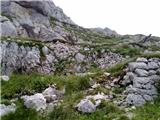 11
11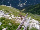 12
12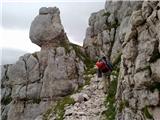 13
13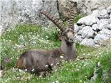 14
14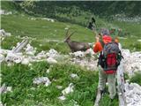 15
15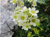 16
16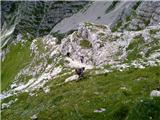 17
17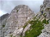 18
18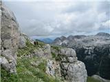 19
19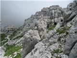 20
20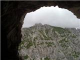 21
21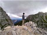 22
22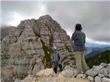 23
23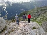 24
24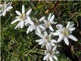 25
25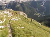 26
26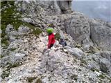 27
27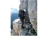 28
28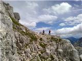 29
29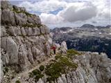 30
30 31
31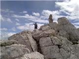 32
32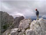 33
33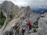 34
34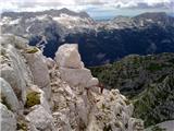 35
35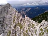 36
36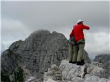 37
37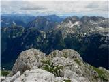 38
38
Discussion about the trip Prelaz Na Žlebeh / Sella Nevea - Punta Plagnis (unmarked mule track)
|
| Robie6. 09. 2022 15:27:49 |
The last part from the cavern continues on a protected path - exemplary condition of cables and pegs, but still recommend a via ferrata set. This part is also quite exposed and the description of partially difficult path doesn't quite hold... As for timing, the summit is reachable at a normal walking pace in about 3.5 hours.
|
|
|
To post a comment you must log in:
If you do not yet have a username, you must first
register.