Nevejski preval - Speleological bivouac Modonutti - Savoia (via 637)
Starting point: Nevejski preval (1190 m)
| Latitude/Longitude: | 46,39070°N 13,48390°E |
| |
Route name: via 637
Walking time: 2 h 20 min
Difficulty: easy marked way
Elevation gain: 718 m
Elevation difference along the route: 760 m
Map: Julijske Alpe - zahodni del 1:50.000
Recommended equipment (summer):
Recommended equipment (winter): ice axe, crampons
Views: 4.131
 | 1 person like this post |
Access to starting point:
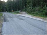
From Kranjska Gora over the border crossing Rateče we drive to Trbiž / Tarvisio. In Trbiž we continue left in the direction of Bovec and we follow the road to the crossroads near Rabeljsko jezero. Here we continue right in the direction of Nevejski preval / Sella Nevea. Further, we drive on an ascending road which higher up makes a few hairpin turns, then just a few dozen meters before the road starts barely noticeably descending, on the left side we notice a poor forest road which branches off sharply to the left from the main road (at the crossroads there is a traffic sign and next to it a rock with blazes - the beginning of our path). Because there are no appropriate parking spots at the crossroads, we drive another good 100 m further and then park on an appropriate spot by the road.
From Bovec we drive to the border crossing Predel, from which we descend to the Italian side. Just a little after Rabeljsko jezero we come to the crossroads, where we continue left in the direction of Nevejski preval / Sella Nevea. Further, we follow the above description.
Route description:
From the starting point we return a little back, then we head onto footpath no. 637, which initially runs along a poor forest road. After a few minutes of easy walking, the blazes direct us right onto a footpath which, with the help of numerous small steps, starts to ascend steeply. A little higher a nice view opens up on the surrounding peaks, the path flattens and returns to the forest. The path continues in moderate ascent (meanwhile it also slightly descends a few times) crossing the slopes to the left, then for a short time it ascends somewhat more steeply and brings us from the steep slopes into transitional flatter terrain. The increasingly panoramic path, which runs along an old military mule track, then leads us across a series of short valleys, traverses and a few short descents. The mentioned path eventually brings us to the foot of the steep, smooth and in places even overhanging western wall of Velika Bavha. Right at the foot of the wall the marked path turns right and then ascends across a short scree slope. A little further on the path turns even more to the right, where after a short traverse it brings us to the edge of a torrent gully. Here we turn sharply left and ascend along the edge of the torrent to its mouth. Here through some sort of natural gates we enter a beautiful high-mountain cirque, where the path completely flattens, and if we are quiet we can also observe numerous marmots.
Through the mentioned cirque we walk slightly to the left, then we join the path from the mountain hut Rifugio Gilberti. We follow the mentioned path to the left, which brings us in a few hairpin turns to the panoramic saddle Vrh Laških brežičev (in Italian Sella Robon), where there is an information board and next to it a table with two benches.
On the saddle we continue left (straight to Jerebica 6 hours) and continue the ascent along an easy-to-follow but henceforth unmarked path. The path ahead ascends across a fairly steep slope, then flattens and brings us to numerous military fortifications. We bypass the mentioned fortifications on the left along a wide artificial ledge, then only a short ascent follows and the path brings us to the caving bivouac Modonutti - Savoia.

Along the route: Vrh Laških brežičev (1884m)
Photos:
 1
1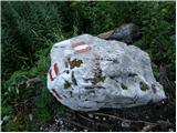 2
2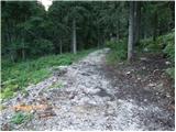 3
3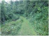 4
4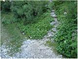 5
5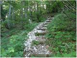 6
6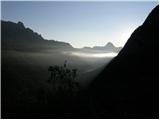 7
7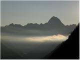 8
8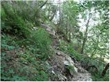 9
9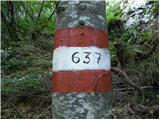 10
10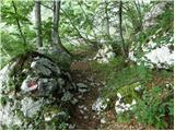 11
11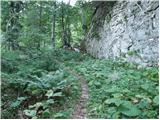 12
12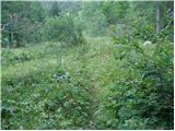 13
13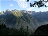 14
14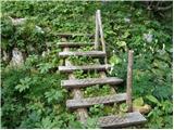 15
15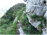 16
16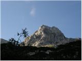 17
17 18
18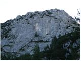 19
19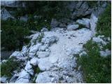 20
20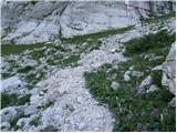 21
21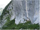 22
22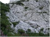 23
23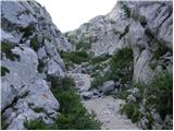 24
24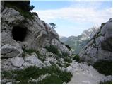 25
25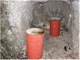 26
26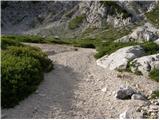 27
27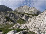 28
28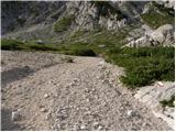 29
29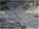 30
30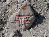 31
31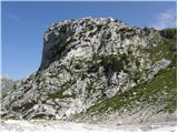 32
32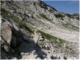 33
33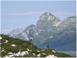 34
34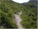 35
35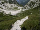 36
36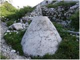 37
37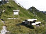 38
38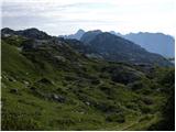 39
39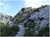 40
40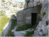 41
41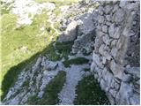 42
42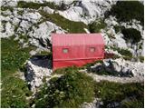 43
43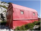 44
44
Discussion about the trip Nevejski preval - Speleological bivouac Modonutti - Savoia (via 637)
To post a comment you must log in:
If you do not yet have a username, you must first
register.