Nevejski preval - Velika Črnelska špica (via 636)
Starting point: Nevejski preval (1170 m)
| Latitude/Longitude: | 46,38740°N 13,47340°E |
| |
Route name: via 636
Walking time: 4 h 45 min
Difficulty: difficult marked way
Elevation gain: 1162 m
Elevation difference along the route: 1450 m
Map: Julijske Alpe - zahodni del 1:50.000
Recommended equipment (summer): helmet
Recommended equipment (winter): helmet, ice axe, crampons
Views: 6.367
 | 2 people like this post |
Access to starting point:
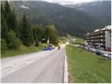
A) First, we drive to Kranjska Gora, and then we continue driving through the border crossing Rateče into Italy. We drive towards Trbiž / Tarvisio, and then at the beginning of the mentioned town, we turn left in the direction of Bovec. Further on, we drive on a regional road towards the border crossing Predel, but we follow the main road to the crossroad near Rabeljsko jezero / Lago del Predil. Here we continue right in the direction of Nevejski preval (V Žlebeh) / Sella Nevea and on an asphalt road we reach the already mentioned saddle. We park on a large parking lot by the lower station of the circular cabin cable car, which runs towards the mountain hut Rifugio Gilberti.
B) First, we drive to Bovec, and then we continue driving towards the border crossing Predel, through which we drive into Italy. There follows a descent to Rabeljsko jezero, after which we leave the main road which leads towards Trbiž and continue driving left in the direction of Nevejski preval (V Žlebeh). The road then starts ascending again, and we follow it to the already mentioned saddle. We park on a large parking lot by the lower station of the circular cabin cable car, which runs towards the mountain hut Rifugio Gilberti.
Route description:
From the parking lot, we head onto a narrow asphalt road that leads us past the Hotel Nevea. After approximately 100 meters of walking, we arrive at a signpost for path no. 636, which directs us left across a meadow onto a marked footpath. The path soon takes us into the forest, through which we ascend further along an old military mule track. Higher up, the forest becomes thinner and thinner, and the path brings us to the ruins of the Poviz barracks amid increasingly frequent beautiful views.
The path ahead continues ascending for a while longer, then takes us to a marked junction, where we continue left towards the Prevala saddle (right to the Rifugio Gilberti hut).
The path ahead levels out somewhat and becomes increasingly scenic. Just a little further on, we reach the next junction. This time, we continue right towards the Prevala saddle (straight ahead to the Vrh Laških brežičev saddle / Sella Robon) along a path that begins to ascend moderately. The wide and well-preserved old military path quickly brings us into rockier terrain, where it begins to turn somewhat more to the right. Higher up, the path takes us to the scree slopes of Lopa, where it ascends somewhat more steeply. A little further on, the marked path comes right up to the upper station of the cable car that connects the Slovenian and Italian sides of the ski area. Here we notice a sign that passage along the old path is prohibited, so we head right onto a poorly trodden path marked with red dots. The path ahead first descends slightly, then climbs up the newly built ski slope, along which we descend to the Prevala saddle in a few minutes.
From Prevala, where five paths meet, we continue left towards Rombon (straight down to Bovec, right to Prestreljenik). We continue eastwards along the path, which gradually leads onto the slopes of Lopa (2406 m), following it through a few ups and downs to a smaller saddle between Lopa and Kotel (1881 m). Here the path turns slightly left and continues past numerous sinkholes that are characteristic of the Kanin mountain range. The path ahead quickly brings us to a junction, where the path to Velika Črnelska špica (2332 m) branches off to the left.
We follow the signs for »Črnjela« (straight to Rombon 2208 m and Speleological Bivouac) along the path that begins to ascend below the slopes of Velika Črnelska špica. The path ahead crosses the slopes to the right, drawing closer and closer to the summit of Mala Črnelska špica, before which the marked path turns left and begins to ascend even more steeply. This is followed by about 15 minutes of ascent up a steep slope that is exposed in places (with a high risk of rockfall too), after which the path levels out and brings us to the summit of Velika Črnelska špica in a few steps.

Along the route: Prevala (2067m)
Photos:
 1
1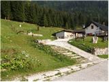 2
2 3
3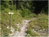 4
4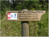 5
5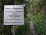 6
6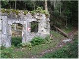 7
7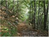 8
8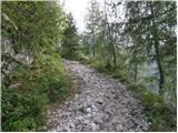 9
9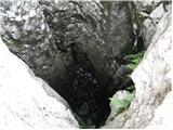 10
10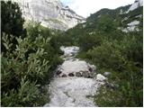 11
11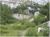 12
12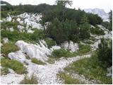 13
13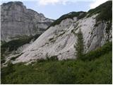 14
14 15
15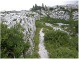 16
16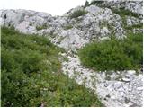 17
17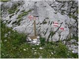 18
18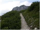 19
19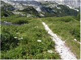 20
20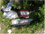 21
21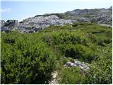 22
22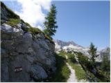 23
23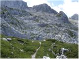 24
24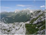 25
25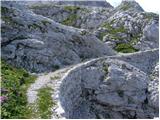 26
26 27
27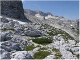 28
28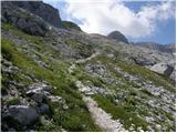 29
29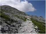 30
30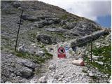 31
31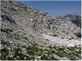 32
32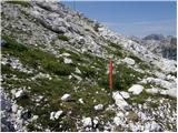 33
33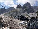 34
34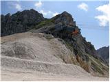 35
35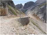 36
36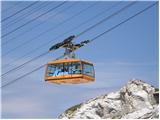 37
37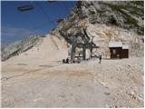 38
38 39
39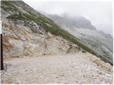 40
40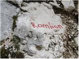 41
41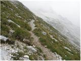 42
42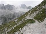 43
43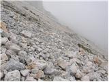 44
44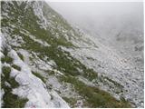 45
45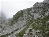 46
46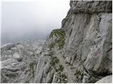 47
47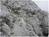 48
48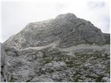 49
49 50
50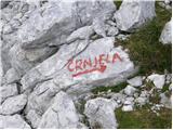 51
51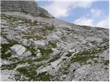 52
52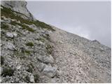 53
53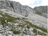 54
54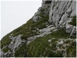 55
55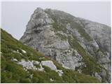 56
56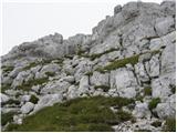 57
57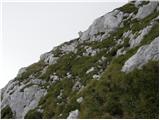 58
58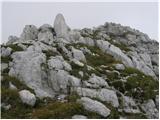 59
59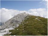 60
60 61
61
Discussion about the trip Nevejski preval - Velika Črnelska špica (via 636)
To post a comment you must log in:
If you do not yet have a username, you must first
register.