Selo nad Polhovim Gradcem - Tošč
Starting point: Selo nad Polhovim Gradcem (710 m)
| Latitude/Longitude: | 46,10170°N 14,29600°E |
| |
Walking time: 1 h
Difficulty: easy marked way
Elevation gain: 311 m
Elevation difference along the route: 315 m
Map: Ljubljana - okolica 1:50.000
Recommended equipment (summer):
Recommended equipment (winter):
Views: 59.903
 | 6 people like this post |
Access to starting point:
a) From the direction of Polhov Gradec: From Horjul or Dobrova we drive to Polhov Gradec, from where we continue driving towards Črni Vrh. A little above Polhov Gradec, at the junction at the confluence of Mala Božna and Velika Božna, we continue straight towards Selo and Škofja Loka (the road to Črni Vrh turns left). For some time we drive along the Mala Božna stream, then at the junction we turn right towards the village of Selo (this is the second right turn from the point where we left the road towards Črni Vrh). We then ascend a rather steep road that levels out higher up, and after a short descent it brings us to the village of Selo. Here we continue right (straight ahead leads to Sveti Ožbolt) and follow the road for only another good 100 meters to the arranged parking lot by the chapel.
b) From the direction of Škofja Loka: From Škofja Loka we take the road that leads through Puštal towards Hrastnica and Log nad Škofjo Loko. We follow the road along the Hrastnica stream up the valley towards the village of Selo. When the valley closes, the road begins to ascend steeply in hairpin bends towards the ridge. When we reach the village of Selo nad Polhovim Gradcem, we soon reach the chapel and the parking lot beside it on the left side (just before the junction for Sveti Ožbolt). The road from the Škofja Loka side is entirely asphalted and regularly plowed in winter.
Route description:
From the parking lot by the chapel we take the road where we see signs for Tošč and the church of St. Jedert. The road, which barely ascends noticeably, quickly brings us out of the forest, where we see the church of St. Jedert ahead, which we reach after a few more minutes of walking.
From St. Jedert we continue left, first across a scenic grassy meadow that ends at a strip of sparse forest. We continue the ascent on a well-marked path that for some time still climbs along the edge of increasingly steep grassy meadows, then passes into dense forest where it gradually levels out. Higher up the path turns slightly to the right and gradually passes onto the northwest, forest-covered ridge of Tošč. The path ahead in moderate ascent crosses several scenic slopes, then begins to ascend more steeply. We then follow this somewhat steeper path in the final section all the way to the summit of Tošč, which we reach after a few more minutes of walking.
Photos:
 1
1 2
2 3
3 4
4 5
5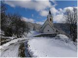 6
6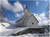 7
7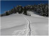 8
8 9
9 10
10 11
11 12
12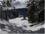 13
13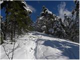 14
14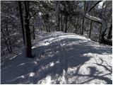 15
15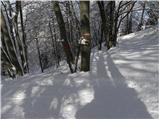 16
16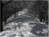 17
17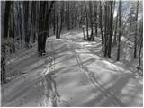 18
18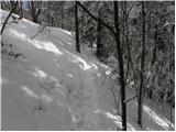 19
19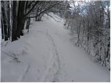 20
20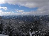 21
21 22
22 23
23 24
24 25
25
Discussion about the trip Selo nad Polhovim Gradcem - Tošč
|
| Gost17. 04. 2007 |
 Oh, this Tošč started tempting me. Oh, this Tošč started tempting me.
|
|
|
|
| Gost16. 09. 2007 |
At that time I wasn't yet enthusiastic about the hills.
|
|
|
|
| nacka125. 02. 2010 |
Hello,
if descending from Tošč along the same path as ascended and described here, you can make a detour. At the 'VODNIK' sign on the beech (photo in path description), continue right along the hunting trail. After a few minutes, when on the ridge and spot the farm on the left, head down the steep meadow past the house to the forest path. Keep left and return to the start at the chapel. This path is perhaps a bit more shady and thus welcome in summer heat.
|
|
|
|
| Breda24. 01. 2011 |
The path is completely dry. Otherwise, it's a pleasant, easy and short hike. In winter, when there are no leaves on the trees, beautiful views open up along the path towards Polhograjske Hills and Škofja Loka side.
|
|
|
|
| Lisica9. 03. 2011 |
Since the road from PG to Selo described above was so icy at one bend today that I couldn't continue with the car to the top, I went back a few 100m and left the car at the sign (Gabrje?) at the 'Tošč 2h' marker and went up that path. Super, nice, dry, sunny path. In the first lower section there are enough markers, then it turns into the hill towards the village, before the village to the right, past one house, soon we reach the chapel and the parking lot described above.
|
|
|
|
| donat17. 12. 2012 |
Yesterday I went on this trail. The road from PG to Selo is very icy at the lower end on the first two bends (2nd turnoff right), so I went back to Škofja Loka instead.
In winter time better access is from Škofja Loka, without chains on the car from PG it's hard to get up, downhill, due to the steep winding road, is even more dangerous. l.p.
|
|
|
|
| ljubitelj gora16. 05. 2014 |
No need to drive to Selo (windy roads, steep unpaved sections), instead leave the car at Mala Božna (paved for about 3 km) it is marked this is from Polhov Gradec further in the direction of Zaloga-črnega vrha. Also from the direction of Škofje Loke the road is not fully paved. As far as I can see, this description is not there yet.
|
|
|
|
| ljubitelj gora9. 01. 2018 |
From the direction of Škofja Loka to Selo it is now fully asphalted.
|
|
|
To post a comment you must log in:
If you do not yet have a username, you must first
register.