Selo pri Vodicah - Rašica (Vrh Staneta Kosca)
Starting point: Selo pri Vodicah (335 m)
| Latitude/Longitude: | 46,15800°N 14,51720°E |
| |
Walking time: 1 h 30 min
Difficulty: easy marked way
Elevation gain: 306 m
Elevation difference along the route: 375 m
Map: Ljubljana - okolica 1:50.000
Recommended equipment (summer):
Recommended equipment (winter):
Views: 5.430
 | 1 person like this post |
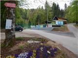
Access to starting point:
A) From the highway Ljubljana - Jesenice, take the exit Ljubljana - Šmartno, then continue driving towards Šmartno. In Šmartno, turn right towards Vodice; on the main road towards Vodice, drive a few kilometers, then just before the beginning of the settlement Skaručna, turn right in the direction of the settlements Vojsko and Selo pri Vodicah. On the main road, drive along the Skaruško field, then still before the beginning of the settlement Selo pri Vodicah, notice the signs for the ski club Strahovica, which direct us right onto a local road. Further on, drive through the village, following the road to the parking lot at the foot of the ski jump.
B) From the highway Jesenice - Ljubljana, take the exit Vodice and continue driving towards Vodice. At the traffic-light intersection in Vodice, continue straight, then at the next intersection, turn right in the direction of Bukovica pri Vodicah and Utika. At the end of Utika, continue right towards Selo pri Vodicah, then at the bus stop on the edge of Selo, turn right again. From the bus stop, drive on the main road only a little over 100 m, then the signs for the ski club Strahovica direct us left onto a local road. Further on, drive through the village, following the road to the parking lot at the foot of the ski jump.
C) First, drive to Mengeš, then continue driving towards Komenda. At the end of the settlement Mengeš, just a little after crossing the Pšata stream, turn left onto a local road towards the settlement Topole. Before arriving at the mentioned settlement, continue left again, this time towards Utik. Further on, drive on the local road to the hamlet Koseze, where turn left in the direction of Selo pri Vodicah. Soon arrive at the bus stop on the edge of Selo, where continue straight. From the bus stop, drive on the main road only a little over 100 m, then the signs for the ski club Strahovica direct us left onto a local road. Further on, drive through the village, following the road to the parking lot at the foot of the ski jump.
Route description:
From the starting point, we head onto the footpath in the direction of the mountain hut Mengeška koča, Dobeno and the ridge path to Rašica. The path first moderately ascends through the forest, then crosses a forest road, after which it leads us over numerous junctions, where we carefully follow the blazes. The marked path further crosses the "downhill" mountain bike trail several times, so some additional caution is not amiss. The path, which runs through the forest the whole time, levels out higher up and a little further joins the ridge path from the mountain hut Mengeška koča to Gobavica.
We follow the mentioned path right in the direction of Rašica, where we first ascend the indistinct Debeli hrib, from which we quickly descend to a forest road. We walk along the road to the first left bend, then continue straight in the direction of the ridge path to Rašica. A few more junctions follow, where we follow the signs for Rašica, and the path, which mainly ascends gently to moderately, brings us after some time to the lookout tower on Rašica.
On our own responsibility, we can ascend the tower, from which a nice view opens up; otherwise, we can continue to the nearby mountain hut.
Description and pictures refer to the condition in 2017 (April).

Along the route: Debeli hrib (594m)
Photos:
 1
1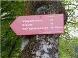 2
2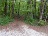 3
3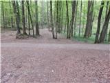 4
4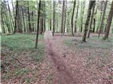 5
5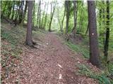 6
6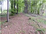 7
7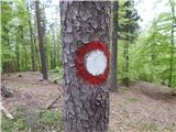 8
8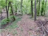 9
9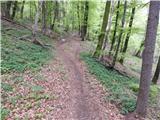 10
10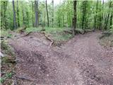 11
11 12
12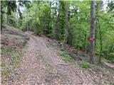 13
13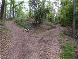 14
14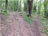 15
15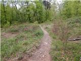 16
16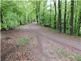 17
17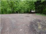 18
18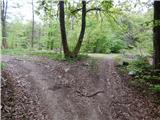 19
19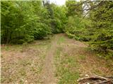 20
20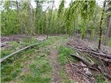 21
21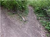 22
22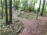 23
23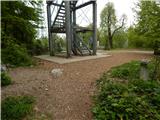 24
24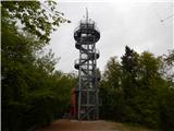 25
25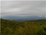 26
26 27
27
Discussion about the trip Selo pri Vodicah - Rašica (Vrh Staneta Kosca)
|
| Darxta15. 01. 2024 11:29:07 |
The path is well marked, the description is still completely up to date.
|
|
|
To post a comment you must log in:
If you do not yet have a username, you must first
register.