Selski most - Babji zob (via Kupljenik)
Starting point: Selski most (427 m)
| Latitude/Longitude: | 46,34590°N 14,10260°E |
| |
Route name: via Kupljenik
Walking time: 2 h 40 min
Difficulty: easy marked way
Elevation gain: 701 m
Elevation difference along the route: 745 m
Map: Karavanke - osrednji del - 1:50.000
Recommended equipment (summer):
Recommended equipment (winter): ice axe, crampons
Views: 9.340
 | 1 person like this post |
Access to starting point:
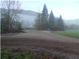
A) From the Ljubljana-Jesenice highway, take the Lesce exit, then continue driving towards Bled. In Bled, "ignore" the left turn-offs towards Koritno, Bodešče, Ribno and Selo and continue driving to the traffic light, where the road branches off to the right towards Gorje and Pokljuka. At the mentioned intersection, continue straight and begin descending towards Lake Bled. When the Chinese restaurant Peking is noticed on the left, leave the main road towards Bohinjska Bistrica and continue left onto Ulica Narodnih herojev behind the restaurant. At a few smaller intersections, continue on the main road, then arrive at Cankarjeva cesta, along which drive for some time, or to the intersection at the chapel, where continue slightly right towards Selo and Dobra gora (still on the main Ribno road). Continue driving on a gradually narrower road that for some time leads us by meadows and fields, then passes into the forest through which it begins to descend. Lower down, the forest ends, and arrive in the village Selo and a little further at the smaller intersection, where continue straight (left and then immediately right) downhill towards Sava and Kupljenik (left Ribno, right Bled). There follows some descent on the still relatively narrow road, then the asphalt ends, and drive to the Selski most bridge over the Sava Bohinjka river on a slightly wider macadam road. Park at a suitable place by the bridge.
B) First drive to Podbrdo, from there to Bohinjska Bistrica (by car train or over Soriška planina). From Bohinjska Bistrica, continue driving towards Bled, and there, upon reaching the lake, turn right towards Selo. In the continuation, drive on the narrow Mlinska cesta. Bled soon ends, the still relatively narrow road brings us to the village Selo, where at the smaller intersection in the middle of the village continue right towards Sava and Kupljenik (left Bled, straight Ribno). There follows some descent on the still relatively narrow road, then the asphalt ends, and drive to the Selski most bridge over the Sava Bohinjka river on a slightly wider macadam road. Park at a suitable place by the bridge.
Route description:
From the starting point, go over the bridge across Sava Bohinjka, from which a nice view opens onto Ribenska gora, behind the bridge continue right towards Bohinjska Bela, Kupljenik and Talež. For a short time continue on the macadam road, then arrive at a smaller intersection, where to the left branches off at first still the road towards Talež, we continue straight towards Kupljenik. Continue further on the road, then at the next unmarked intersection continue slightly left, so walk along the right edge of the nearby fence. Further on, the still gentle road changes into a cart track, which at the forks we follow towards Kupljenik. A few minutes further, when the path goes onto the slopes of Hom (675 m), it begins to ascend more steeply to the right, leading us across quite steep slopes. Higher up, the forest temporarily ends and the path takes us to a nice viewpoint at the chapel Na Koren, where we can briefly pause and enjoy the nice views.
The path ahead temporarily returns to the forest, then leads along the edge of meadows. Somewhat behind the NOB memorial, which we notice on the left side, the path turns somewhat more to the left and begins to ascend towards the settlement Kupljenik with views of Babji zob. The asphalt road that leads through Kupljenik is reached a few steps above the small chapel, and we follow it left towards Jama. The path ahead leads past a relatively new cross, then the road slowly begins to turn increasingly to the right. At the smaller intersection located between individual houses, continue right (left Talež), then continue on the gentle asphalt road, from which nice views open towards the Karawanks and Lake Bled. Past another NOB memorial and past the fire station, soon arrive at the place where to the left branches off a short path to the church of St. Štefan (from the church across the hay meadow it is possible to continue to the marked path Kupljenik - Babji zob, as signs for the cave under Babji zob also point in that direction, but locals prefer that the somewhat longer path by a few minutes is used, which avoids the hay meadow), we continue straight along the road, which first turns slightly right, then left and descends to the right serpentine.
At the right serpentine, leave the road and continue straight to the marked parking lot, where the marked footpath Kupljenik - Babji zob begins.
From the marked parking lot, continue along the poorer road towards the cave under Babji zob and Babji zob. The road first leads along the edge of the pasture, from where a nice view temporarily opens, reaching to the highest peaks of the Karawanks, then behind the left bend, where hiking direction signs are noticed, gradually enters the forest. Walk on the road for a few minutes, then at the relatively new intersection of macadam roads continue slightly left (at the time of description the fork was not marked) onto the cart track, which after a few meters turns even more left (straight to cave under Babji zob). Follows ascent through the forest, a few minutes higher the cart track brings us to a scenic hay meadow, where a wooden hut is located along its lower edge, and a nice view opens towards Lake Bled and the part of Karawanks around Golica. The cart track a little higher brings us to another hay meadow, where the signs take us right onto an initially less noticeable path that enters the forest. Once in the forest, the path becomes well traceable, and it begins to ascend more steeply. A few minutes higher, cross a new, not yet fully completed forest road, above it the marked path ascends quite steeply through the forest. When the path turns right, it levels somewhat, then ascends transversely to the right across increasingly steep slopes. Higher up, the slope becomes even steeper, but the path is relatively wide, so crossing causes no major difficulties, though in wet conditions, snow or leaves more caution is needed, especially on descent. When the path bypasses some rocky pinnacles, it turns left, enters a small valley, and a few steps further out of the forest onto Planina Prihod, which has just the right name, as we have reached the edge of Jelovica.
Upon reaching the mountain pasture, continue straight or slightly right, then step onto the cart track, where the path from Planina Vršana and Danejeva planina joins us. The cart track soon turns into a footpath that with the "help" of a direction sign leads onto the precipitous ridge. The path mostly runs a few meters left of the precipice, so there is no major slipping hazard, caution is needed mainly when stepping a few steps right of the marked path for a nice view. The path, from which nice views open through the tree crowns towards Bled, Bohinjska Bela and the highest peaks of the Julian Alps, takes us to the forepeak, where to the left branches off a less noticeable path towards the nearby Planina Ricman.
Continue straight along the path that begins to descend visibly. After a few minutes, the descent ends, and only a short moderate ascent separates us from the viewpoint and summit register of Babji zob.
Selski most - chapel Na Koren 30 minutes, chapel Na Koren - Kupljenik 35 minutes, Kupljenik - planina Prihod 1:05, planina Prihod - Babji zob 30 minutes.
Description and pictures refer to the state in 2015 (April).

Photos:
 1
1 2
2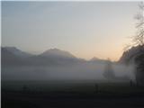 3
3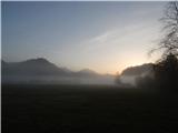 4
4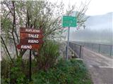 5
5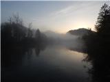 6
6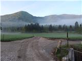 7
7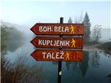 8
8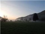 9
9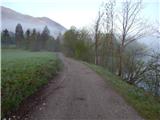 10
10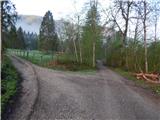 11
11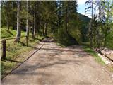 12
12 13
13 14
14 15
15 16
16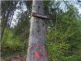 17
17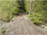 18
18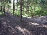 19
19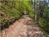 20
20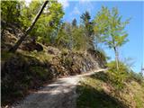 21
21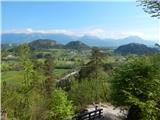 22
22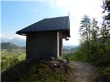 23
23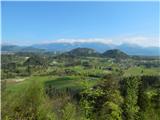 24
24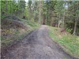 25
25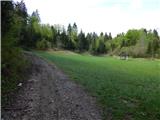 26
26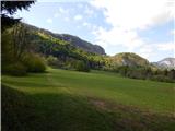 27
27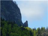 28
28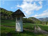 29
29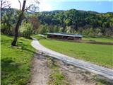 30
30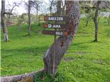 31
31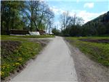 32
32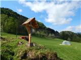 33
33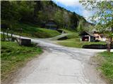 34
34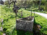 35
35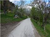 36
36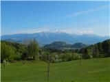 37
37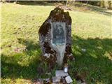 38
38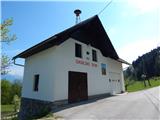 39
39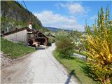 40
40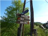 41
41 42
42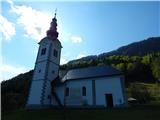 43
43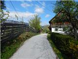 44
44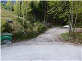 45
45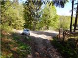 46
46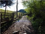 47
47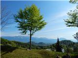 48
48 49
49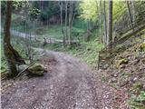 50
50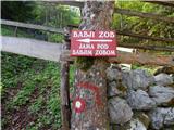 51
51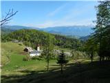 52
52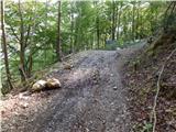 53
53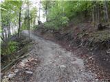 54
54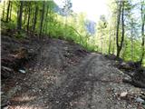 55
55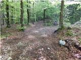 56
56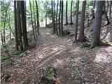 57
57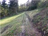 58
58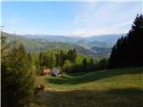 59
59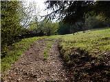 60
60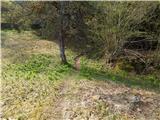 61
61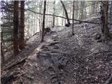 62
62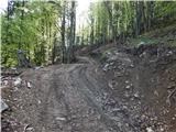 63
63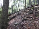 64
64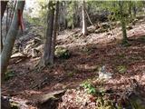 65
65 66
66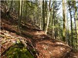 67
67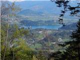 68
68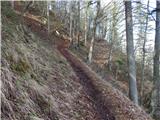 69
69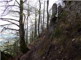 70
70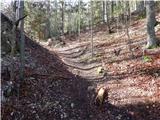 71
71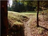 72
72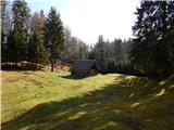 73
73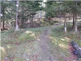 74
74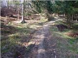 75
75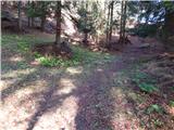 76
76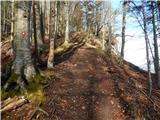 77
77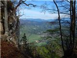 78
78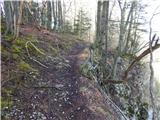 79
79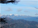 80
80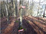 81
81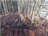 82
82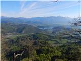 83
83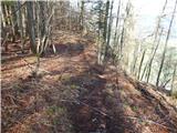 84
84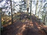 85
85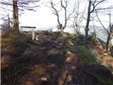 86
86 87
87
Discussion about the trip Selski most - Babji zob (via Kupljenik)
|
| tango9. 02. 2019 |
Today's tour wasn't exactly some great achievement, but it was wonderful. Bled with Lake Bled is really a picture of paradise, especially with the backdrop of snow-covered Karavanke and the nicely green Sava. Only the Julian Alps and Bohinj mountains were poorly visible, as the sky was covered by thin hazy clouds. For the descent small crampons were quite welcome, although it would go without them too, just a bit slower. Recommended.
|
|
|
|
| čara30. 09. 2021 12:18:01 |
Nice path. Thanks to the location of the starting point on Google Maps I didn't get lost. But on the path towards Babji zob there are quite a few flags and some even broken.
|
|
|
To post a comment you must log in:
If you do not yet have a username, you must first
register.