Selski most - Tolsti vrh (Talež)
Starting point: Selski most (427 m)
| Latitude/Longitude: | 46,34590°N 14,10260°E |
| |
Walking time: 1 h 15 min
Difficulty: easy unmarked way
Elevation gain: 456 m
Elevation difference along the route: 456 m
Map: Karavanke - osrednji del 1:50.000
Recommended equipment (summer):
Recommended equipment (winter): ice axe, crampons
Views: 9.421
 | 2 people like this post |
Access to starting point:
A) From the Ljubljana - Jesenice highway we take the Lesce exit, then continue driving towards Bled. In Bled we "ignore" the left turn-offs towards Koritno, Bodešče, Ribno and Selo and continue driving to the traffic light, where a road branches off to the right towards Gorje and Pokljuka. At the mentioned crossroad we continue straight and start descending towards Lake Bled. When on the left we notice the Chinese restaurant Peking we leave the main road towards Bohinjska Bistrica and behind the restaurant continue left onto Ulica Narodnih herojev. At a few smaller crossroads we continue on the main road, then arrive at Cankarjeva cesta, along which we drive for some time, or to the crossroad by the chapel, where we continue slightly right in the direction of Selo and Dobre gore (still on the main road Ribno). We continue driving on a gradually narrower road which for some time leads past meadows and fields, then passes into the forest through which it starts descending. Lower down the forest ends, and we arrive in the village Selo and a little further at the smaller crossroad, where we continue straight (left and then immediately right) downwards in the direction of Sava and Kupljenik (left Ribno, right Bled). There follows some descent on the still relatively narrow road, then the asphalt ends, and we drive on a somewhat wider macadam road to Selski most over the river Sava Bohinjka. We park at an appropriate place by the bridge.
B) First we drive to Podbrdo and from there to Bohinjska Bistrica (with car shuttle train or over Soriška planina). From Bohinjska Bistrica we continue driving towards Bled, and there, when we arrive at the lake, we turn right in the direction of Selo. We continue on the narrow Mlinska cesta. Bled soon ends, and the still relatively narrow road brings us to the village Selo, where at the smaller crossroad in the middle of the village we continue right in the direction of Sava and Kupljenik (left Bled, straight Ribno). There follows some descent on the still relatively narrow road, then the asphalt ends, and we drive on a somewhat wider macadam road to Selski most over the river Sava Bohinjka. We park at an appropriate place by the bridge.
Route description:
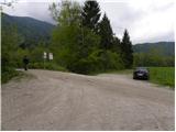
From the starting point we first cross Selski most, then on its other side continue right in the direction of Kupljenik and Bohinjska Bela. For a short time we walk on the road, then signs for Talež direct us left onto a wider cart track which starts gently ascending along the fenced pasture. In a gentle right turn we leave the wide cart track and continue straight on a noticeably narrower cart track which slowly starts turning to the left. The cart track crosses a shorter meadow, along the edge of which stands a decaying shack, then passes into the forest through which it starts moderately ascending. After a few minutes of further walking the cart track splits into two parts, and we continue on the right one, which after the junction starts ascending more steeply (straight Koča na Taležu). To the cart track, which all the time runs through the forest, higher up joins a marked path from the village Kupljenik, which we follow in the ascent until we reach a smaller saddle, where there is also a junction of several paths.
Here we continue left and past a bench and NOB memorial plaque walk to the end of the cart track.
From the end of the cart track we continue on a steeper forest path, along which in a few minutes of further walking we arrive at the forest-covered Tolsti vrh.

Photos:
 1
1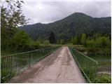 2
2 3
3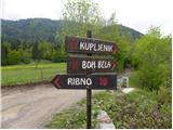 4
4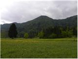 5
5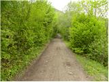 6
6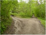 7
7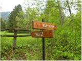 8
8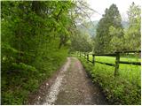 9
9 10
10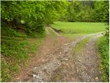 11
11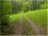 12
12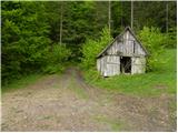 13
13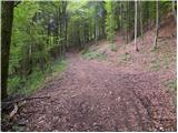 14
14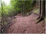 15
15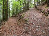 16
16 17
17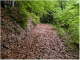 18
18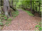 19
19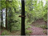 20
20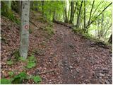 21
21 22
22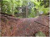 23
23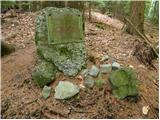 24
24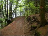 25
25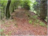 26
26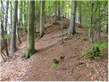 27
27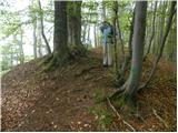 28
28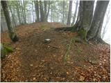 29
29
Discussion about the trip Selski most - Tolsti vrh (Talež)
To post a comment you must log in:
If you do not yet have a username, you must first
register.