Šembije - Šilentabor (via Brkinški rob)
Starting point: Šembije (597 m)
| Latitude/Longitude: | 45,60390°N 14,23140°E |
| |
Route name: via Brkinški rob
Walking time: 2 h 5 min
Difficulty: easy unmarked way
Elevation gain: 154 m
Elevation difference along the route: 330 m
Map: Snežnik 1:50.000
Recommended equipment (summer):
Recommended equipment (winter):
Views: 6.412
 | 1 person like this post |
Access to starting point:
A) From the highway Ljubljana - Koper, we take the exit Postojna and continue following the road in the direction of Pivka, Reka and Ilirska Bistrica. In the settlement Pivka we leave the main road which runs towards Ilirska Bistrica and we continue driving towards Knežak. Only a little after Knežak, we get to the village Šembije, where in the middle of the village we turn right towards the nearby church. A little further from the church, the village ends, and we continue driving on the macadam road, on which we gently ascend to a smaller crossroad near the old bunkers. We park nearby in a suitable place by the road.
B) We drive to Ilirska Bistrica, and then we continue driving towards Knežak. Before we get to Šembije, we leave the main road and continue left towards the village Podtabor. At the beginning of Podtabor we get to a crossroad of several roads, and we choose the rightmost one (far right yard of the nearby house) and for a short time we steeply ascend on it. When the road flattens, we will notice old bunkers on the left side, and on the right a small concrete cross, a few meters ahead there is a smaller crossroad. We park somewhere nearby in a suitable place by the road.
Route description:
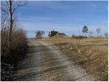
From the starting point, we go on a side macadam road which starts gently ascending towards the northwest, and it quickly changes into a wide cart track. Already after a few 10 m, the cart track splits into two parts, and we choose the left one, which quickly brings us above the upper edge of precipitous cliffs. From the edge a nice view opens up on the village Podtabor, which is almost vertically below us and in the distance towards Brkini. During the further ascent we can by the path notice even some old and faded blaze, which is rather a rarity than a rule. A little higher, the path leads us through some rare lanes of bushes, and then it gradually passes on to ample grassy slopes. Here the path turns a little to the right and brings us to a smaller saddle (saddle between the peaks Bezgovica 738 m and Vrh 777 m).
On the saddle, we cross a grazing fence and behind it we start gently descending. The cart track quickly flattens, we walk on it only a short time, and then on the left side we notice several smaller footpaths, which are diagonally ascending across a gentle grassy slope. We continue on one of the footpaths, and in doing so we have to be careful to stick to the most left paths, that is those which run as close as possible to Brkinški rob. Higher, we cross a short lane of forest, and the path, which gradually passes on to a distinct ridge, with increasingly beautiful views quickly brings us to the less known but relatively panoramic peak Gradišče.
From the top, we continue on a path which goes into the forest, through which it starts gently descending. The path ahead occasionally still runs along Brkinški rob, and then gradually passes into a quite overgrown part, where mainly in the summer months the passage is difficult because of thorns. A little further, the path turns a little to the right and joins a wider cart track, which then in a gentle descent leads us across panoramic slopes. We continue the path along the edge of pastures, and it brings us, with a view of Snežnik and Zgornja Pivška kotlina, to a junction on the saddle Klanec.
Here, to the left downwards branches off the path to the nearby cross, Narin and Ratečevo Brdo, and we continue straight ahead (right downwards Zagorje) and continue the path on a relatively gentle and panoramic cart track. After approximately 15 minutes of further walking, we arrive at a crossroad, where to the left branches off a macadam road towards the nearby church of St. Martin, and we continue straight on the asphalt road, on which we quickly arrive at the next crossroad.
Here we continue right into the village Šilentabor (left Narin), where past a few houses we walk to the place where from the right also the marked path from Pivka joins us.
Here we continue straight and past the stamp box and transmitters in a few minutes we walk to the panoramic summit.

Photos:
 1
1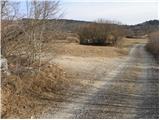 2
2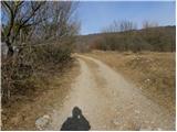 3
3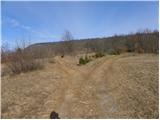 4
4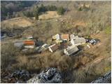 5
5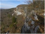 6
6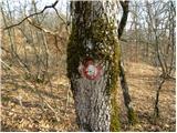 7
7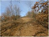 8
8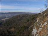 9
9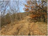 10
10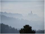 11
11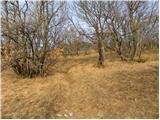 12
12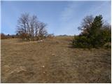 13
13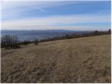 14
14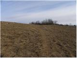 15
15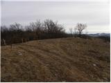 16
16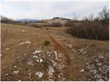 17
17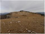 18
18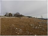 19
19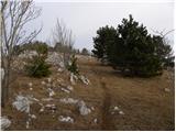 20
20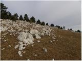 21
21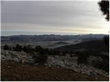 22
22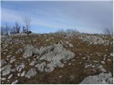 23
23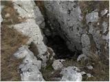 24
24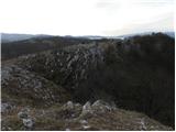 25
25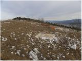 26
26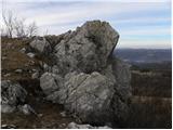 27
27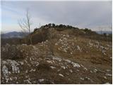 28
28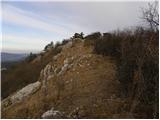 29
29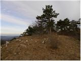 30
30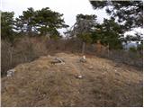 31
31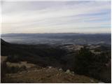 32
32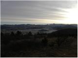 33
33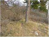 34
34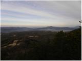 35
35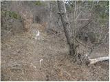 36
36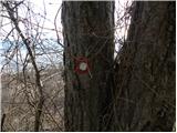 37
37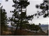 38
38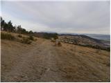 39
39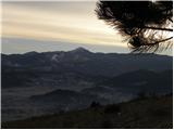 40
40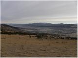 41
41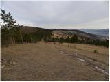 42
42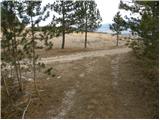 43
43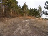 44
44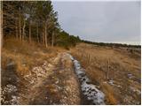 45
45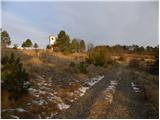 46
46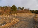 47
47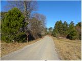 48
48 49
49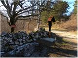 50
50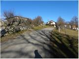 51
51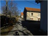 52
52 53
53 54
54 55
55 56
56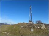 57
57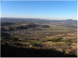 58
58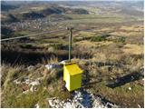 59
59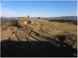 60
60 61
61 62
62
Discussion about the trip Šembije - Šilentabor (via Brkinški rob)
|
| bizgo9328. 02. 2021 |
Magnificent and fairly long circular hike (14 km) with beautiful views and walks across pastures and through pine groves. The steeper ascent is only at the beginning towards Bezgovica, then the hike along the Brkini edge ascends moderately and gently descends after the summit of Gradišče (791 m) to the church of St. Martin. Already along the path itself there is a nice view of the Brkini with the Reka river valley and Čičarija to the west, and Snežnik with surrounding hills and the Lož Valley to the east. From the summit above the village it opens further towards Nanos, Vremščica, and in the distance we can see the Dolomites, Julian Alps and Trnovska planota. For the return I suggest circling back along the old Italian road towards Podtabor, where you can observe the beautiful landscape where flysch and limestone mix, which ends with the beautiful Podtabor Wall after the carved tunnel. About 100 m further from the remains of Tabor Castle in the wall, you will notice a path that steeply ascends through the forest and brings you back to the starting point in Šembije.
|
|
|
|
| navdušena26. 04. 2021 20:43:12 |
Nice path, but no markers to Šilentabor. No problem, it's easy to follow. But don't go there in fog!
|
|
|
|
| ločanka23. 02. 2022 18:22:49 |
As described by bizgo93, a wonderful path along this Brkinski rob, but certainly the most beautiful as a loop, only we did it yesterday in the opposite direction. Up along the old Italian path through the Mussolini tunnel under the wonderful walls from the village of Podtabor. Return along the above-described path with views on both sides, along the ridge among beautiful junipers, later along the edge of pastures. In between, marked point for Gradišče 791 m. Truly magnificent!
|
|
|
To post a comment you must log in:
If you do not yet have a username, you must first
register.