Starting point: Šembije (597 m)
| Latitude/Longitude: | 45,60390°N 14,23140°E |
| |
Walking time: 45 min
Difficulty: easy unmarked way
Elevation gain: 180 m
Elevation difference along the route: 180 m
Map: Snežnik 1:50.000
Recommended equipment (summer):
Recommended equipment (winter):
Views: 4.225
 | 1 person like this post |
Access to starting point:
A) From the highway Ljubljana - Koper we take the exit Postojna and follow the road ahead in the direction of Pivka, Reka and Ilirska Bistrica. In the settlement Pivka we leave the main road which runs towards Ilirska Bistrica and we continue driving towards Knežak. Only a little after Knežak, we get to the village Šembije, where in the middle of the village we turn right towards the nearby church. A little further from the church, the village ends, and we continue driving on the macadam road, on which we gently ascend to a smaller crossroad near the old bunkers. We park nearby on an appropriate place by the road.
B) We drive to Ilirska Bistrica, and then we continue driving towards Knežak. Before we get to Šembije, we leave the main road and we continue left towards the village Podtabor. At the beginning of Podtabor we get to a crossroad of several roads, and we choose the most right one (far right yard of the nearby house) and for a short time we steeply ascend there. When the road flattens, we will see old bunkers on the left side, and on the right a small concrete cross, a few meters ahead there is a smaller crossroad. We park somewhere nearby on an appropriate place by the road.
Route description:
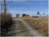
From the starting point, we go on a side macadam road which starts gently ascending towards the northwest, and it quickly changes into a wide cart track. Already after a few 10 meters, the cart track splits into two parts, and we choose the left one, which quickly brings us above the upper edge of precipitous cliffs. From the edge a nice view opens up on the village Podtabor, which is almost vertically below us and in the distance towards Brkini. During the further ascent we can by the path notice even some old and faded blaze, which is more a rarity than a rule. A little higher, the path leads us through some rare lanes of bushes, and then it gradually passes on ample grassy slopes. Here the path turns a little to the right and it brings us to a smaller saddle (saddle between the peaks Bezgovica 738 m and Vrh 777 m).
On the smaller saddle, the cart track turns a little to the left and starts gently descending, and right on this spot we leave it and we continue right on a well visible, but still unmarked footpath. We continue on a quite gently sloping path, on which with a view on Snežnik we walk to the nearby grassy cart track. The cart track, which temporarily ascends a little steeper and higher changes into an easy to follow footpath, through ample meadows quickly brings us to a metal pole, where it entirely flattens. From the pole follows only a few 10 strides of walking and a panoramic path brings us to a concrete stone on the top of Vrh.

Photos:
 1
1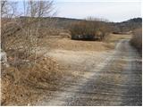 2
2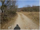 3
3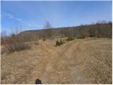 4
4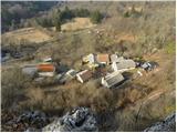 5
5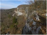 6
6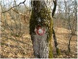 7
7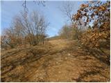 8
8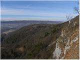 9
9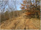 10
10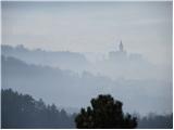 11
11 12
12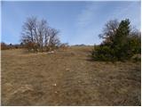 13
13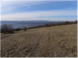 14
14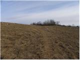 15
15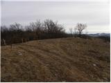 16
16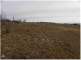 17
17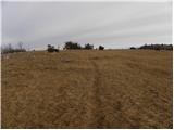 18
18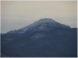 19
19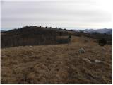 20
20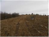 21
21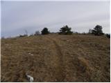 22
22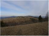 23
23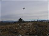 24
24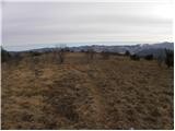 25
25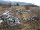 26
26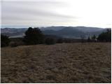 27
27
Discussion about the trip Šembije - Vrh
|
| bizgo937. 03. 2021 |
As a local, I climb to Vrh quite often. I would point out that for the excursion from the mentioned point near the starting point we don't see the old bunkers (they are located on the ridge of Volovje rebri) - you probably meant the water reservoir and underground storage of one of the parcel owners.
In addition to the described trail, I recommend two more trails to Vrh.
One goes through Krivica (nicely marked on geopedija) and is a bit more varied and also crosses two pastures. You can return via the above-described trail and stop at the summit of Bezgovica/Merejski vrh (738 m) from where there is a great view of Brkine and Čičarija (especially nice at sunset).
The other trail, which is the most picturesque but a bit harder to find, is from Podtabor, where you walk along the road under the magnificent Podtaborska stena, about 200 m after exiting the tunnel you turn right onto a poorly visible path towards Uršja luknja (which is only about 100 m from the path). Here you will need to climb a bit through the rocks (requires some caution and especially appropriate footwear). Then you will reach Brkinski rob and join the above-described trail through the fir grove.
In addition to the above-described views, from Vrh on a nice day you can see even part of the Kvarnerski zaliv with Cres in the background, and to the NW also the Dolomites.
Very beautiful and picturesque excursions in the karst landscape!
|
|
|
To post a comment you must log in:
If you do not yet have a username, you must first
register.