Starting point: Senožeti (275 m)
| Latitude/Longitude: | 46,09050°N 14,73360°E |
| |
Walking time: 1 h 30 min
Difficulty: easy marked way
Elevation gain: 561 m
Elevation difference along the route: 561 m
Map: Ljubljana - okolica 1:50.000
Recommended equipment (summer):
Recommended equipment (winter):
Views: 10.517
 | 1 person like this post |
Access to starting point:
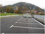
A) From the highway Ljubljana - Celje, we take the exit Šentjakob and follow the road ahead towards Litija. A few kilometres after Dolsko, the road brings us to the roundabout, where we head towards the village Senožeti. The road then immediately brings us into the village, where at the intersection we turn right and drive approximately 100 m to a larger parking lot near the school playgrounds.
B) From Litija, we drive towards Ljubljana but only to the roundabout, where the signs direct us towards the village Senožeti. The road then immediately brings us into the village, where at the intersection we turn right and drive approximately 100 m to a larger parking lot near the school playgrounds.
Route description:
From the parking lot, we continue on the road, which takes us over a stream to an intersection where we continue left. The road then already after a few metres brings us to the next intersection, where the blazes direct us left from the chapel onto a footpath. The path along the trail is short since already after a few metres we step back onto the road. We continue walking on the road for only a few minutes, since then the signs for Miklavž direct us left steeply upwards. Further, we follow the path, which ascends through the forest and a little higher brings us to a larger clearing behind which we join the road. The road then brings us to an intersection in Velika vas, where the signs direct us right. The road then in a few minutes brings us above the village. Here the signs direct us left onto a cart track, which soon turns into a footpath. Further, we follow the path, which ascends transversely and a little higher brings us to a fork, where we continue left in the direction of Cicelj. The path ahead has quite a few unmarked forks so we carefully follow the blazes, which are quite rare. The path, which mostly runs through the forest, then brings us to the non-panoramic summit without major difficulties.

Along the route: Velika vas (510m)
Photos:
 1
1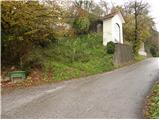 2
2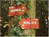 3
3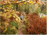 4
4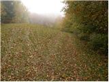 5
5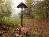 6
6 7
7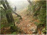 8
8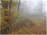 9
9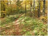 10
10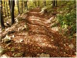 11
11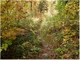 12
12 13
13
Discussion about the trip Senožeti - Cicelj
|
| Suriljana23. 04. 2016 |
Today on this path, which is a beautiful choice for a trip around Ljubljana. The path is excellently marked. I suggest also a short detour to the church of St. Miklavž. For faster return from the top of Cicelj there's a hunting path directly to Velika vas, which is quite steep though.
|
|
|
To post a comment you must log in:
If you do not yet have a username, you must first
register.