Senožeti - Murovica (via Vrh pri Dolskem)
Starting point: Senožeti (275 m)
| Latitude/Longitude: | 46,09050°N 14,73360°E |
| |
Route name: via Vrh pri Dolskem
Walking time: 2 h 5 min
Difficulty: easy marked way
Elevation gain: 468 m
Elevation difference along the route: 545 m
Map:
Recommended equipment (summer):
Recommended equipment (winter): ice axe, crampons
Views: 1.940
 | 2 people like this post |
Access to starting point:
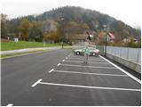
A) From the highway Ljubljana - Celje, we take the exit Šentjakob and follow the road ahead towards Litija. A few kilometers after Dolsko, the road brings us to the roundabout, where we go towards the village Senožeti. The road then immediately brings us into the village, where at the crossroad we turn right and drive approximately 100 meters to a larger parking lot near the school playgrounds.
B) From Litija we drive towards Ljubljana but only to the roundabout, where signs point us towards the village Senožeti. The road then immediately brings us into the village, where at the crossroad we turn right and drive approximately 100 meters to a larger parking lot near the school playgrounds.
Route description:
From the parking lot, we continue on the road which over the stream brings us to a crossroad from which we continue left. The road then already after a few meters brings us to the next crossroad, where blazes point us to the left, on a footpath which continues left from the chapel. The path on the trail is short, as already after a few meters we return to the road. We continue walking on the road for a few minutes, then signs for Miklavž point us left, steeply upwards. Further we follow the path which ascends through the forest and a little higher brings us to a larger clearing, behind which we join the road. The road then brings us to a crossroad in Velika vas, where we continue left in the direction of Križevska vas (right - sv. Miklavž). The dense part of the settlement quickly ends, and we further ascend diagonally towards the left. With nice views we reach a small saddle, where on the left we notice a hunting observatory, and on the right the beginning of the hunting path to Cicelj.
We continue straight ahead on the road which leads us past the NOB memorial, then we already arrive in Križevska vas and after a short ascent also to the church of Sv. Križa.
At the church, paths branch off to Cicelj and Murovica, and we descend on the asphalt road to the settlement Zagorica pri Dolskem, where the path leads us past the birth house of baron Jurij Vega. When the dense part of the settlement ends, at the smaller crossroad we continue slightly right onto a steep asphalt road in the direction of house numbers Zagorica 33, 35 and 37. The road quickly brings us to the mentioned houses, and we continue the path on a scenic cart track which past the chapel brings us to a marked junction, where the path from Dolsko also joins us.
From the saddle, where we also notice signs for Vegova pot, we continue right in the direction of BKP (Badjurova krožna pot) and continue the path towards the last house in the village Vrh pri Dolskem. Before the last house we continue straight onto the footpath, which then begins to ascend more steeply. Higher the path turns left and levels out, a little further it brings us to a marked junction, from which we continue straight towards Murovica (right Cicelj, Zagorica and Križevska vas). There follows less than 10 minutes of moderate ascent and the path brings us to the top of Murovica.
Senožeti - Velika vas 40 minutes, Velika vas - Križevska vas 30 minutes, Križevska vas - Murovica 55 minutes.

Along the route: Velika vas (510m), Križevska vas (584m), Zagorica pri Dolskem (547m), Vrh pri Dolskem (573m)
The trip can be extended to the following destinations: Cicelj
Photos:
 1
1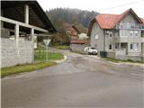 2
2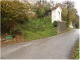 3
3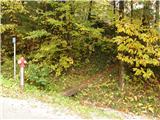 4
4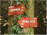 5
5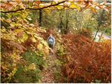 6
6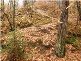 7
7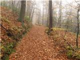 8
8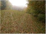 9
9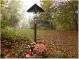 10
10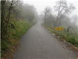 11
11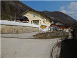 12
12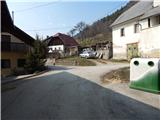 13
13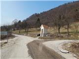 14
14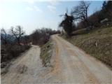 15
15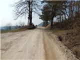 16
16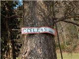 17
17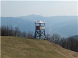 18
18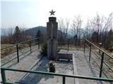 19
19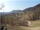 20
20 21
21 22
22 23
23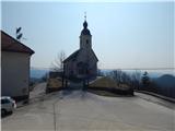 24
24 25
25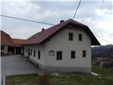 26
26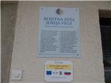 27
27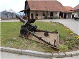 28
28 29
29 30
30 31
31 32
32 33
33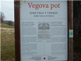 34
34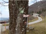 35
35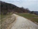 36
36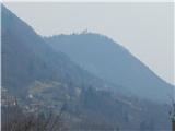 37
37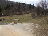 38
38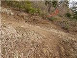 39
39 40
40 41
41 42
42 43
43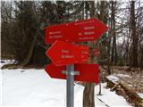 44
44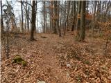 45
45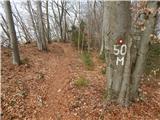 46
46 47
47
Discussion about the trip Senožeti - Murovica (via Vrh pri Dolskem)
To post a comment you must log in:
If you do not yet have a username, you must first
register.