Starting point: Šentjur (280 m)
| Latitude/Longitude: | 46,20260°N 15,39320°E |
| |
Walking time: 45 min
Difficulty: easy marked way
Elevation gain: 288 m
Elevation difference along the route: 288 m
Map:
Recommended equipment (summer):
Recommended equipment (winter):
Views: 23.073
 | 2 people like this post |
Access to starting point:
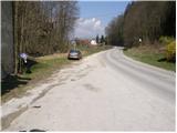
From the highway Ljubljana - Maribor, we take the exit Dramlje and follow the road ahead in the direction of Šentjur. In Šentjur, at the traffic light, we continue straight through the underpass under the railway track and follow the road ahead in the direction of Šentrupert. Only a little after the sign "end of Šentjur", on the right side of the road, we notice a parking lot and signposts for Resevno.
Route description:
From the parking lot, we return along the road approximately 100 meters back towards Šentjur, where at the bus stop we notice hiking signposts for Rifnik. A marked footpath directs us to stairs, which climb up through a meadow. Further, the path crosses a short stretch of forest and then leads us onto an asphalt road, which we follow for some time to a crossroad, where we continue straight uphill on a worse road towards Rifnik (left, ruins of Rifnik castle, 5 minutes). The increasingly worse road then changes into a cart track, which we follow in the direction of the archaeological site Rifnik. A little higher, the cart track turns into a footpath, which for a short time steeply ascends and then quickly brings us to the top of Rifnik.
Along the route: Grad Rifnik (Reicheneck) (450m)
Photos:
 1
1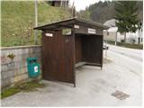 2
2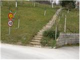 3
3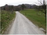 4
4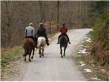 5
5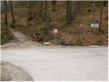 6
6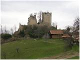 7
7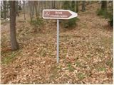 8
8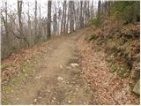 9
9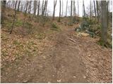 10
10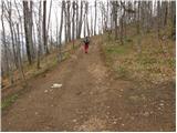 11
11 12
12
Discussion about the trip Šentjur - Rifnik
|
| andymann5. 05. 2009 |
Does anyone perhaps know why there are those signs 'movement at your own risk' around the Reicheneck castle? Is it perhaps because of some crazy landowner with a whip or something else?
|
|
|
|
| aljazzz5. 05. 2009 |
because the walls are not exactly safe, everything can collapse at any moment..people go there cheerfully and dig around, because it's more or less an open thing.
|
|
|
|
| Planinček6. 05. 2009 |
It's true! The walls are not in the best condition and we can expect that a rock can fall off at any moment.
|
|
|
|
| andymann29. 07. 2009 |
One could write that there is a parking lot at the end of the asphalt (sixth picture), because a half-hour walk on asphalt isn't interesting anyway. Or is it.
|
|
|
|
| klavdipo17. 12. 2009 |
Is there a stamp at this summit too?
|
|
|
|
| rogi18. 12. 2009 |
There is a stamp at the top of Rifnik too.
|
|
|
|
| klavdipo18. 12. 2009 |
Is it possible to do a circular variant Šentjur-Rifnik-Resevna-Šentjur too? So as not to return from Rifnik along the same path?
|
|
|
|
| rogi19. 12. 2009 |
Yes it is possible and the path is about 4 hours long, and marked too.
Regards
|
|
|
|
| boba:)15. 03. 2012 |
Today I was at Rifnik. Unfortunately there's no stamp at the top anymore. In the box only the chain remained where it was attached. Where could I stamp the logbook? Where could I stamp the logbook?
|
|
|
|
| Zvonček22. 04. 2013 |
I'm also interested where the stamp is located now? Or does anyone perhaps know whom to ask?
|
|
|
|
| onsight22. 05. 2013 |
Hello. It's true, the stamp is missing at Rifnik, I called PD Šentjur myself, they explained I can get the stamp during office hours at headquarters... I did that. Office hours are every Thursday from 5pm to 6pm.
|
|
|
|
| bruny29. 09. 2017 |
Today to Rifnik via the described path...
|
|
|
|
| bruny30. 03. 2019 |
Ascent today on the described path...
|
|
|
To post a comment you must log in:
If you do not yet have a username, you must first
register.