Šenturška Gora - Ambrož pod Krvavcem
Starting point: Šenturška Gora (667 m)
| Latitude/Longitude: | 46,25840°N 14,54490°E |
| |
Walking time: 1 h 20 min
Difficulty: easy marked way
Elevation gain: 418 m
Elevation difference along the route: 420 m
Map:
Recommended equipment (summer):
Recommended equipment (winter): crampons
Views: 5.680
 | 1 person like this post |
Access to starting point:
A) From the highway Ljubljana - Jesenice we take the Vodice exit, then follow the signs for the Krvavec ski slope. We continue driving through Vodice, Spodnji Brnik, Zgornji Brnik, Cerklje na Gorenjskem to the settlement Grad, where we turn right towards Ambrož pod Krvavcem and Šenturška Gora. A steep ascent follows; when the road flattens, we continue straight towards Šenturška Gora (left Ambrož pod Krvavcem and Stiška vas). Driving through Ravne and Apno follows, then we arrive at Šenturška Gora, where we park on the parking lot by the Krajevni dom.
B) From the highway Jesenice - Ljubljana we take the Brnik exit, then follow the signs for the Krvavec ski slope. We continue driving past the airport and through the settlements Spodnji Brnik, Zgornji Brnik, Cerklje na Gorenjskem and the settlement Grad, where we turn right towards Ambrož pod Krvavcem and Šenturška Gora. A steep ascent follows; when the road flattens, we continue straight towards Šenturška Gora (left Ambrož pod Krvavcem and Stiška vas). Driving through Ravne and Apno follows, then we arrive at Šenturška Gora, where we park on the parking lot by the Krajevni dom.
C) First, we drive to Kamnik, then towards Tunjice. From Tunjice we follow the road towards Sidraž, from Sidraž towards Šenturška Gora. When we arrive at Šenturška Gora, we park on the parking lot behind the Krajevni dom.
Route description:
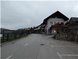
From the Krajevni dom on Šenturška Gora, opposite which there is also a children's playground, we continue on the asphalt road that continues towards the east and leads towards Sidraž. After a few minutes of walking on the asphalt road, the settlement Šenturška Gora ends, and just a few steps further we arrive at a marked crossroads.
From the crossroads, we continue on the left road in the direction of Sv. Lenart, from it we immediately go left in the direction of sv. Ambrož and Krvavec, so that we bypass the nearby playground on the left side. Blazes and signs for Martinova pot guide us to the path that ascends beside the playground and above it enters the forest, through which it ascends to the place where we return to the road.
We continue on the road, which makes a right serpentine (at the end of the bend, Martinova pot branches off slightly to the left), then we ascend diagonally through the forest on it. Higher up, the forest thins out and we arrive at a marked junction before the hamlet Jagošci.
We continue left in the direction of Krvavec and sv. Ambrož (straight to planina Osredek, Kamniški vrh and also Ambrož pod Krvavcem over Jagošce), where blazes guide us to a cart track, along which we ascend at the edge of the forest. Somewhat higher, the cart track forks, and we go left, where we ascend through a belt of bushes and forest, then arrive at the next hay meadows, where we continue along the left edge. For a few minutes we ascend on a poorer path that leads us along the edge of the forest, then at the tourist farm Pr Dovar we reach an asphalt road.
We continue diagonally to the right; near the houses the road ends and behind them we continue on a cart track that ascends diagonally across a panoramic hay meadow. When the cart track turns right, we leave it and continue somewhat more to the right on a marked path that begins to ascend more steeply on the grassy slope. An ascent follows on the panoramic grassy slope, and the path slowly turns somewhat to the right, so that in a traversing ascent we reach the chapel of sv. Ambrož and the Tourist farm Pr Ambružarju.
Description and pictures refer to the condition in 2019 (April and May).

Photos:
 1
1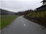 2
2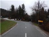 3
3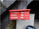 4
4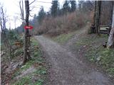 5
5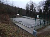 6
6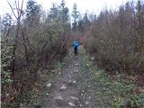 7
7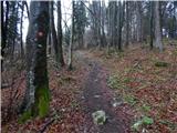 8
8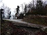 9
9 10
10 11
11 12
12 13
13 14
14 15
15 16
16 17
17 18
18 19
19 20
20 21
21 22
22 23
23 24
24 25
25 26
26 27
27 28
28 29
29 30
30 31
31 32
32 33
33 34
34 35
35 36
36 37
37 38
38
Discussion about the trip Šenturška Gora - Ambrož pod Krvavcem
To post a comment you must log in:
If you do not yet have a username, you must first
register.