Široko - Veliki vrh (above Lom) (direct way)
Starting point: Široko (750 m)
| Latitude/Longitude: | 46,13207°N 13,75932°E |
| |
Route name: direct way
Walking time: 1 h 30 min
Difficulty: easy marked way
Elevation gain: 321 m
Elevation difference along the route: 355 m
Map:
Recommended equipment (summer):
Recommended equipment (winter):
Views: 3.150
 | 1 person like this post |
Access to starting point:
The starting point is at Tourist farm Široko in Tolminski Lom. Accesses from the direction of Nova Gorica and Idrija are described in detail; access is also possible from the direction of Tolmin and via Banjška planota through Kanalski Lom.
a) From Nova Gorica, we follow the signs for Bovec and Tolmin, drive through Kanal and then pay attention to the turn-off for Most na Soči (in the direction of Idrija and Ljubljana). We continue driving through the village Kozaršče; in the center of Most na Soči at the crossroads, we turn right in the direction of Lom (straight ahead - direction Ljubljana, left - direction Tolmin). When we cross the bridge over the river Idrijca, we continue on a steep local road into a sharp right turn. The road continues ascending for the next 4 kilometers and brings us to a saddle, where a steep road branches off to the left towards Tourist farm Široko. After less than two kilometers of further ascending, we get to the tourist farm, where we look for a parking spot.
b) From the direction of Idrija, we follow the signs for Tolmin. In the center of Most na Soči at the crossroads, we turn sharply left in the direction of Lom (straight ahead - direction Nova Gorica, right - direction Tolmin). When we cross the bridge over the river Idrijca, we continue on a steep local road into a sharp right turn. The road continues ascending for the next 4 kilometers and brings us to a saddle, where a steep road branches off to the left towards Tourist farm Široko. After less than two kilometers of further ascending, we get to the tourist farm, where we look for a parking spot.
Route description:
The path is well marked with signposts and is undemanding. It mostly runs on macadam roads and forest paths; below the summit, it runs for a short time on a narrower footpath. Along the path there are several marked attractions and two vantage points with panorama boards (Široko and Ledince); the peak is also panoramic.
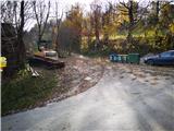
When we park at the tourist farm, we can turn to the vantage point above the farm; otherwise, we look for the starting point at the end of the road, where the road descends to houses and where there are garbage containers. Here we notice signposts for Ledince, Grudnica and Veliki vrh, which direct us onto a steep macadam forest road. It ascends for some time and then gradually flattens. We leave the wide macadam road at the top of the next longer slope, where signs direct us right towards the vantage point Ledince and Veliki vrh (sign for shortcut).
From the vantage point, we continue on a gentle forest cart track to the next marked crossroads, where we turn slightly left upwards; right downwards goes the path in the direction of Močilo na Kalu and Kanalski Lom. From here the path is well marked with signposts and blue-yellow blazes, which mark the circular trail »Lom je moj dom«. The path goes past the abyss Brezno v Špilah a little higher than the path arranged for sightseeing, also with a description on the info board. The path then narrows after a few turns and ascends to the border stone, where there is the next info board.
After the border stone, we turn right onto a slightly wider path again. In a dried spruce forest, just before the clearing, we leave the path and turn right onto a narrower footpath. It brings us to an indistinct ridge, which rises gently towards Veliki vrh. After a few minutes of walking we notice a preserved observation post from the 1st World War; after a short descent, only a short ascent to the summit follows. Just below the summit there is also an info board on the theme of the 1st World War; on the summit there is a miniature Aljaž tower with a summit logbook (it opens by lifting the cover).
We can return along the same path or make a detour along the marked path »Lom je moj dom« in the direction of Grudnica (extends the path by 30 minutes; we rejoin at the vantage point Ledince). Alternatively, on the way back after the abyss, we can turn far left towards Močilo na Kalu and descend along the path »Lom je moj dom« in the other direction to Kanalski Lom and then ascend back to Široko (extends the path by over 1 hour and an additional 200-meter ascent).

Along the route: Razgledna točka Široko (755m)
Photos:
 1
1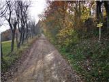 2
2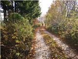 3
3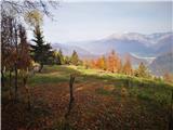 4
4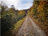 5
5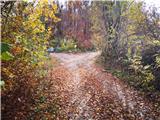 6
6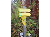 7
7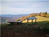 8
8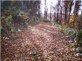 9
9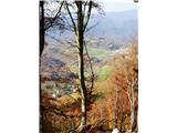 10
10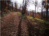 11
11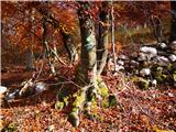 12
12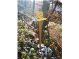 13
13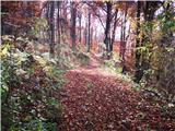 14
14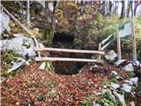 15
15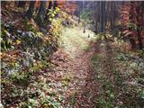 16
16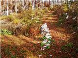 17
17 18
18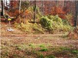 19
19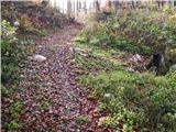 20
20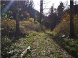 21
21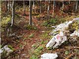 22
22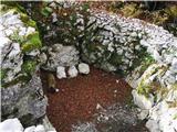 23
23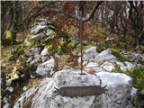 24
24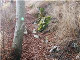 25
25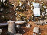 26
26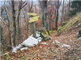 27
27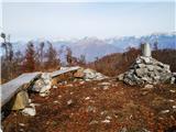 28
28 29
29
Discussion about the trip Široko - Veliki vrh (above Lom) (direct way)
To post a comment you must log in:
If you do not yet have a username, you must first
register.