Skalnica - Sveta Gora (path through trenches)
Starting point: Skalnica (320 m)
| Latitude/Longitude: | 45,98720°N 13,66190°E |
| |
Route name: path through trenches
Walking time: 1 h
Difficulty: partly demanding marked way
Elevation gain: 361 m
Elevation difference along the route: 370 m
Map: Goriška - izletniška karta 1:50.000
Recommended equipment (summer): helmet, lamp
Recommended equipment (winter): helmet, crampons, lamp
Views: 19.432
 | 1 person like this post |
Access to starting point:
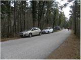
A) We drive to Nova Gorica, then continue driving towards Tolmin and Kobarid. We follow the main road towards Tolmin only to Solkan, where at the traffic-light intersection we continue right in the direction of Sveta Gora and Grgar. The ascending road further leads past the Solkan quarry, then a little higher turns sharply to the right and brings us to the Skalnica inn, behind which we continue slightly left in the direction of Sveta Gora. Further, we drive on a narrower asphalt road, beside which we park in an appropriate place by the road (best before the first cross, which we will notice on the left side of the road).
B) From Tolmin or Most na Soči we drive on the main road towards Nova Gorica, then only a little before Nova Gorica, more precisely at the traffic-light intersection in Solkan, we turn left in the direction of Sveta Gora and Grgar. The ascending road further leads past the Solkan quarry, then a little higher turns sharply to the right and brings us to the Skalnica inn, behind which we continue slightly left in the direction of Sveta Gora. Further, we drive on a narrower asphalt road, beside which we park in an appropriate place by the road (best before the first cross, which we will notice on the left side of the road).
C) From Goriška Brda we drive to Solkan, where at the first intersection after the new Solkan bridge we continue straight in the direction of Sveta Gora. The ascending road further leads past the Solkan quarry, then a little higher turns sharply to the right and brings us to the Skalnica inn, behind which we continue slightly left in the direction of Sveta Gora. Further, we drive on a narrower asphalt road, beside which we park in an appropriate place by the road (best before the first cross, which we will notice on the left side of the road).
Route description:
From the parking spot we first walk to the first cross, from there we continue slightly left on the marked footpath that leads to Sveta Gora. After a good 50 meters from the cross we will arrive at a smaller junction, where we continue right on the Pot po jarkih path (straight Sveta Gora - easy path).
The Pot po jarkih path splits again just a few meters further, and we continue right into the cavern (slightly left the path that bypasses the first and second cavern). Further on, a headlamp will come in handy, and due to the low ceiling in places and the danger of falling rocks, a helmet as well. On the other side of the first cavern the path turns slightly to the left and moderately ascends through the forest. Higher up we arrive at the second cavern, which is relatively short. When we exit it we return to the path that bypassed the first two caverns and which is a few minutes shorter.
Further on the path becomes steeper, leading us along and beside the former military trenches. A little higher we arrive at a nice viewpoint, which is only a few steps from the path (from the viewpoint a nice view opens up on both Solkan bridges, Nova Gorica, and Sabotin). Above the viewpoint the path flattens, then approaches the asphalt road to Sveta Gora completely.
At the spot where we get very close to the road, we will notice the entrance to the third 260-meter-long cavern. Here we again put on the helmet and headlamp and descend into the cavern, to which the trail marker above its entrance also directs us. The path through the cavern is at first quite slippery and relatively steep, as besides the thick steel cable, staples assist us at several spots. Higher up the path or cavern flattens, and all the fixed safety gear ends as well. A few more minutes of walking follow and the path brings us out of the cavern, where we join the path from Grgar.
Here we continue right and continue the ascent on the path that ascends diagonally through the forest. Further on the path leads us past a few more smaller caverns, then temporarily ascends a bit more steeply and brings us to Frančiškov hrib, from which a nice view opens up.
From Frančiškov hrib we continue on the wide ridge path, along which in a good 5 minutes of further walking we arrive at the cemetery and some 10 meters further to the summit of Sveta Gora.

Photos:
 1
1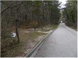 2
2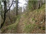 3
3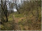 4
4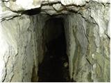 5
5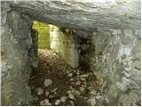 6
6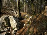 7
7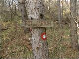 8
8 9
9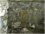 10
10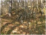 11
11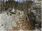 12
12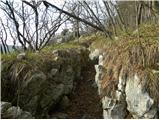 13
13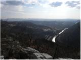 14
14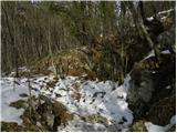 15
15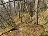 16
16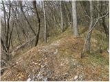 17
17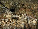 18
18 19
19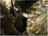 20
20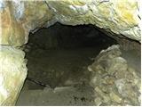 21
21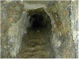 22
22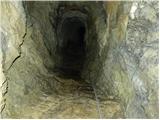 23
23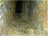 24
24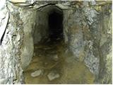 25
25 26
26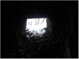 27
27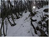 28
28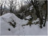 29
29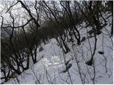 30
30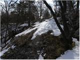 31
31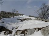 32
32 33
33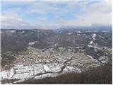 34
34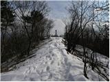 35
35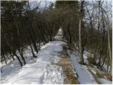 36
36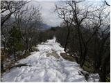 37
37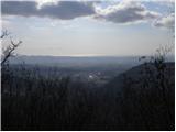 38
38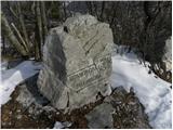 39
39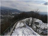 40
40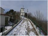 41
41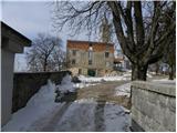 42
42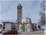 43
43
Discussion about the trip Skalnica - Sveta Gora (path through trenches)
|
| VanSims20. 02. 2013 |
I would mark that tunnel as quite demanding. Really slippery and also quite steep. Moreover, it is really dark inside like in a corner. A really good flashlight is mandatory.
When I came out of the tunnel, I went left. There I first went about 10-15 min. along a narrow unmarked path. Then I reached a marked intersection (I don't remember where the downward path led, but upwards you can also reach Sveta Gora via switchbacks).
|
|
|
|
| Majdag26. 10. 2022 14:38:15 |
The trench path - Sveta Gora - my long-awaited wish has come true. At the beginning of the tunnel a normal headlamp helps. Then a thick wire rope, mostly dragging on the tunnel floor. Rocks are wet, slippery, water trickling all the time. Without lights passage impossible. At some points it climbs steeply and the path is not easy. But it's a pleasure, we Gorenjci have mouths to ears when we emerge from the tunnel. Super! At the beginning of the tunnel a normal headlamp helps. Then a thick wire rope, mostly dragging on the tunnel floor. Rocks are wet, slippery, water trickling all the time. Without lights passage impossible. At some points it climbs steeply and the path is not easy. But it's a pleasure, we Gorenjci have mouths to ears when we emerge from the tunnel. Super!
https://jelenkamenmajdag.blogspot.com/2022/10/pot-po-jarkih-sveta-gora.html
|
|
|
To post a comment you must log in:
If you do not yet have a username, you must first
register.