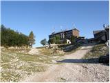
Ski hotel Vogel - Planina za Migovcem
Starting point: Ski hotel Vogel (1540 m)
| Latitude/Longitude: | 46,27580°N 13,83580°E |
| |
Walking time: 3 h 15 min
Difficulty: easy marked way
Elevation gain: 60 m
Elevation difference along the route: 500 m
Map: TNP 1:50.000
Recommended equipment (summer):
Recommended equipment (winter): ice axe, crampons
Views: 4.308
 | 1 person like this post |
Access to starting point:
From the Ljubljana–Jesenice motorway, take the Lesce exit and follow the road towards Bled and then towards Bohinjska Bistrica. We continue driving towards Lake Bohinj (Ribčev Laz), where we come to a junction, where we continue straight along the left (southern) side of the lake in the direction of Ukanc and Savica Waterfall. We follow this road to the lower station of the Vogel cable car, then buy a ticket and take the cable car to the upper station, which is the starting point for our tour.
Route description:
At the Ski Hotel we turn right (towards the west) and continue on the macadam road that passes the mountain hut Merjasec. The road begins to descend slightly and brings us to a junction. We take the right road following the signs «Komna, Sirarna Zadnji Vogel». The road continues to descend slightly and soon we are at another junction. This time we take the left road following the signs «Pl Zadnji Vogel, Komna». Already after a few tens of metres of ascent, an inscription on the rock (Vogel) directs us to a footpath that goes right into the forest. The path through the forest runs parallel to the road and begins to descend slightly. When we rejoin the road, we continue following the signs «Pl. Zadnji Vogel». The road then crosses the Zadnji Vogel cableway and brings us to a junction at the Sirarna Zadnji Vogel.
We continue straight past the Sirarna and follow the signs «Komna» (left branches the path to Vogel). The path then through the dwarf pines brings us into the forest and begins to descend slightly again. Right branches a path that leads into the valley towards the Hotel Zlatorog, we continue on the left path, which soon takes us out of the forest and beautiful views open up on the surrounding peaks. The path here begins to ascend again and runs mostly across grassy terrain surrounded by sparse dwarf pines. The path slowly turns left and brings us to a junction. Left leads the path towards the saddle Globoko (1828 m), we continue right towards Konjsko sedlo. Here we begin to ascend up the left side of the valley, and the view is finest towards Konjski vrh and Bohinjski Migovec. When we reach the saddle we continue right following the signs «Komna», left leads the path towards Vogel. The path from the saddle begins to descend and crosses the slopes on the western side of Bohinjski Migovec (1901 m). Soon we are at another junction. Left leads the path towards Škrbina (1910 m) and onwards towards the Koča na Planini Razor mountain hut, we continue right across mostly grassy terrain surrounded by sparse dwarf pines. Just a few minutes below the junction, we arrive in the grassier area of the Planina za Migovcem mountain pasture.

Along the route: Konjsko sedlo (1782m)
Photos:
 1
1 2
2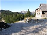 3
3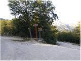 4
4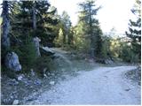 5
5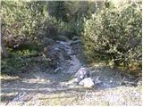 6
6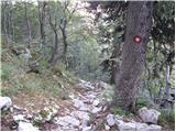 7
7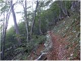 8
8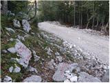 9
9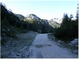 10
10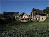 11
11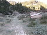 12
12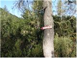 13
13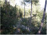 14
14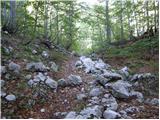 15
15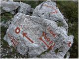 16
16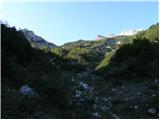 17
17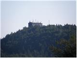 18
18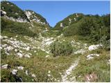 19
19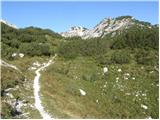 20
20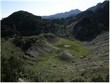 21
21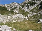 22
22 23
23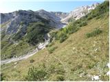 24
24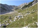 25
25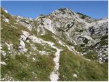 26
26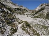 27
27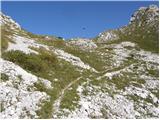 28
28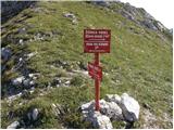 29
29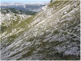 30
30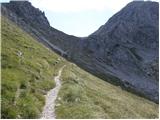 31
31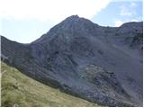 32
32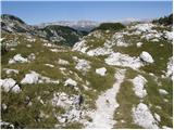 33
33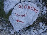 34
34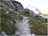 35
35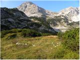 36
36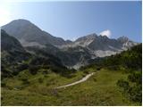 37
37
Discussion about the trip Ski hotel Vogel - Planina za Migovcem
To post a comment you must log in:
If you do not yet have a username, you must first
register.