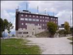
Starting point: Ski hotel Vogel (1540 m)
| Latitude/Longitude: | 46,27580°N 13,83580°E |
| |
Walking time: 3 h
Difficulty: easy marked way
Elevation gain: 426 m
Elevation difference along the route: 800 m
Map: TNP 1:50.000
Recommended equipment (summer):
Recommended equipment (winter): ice axe, crampons
Views: 57.717
 | 4 people like this post |
Access to starting point:
From the Ljubljana-Jesenice motorway, take the Lesce exit and follow the road towards Bled and then towards Bohinjska Bistrica. Continue driving towards Lake Bohinj (Ribčev laz), where we come to a junction, where we continue straight on the left (south) side of the lake in the direction of Ukanc and Savica Waterfall. Follow this road to the lower station of the Vogel cable car, then buy a ticket and take the cable car to the upper station, which is the starting point for our tour.
Route description:
When we step out from the upper station of the cable car, we head right towards the mountain hut Merjasec. We reach it after 100 meters of walking.
At the mountain hut, we take the path in the direction of Vogel, Šija and Rodica. The path ahead starts to descend slightly along a ski slope, then brings us to an indistinct saddle, where the path to Zlatorog branches off to the right.
We continue left along a poor road where there are no markers; we encounter the markings a little further on. The cart track starts to ascend and turns slightly right. A little further, the cart track has a junction, but the left steep and right gentle branches quickly merge. Then on the right side we notice a cross, where the poorer road levels out and brings us to a trail junction on a smaller plateau.
We head straight in the direction of Šija and continue slightly uphill further along the transport-rescue road. A little further, the signs for Vogel and Šija direct us right onto a footpath, which soon brings us to the spot where we cross a ski slope. There is also a junction here, where we continue left (right is one of the paths to Vogel) on the path that leads beside and under the cable car to the highest point of the ski slopes (Visoki Orlov rob).
The path ahead turns into a pleasant mountain path, which descends slightly for a short time, then ascends a little to a junction below the Šija summit. Here we continue left (straight to Šija, right to Vogel) on the path that starts to descend. The path then crosses a short scree, enters a belt of dwarf pines and brings us to a somewhat more demanding passage. The path ahead ascends steeply, crossing a slightly exposed gully. The path continues along a panoramic ridge and brings us in a few minutes of further walking to the saddle Čez Suho, where the path from the Suha pasture joins from the left.
We continue straight on the path, which occasionally ascends slightly and then descends again. The very panoramic path brings us a little further below the summit pyramid of Rodica, where we have two options for continuing. We can continue slightly right on the marked path or head left and reach the summit via an unmarked path. If we choose the ascent along the marked path, a little higher the path from Ruta joins from the right. We continue in the direction of Rodica and proceed with the ascent along the indistinct summit ridge of Rodica, whose summit we reach after another 10 minutes of walking.

Photos:
 1
1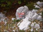 2
2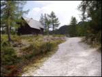 3
3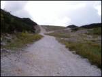 4
4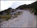 5
5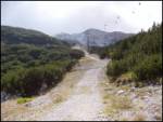 6
6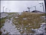 7
7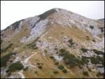 8
8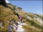 9
9 10
10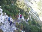 11
11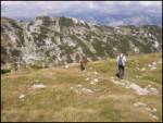 12
12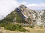 13
13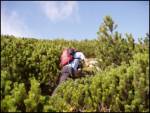 14
14 15
15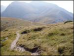 16
16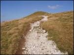 17
17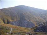 18
18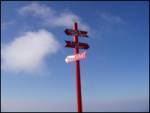 19
19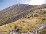 20
20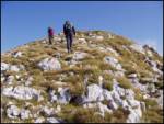 21
21 22
22
Discussion about the trip Ski hotel Vogel - Rodica
|
| el rocco28. 06. 2010 |
Yesterday my wife and I hiked this little tour. Basically nothing special, but I'd warn that you must have head cover and enough fluids. Practically no shade on the path and now in summer especially for those who don't tolerate sun well it can be problematic.
|
|
|
|
| tk72. 05. 2014 |
Hi!
Soon we plan with friends to hike the tour Ski hotel Vogel - Vogel - Rodica - Črna prst. Wondering if someone can tell me the walking time and what the conditions are like these days in this area!
Thanks for answers!
|
|
|
|
| zabava14. 06. 2014 |
tk7 I hope it's not too late. Years ago I did the ski hotel Vogel-Vogel-Rodica-Črna prst route from 7:00 am when the gondola started running and at 17:00 I was at Črna prst. I also plan to do the mentioned route again. Safe steps, the route is gorgeous.
|
|
|
|
| zabava14. 06. 2014 |
oh, forgotten, you can see it's been a long time since I was in that area, From Vogel I also went to Planina Razor and of course back to Vogel and then towards Rodica.
|
|
|
|
| tk725. 06. 2014 |
Thanks, fun, also interests me whether from Vogel summit I have to go back to the ski hotel, or if I can cross to Rodica somewhere. Thanks for the answer.
|
|
|
|
| julika25. 06. 2014 |
From Vogel summit to Rodica no need to go back to Ski hotel. The path runs more or less along the summits or at the foot of the summits. On maps such as Julijske Alpe vzhodni del 1:50 000, it is all nicely marked.
|
|
|
|
| anzecokl26. 06. 2017 |
Last week I walked from Sorica to Lepena, i.e. from east to west, this time from north to south and thus completed the Bohinj Cross from Lake Bohinj to Grahovo ob Bači.
Due to the abundance of heat, the other feats in the range will wait for cooler autumn
PHOTO REPORT HERE  
|
|
|
|
| Hermina 18. 07. 2022 13:16:57 |
On the path between Rodica and Crna prst, soon at the start a landslide and almost nowhere to step. Great caution needed.
|
|
|
|
| NEIC00812. 08. 2022 09:30:47 |
How many hours of walking from Rodica to Črna prst?
|
|
|
To post a comment you must log in:
If you do not yet have a username, you must first
register.