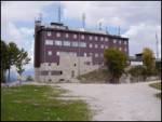
Ski hotel Vogel - Zavitar
Starting point: Ski hotel Vogel (1540 m)
| Latitude/Longitude: | 46,27580°N 13,83580°E |
| |
Walking time: 1 h
Difficulty: easy unmarked way
Elevation gain: 210 m
Elevation difference along the route: 300 m
Map: TNP 1:50.000
Recommended equipment (summer):
Recommended equipment (winter): ice axe, crampons
Views: 5.422
 | 1 person like this post |
Access to starting point:
From the Ljubljana - Jesenice motorway, take the Lesce exit and follow the road towards Bled and then towards Bohinjska Bistrica. Continue driving towards Bohinj Lake (Ribčev laz), where we come to a junction, where we continue straight along the left (southern) side of the lake in the direction of Ukanc and Savica Waterfall. Follow this road to the lower station of the Vogel cable car, then buy a ticket and take the cable car to the upper station, which is the starting point for our tour.
Route description:
When we step out from the upper station of the cable car, we head right towards the mountain hut Merjasec. We reach it after 100 m of walking.
At the hut, we head onto the path in the direction of Vogel, Šija and Rodica. The path ahead starts slightly descending along a ski slope, then brings us to an indistinct saddle, where the path to Zlatorog branches off to the right.
We continue left along a poor road, where there are no marks; we encounter blazes a little further. The cart track road starts ascending and turns slightly right. A little further ahead, the cart track has a junction, but the steep left and gentle right quickly merge. Then on the right side we spot a cross, where the poorer road levels out and brings us to a path junction on a smaller plateau.
Here we head left, first downhill, then on the other side of the sinkhole uphill to the top of the ski tow. When the wide path brings us to the top of this ski tow, we leave the path.
We head along the ridge towards the north. Already after a few metres, dwarf pines block the path. We find the passage to the right in a slight descent. Soon we spot an indistinct saddle on the ridge which we had left. The path to the saddle is hard to pass, but possible without much scrambling through dwarf pines. On the other side of the saddle we descend a few metres and then continue right below the rocks. We ascend on grass, but the path is again stopped by dwarf pines. We find the best passage a little to the right. We are again on an indistinct ridge. Here we see the summit and choose the passage on the right side of a smaller sinkhole a few metres below the summit. The last metres are not difficult.
The path from the top of the ski tow to the summit is entirely pathless. In fog, orientation is very demanding.

Photos:
 1
1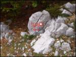 2
2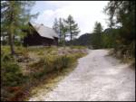 3
3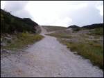 4
4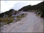 5
5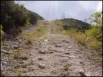 6
6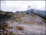 7
7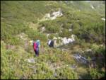 8
8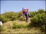 9
9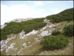 10
10 11
11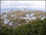 12
12
Discussion about the trip Ski hotel Vogel - Zavitar
To post a comment you must log in:
If you do not yet have a username, you must first
register.