Slavkov dom na Golem Brdu - Rog
Starting point: Slavkov dom na Golem Brdu (396 m)
| Latitude/Longitude: | 46,10550°N 14,41690°E |
| |
Walking time: 1 h 40 min
Difficulty: easy unmarked way
Elevation gain: 402 m
Elevation difference along the route: 425 m
Map: Polhograjsko hribovje in Ljubljana 1:50.000
Recommended equipment (summer):
Recommended equipment (winter):
Views: 968
 | 1 person like this post |
Access to starting point:
A) From Celovška cesta in Ljubljana we drive to Medvode, where at the first traffic light we turn left across the railway track, behind the railway track we go left, and then we follow the signs for Slavkov dom na Golem Brdu. We park on a smaller parking lot near Slavkov dom na Golem Brdu, by the recycling spot.
B) From the Gorenjska motorway exit Vodice, Kranj or Škofja Loka, we drive to Medvode, and then we continue driving in the direction of Ljubljana. At the last traffic light in Medvode we turn right in the direction of Golega Brda, behind the railway track we go left, and then we follow the signs for Slavkov dom na Golem Brdu. We park on a smaller parking lot near Slavkov dom na Golem Brdu, by the recycling spot.
Route description:
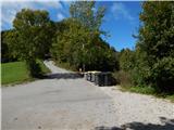
From the starting point, we continue on the left road (right Slavkov dom 1 minute), from there we go quickly left on a marked path in the direction of Jeterbenk, Katarina and Grmada. At first, we gently ascend on a cart track which behind the quarry changes into a somewhat steeper footpath for a while. A little further we join another cart track, and we still follow the signs for Jeterbenk and Katarina. A gentle path leads us past a cross and an oak, and then it starts ascending somewhat more. For a few minutes we still ascend on a cart track, and then the markings lead us on a forest path, along which we arrive at a marked junction.
From the junction, we continue straight in the direction of Katarina, where by the path we notice a yellow X (with yellow signs the Jakobova pot is marked). Next follows some diagonal ascent and we arrive at the next junction, where to the right branches the marked path to Jeterbenk (along the ridge), and we continue straight in the direction of Katarina. When a little further we step out of the forest, we also step on a cart track, on the cart track we cross grassy slopes to the junction with a macadam road. On the road we ascend a little more, and then we arrive at a chapel with Mary of the Seven Sorrows, where from the right the path from Jeterbenk and the path from the starting point Žlebe joins.
We continue straight on a gentle macadam road which leads towards Katarina, before we reach the church of St. Katarina a cart track sharply branches off to the right, on which we continue the ascent. The cart track soon turns semi-circularly left and brings us past a lonely hut to a smaller ridge, where we leave the cart track and continue the ascent on a steep and scenic path. Higher we cross a strip of forest and reach the summit of Rog, from which a nice view opens up.
Description and pictures refer to the condition in the year 2018 (September).

Photos:
 1
1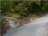 2
2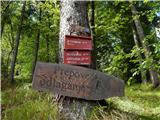 3
3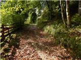 4
4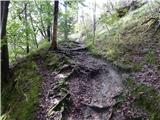 5
5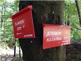 6
6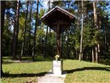 7
7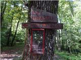 8
8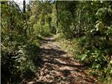 9
9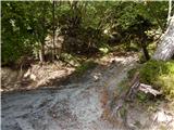 10
10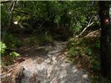 11
11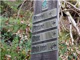 12
12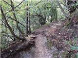 13
13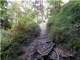 14
14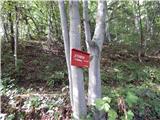 15
15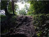 16
16 17
17 18
18 19
19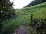 20
20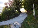 21
21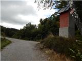 22
22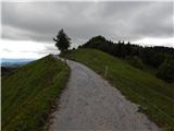 23
23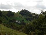 24
24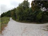 25
25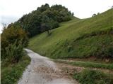 26
26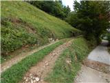 27
27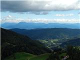 28
28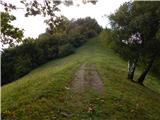 29
29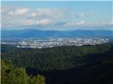 30
30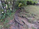 31
31 32
32 33
33 34
34
Discussion about the trip Slavkov dom na Golem Brdu - Rog
To post a comment you must log in:
If you do not yet have a username, you must first
register.