Slevo - Planjava pri Kamniškem vrhu
Starting point: Slevo (650 m)
| Latitude/Longitude: | 46,27400°N 14,57090°E |
| |
Walking time: 1 h 30 min
Difficulty: difficult unmarked way
Elevation gain: 593 m
Elevation difference along the route: 593 m
Map: Kamniške in Savinjske Alpe 1:50.000
Recommended equipment (summer):
Recommended equipment (winter): ice axe, crampons
Views: 5.875
 | 1 person like this post |
Access to starting point:
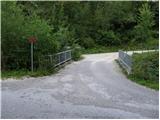
First, we drive to Kamnik, and then we continue driving towards Stahovica. Before we get to Stahovica, more precisely behind the village Godič, we leave the main road and continue driving left in the direction of Županjih Njiv. At the next intersection, we continue left in the direction of Bistričica, and we follow the road to the village Klemenčevo, where we turn right over a smaller bridge towards the village Slevo (at the intersection or by the bridge there are signs for Kamniški vrh and Krvavec). Further on, we drive on an ascending road, which leads us through the village Slevo, and after approximately 1 km from the small bridge we arrive at a smaller quarry, beside which we can park in a suitable spot. It is more considerate to the locals to park immediately behind the small bridge over the Bistričica; this extends our path by approximately 15 minutes.
Route description:
If we've parked below at the bridge, we first walk to the quarry above the village Slevo, from there at the fork of cart tracks we continue on the left one, which is also indicated by signs for Kamniški vrh and Krvavec. Further on, the cart track moderately ascends gentle grassy meadows. After approximately 15 minutes of walking from the quarry we arrive at a spot where a path from the valley also joins from the left, and at this spot we leave the marked path, which continues towards Krvavec and Kamniški vrh over the mountain pasture Osredek, and continue right on a well-beaten but unmarked path. The easy path then leads us across a gentle meadow, over which we reach a decaying shack in a few minutes.
Above the shack the slope gradually stands upright, and the path starts to ascend steeper and steeper. From the gentle grassy slopes we quickly arrive at the slope named Strme senožeti. We continue the ascent on a slightly vegetated slope, and the path leads us directly above a distinct gully, in the middle of which there is a narrower scree (part of the descent is possible on the scree).
A fairly steep path, which is very dangerous for slipping when wet, flattens after approximately 30 minutes, then quickly brings us to the saddle between Planjava on the left and Kamniški vrh on the right.
We continue left (right to Kamniški vrh) and continue the ascent along the panoramic summit ridge of Planjava. We then follow this path, which is not too steep further on, to the summit of Planjava, which we reach after 10 minutes of further walking.

Photos:
 1
1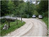 2
2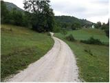 3
3 4
4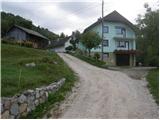 5
5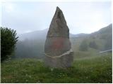 6
6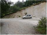 7
7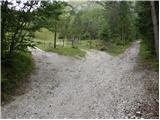 8
8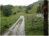 9
9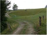 10
10 11
11 12
12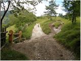 13
13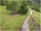 14
14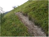 15
15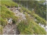 16
16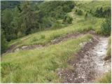 17
17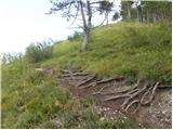 18
18 19
19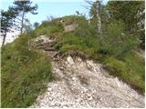 20
20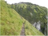 21
21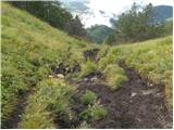 22
22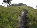 23
23 24
24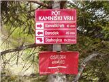 25
25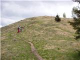 26
26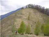 27
27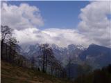 28
28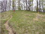 29
29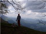 30
30
Discussion about the trip Slevo - Planjava pri Kamniškem vrhu
To post a comment you must log in:
If you do not yet have a username, you must first
register.