Starting point: Slovenska vas (468 m)
| Latitude/Longitude: | 45,66410°N 14,82590°E |
| |
Walking time: 3 h 15 min
Difficulty: easy marked way
Elevation gain: 604 m
Elevation difference along the route: 700 m
Map:
Recommended equipment (summer):
Recommended equipment (winter): ice axe, crampons
Views: 794
 | 3 people like this post |
Access to starting point:
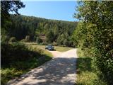
A) First, we drive to Ribnica, and then we continue driving towards Kočevje. After the settlement Mrtvice, we will soon come to a crossroad, where we turn right in the direction of Slovenska vas. Further, we drive through the mentioned village, behind it over the bridge we also cross the river Rinža. After the bridge, we continue right, and only a few meters ahead we notice signs for Slovenski vrh. We park at an appropriate place by the road, or also about 50 meters further by the next crossroad.
B) From Kočevje we drive towards Ljubljana, and then after a few kilometers we turn left in the direction of Slovenska vas (right Stara Cerkev). Further, we drive through the mentioned village, behind it over the bridge we also cross the river Rinža. After the bridge, we continue right, and only a few meters ahead we notice signs for Slovenski vrh. We park at an appropriate place by the road, or also about 50 meters further by the next crossroad.
Route description:
From the starting point, we continue in the direction of Slovenski vrh, and the path goes from the initial meadow into the forest, through which it ascends on at first quite overgrown path. After a short ascent, we quickly reach a cart track, which we follow to the right, from it we go already after a few steps left into the forest, on a well-marked footpath. Further, we ascend more steeply again, then we reach a macadam road, on which we go a few steps to the right, then left onto a steep cart track. On the cart track, we ascend for a few minutes, then at a few junctions we carefully follow the blazes. Higher up, we step again onto a forest road and soon leave it too. There follows temporarily again a more overgrown path, then after crossing yet another road, we arrive at a marked junction, where the path from Jasnica joins from the right.
We continue in the direction of Slovenski vrh, on the path that in a few minutes of further moderate ascent brings us to the summit, on which stands a small antenna tower.
From Slovenski vrh we continue left in the direction of Ledenik and Mestni vrh, on the path that continues along the forested ridge of Stojna. After the initial descent, the poorly beaten but well-marked path levels out and soon crosses a forest road. When somewhat further we reach the second forest road, we follow it to the left, walking along it to its end, from where we continue left uphill on a marked cart track. From the cart track we soon go right, then continue through dense forest. After a few minutes we reach the next forest road, which we follow to the left; it slowly turns right, thus semicircularly bypassing the nearby forestry cottage Bivaki.
A little further from the cottage, at the stump with a shelter, we leave the road and continue right on the path in the direction of Ledenik. After a short ascent, in the middle of the bend we reach the next road, on which we ascend to its end. From the end of the road we follow the marked path, which temporarily ascends more steeply, then levels out for a short time, turns slightly to the right and gradually transitions to the ridge, along which we then ascend to the highest peak of Stojna in a few minutes.
Slovenska vas - Slovenski vrh 1:30, Slovenski vrh - Ledenik 1:45.
Description and pictures refer to the condition in the year 2016 (September).

Photos:
 1
1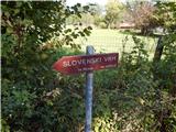 2
2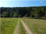 3
3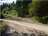 4
4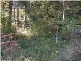 5
5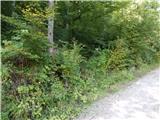 6
6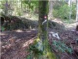 7
7 8
8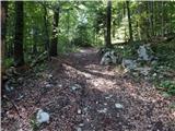 9
9 10
10 11
11 12
12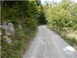 13
13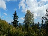 14
14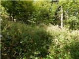 15
15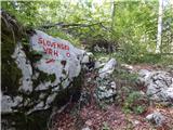 16
16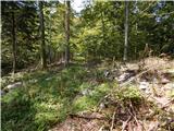 17
17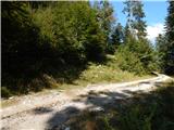 18
18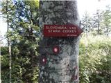 19
19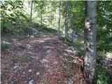 20
20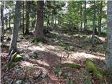 21
21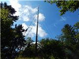 22
22 23
23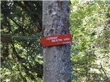 24
24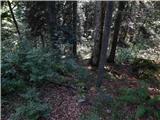 25
25 26
26 27
27 28
28 29
29 30
30 31
31 32
32 33
33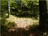 34
34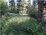 35
35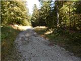 36
36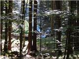 37
37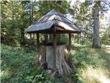 38
38 39
39 40
40 41
41 42
42 43
43 44
44 45
45 46
46 47
47 48
48 49
49
Discussion about the trip Slovenska vas - Ledenik
To post a comment you must log in:
If you do not yet have a username, you must first
register.