Slovenske Konjice - Skala (gentle path)
Starting point: Slovenske Konjice (333 m)
| Latitude/Longitude: | 46,33720°N 15,42040°E |
| |
Route name: gentle path
Walking time: 1 h 30 min
Difficulty: easy marked way
Elevation gain: 417 m
Elevation difference along the route: 450 m
Map:
Recommended equipment (summer):
Recommended equipment (winter): ice axe, crampons
Views: 26.701
 | 3 people like this post |
Access to starting point:
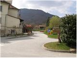
From the highway Ljubljana - Maribor, we take the exit Slovenske Konjice and follow the road to the mentioned town. In the center of Slovenske Konjice, we leave the main road (we continue left) and we head towards the church, near which we park on a large marked parking lot.
Route description:
From the parking lot at the church, we continue on the sidewalk (towards the west), which after a few dozen meters brings us to the school, where we notice the mountain signs for Stolpnik. We continue left on the sidewalk, which slightly ascends and after a short ascent brings us to the mountain signposts right next to the cemetery.
Here we continue straight in the direction of Stari grad on the path which leads us on the left side of the cemetery. At the top of the cemetery, we leave the road and continue the ascent on a marked footpath which steeply ascends. After a few minutes of ascent, the steepness eases and the path brings us out of the forest onto a macadam road, which we only cross (right - Konjice castle 5 minutes). The wide cart track along which we walk brings us in a few steps to a path junction, where the marking directs us left upwards. After a few dozen steps the situation repeats, the difference being that we do not continue the ascent on the cart track but on a footpath ascending through the forest. Higher up the path brings us to the next road, where we continue left on a footpath in the direction of Skala. After a shorter further ascent, the path crosses the recently mentioned road. The path, which further ascends diagonally, quickly brings us to the next path junction, where we have two options for continuing. We choose the right easier one (left - very demanding climbing path), which after a further few minutes of diagonal ascent with the help of a steel cable (undemanding) quickly brings us to the vantage point Skala.

The trip can be extended to the following destinations: Stolpnik
Photos:
 1
1 2
2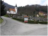 3
3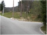 4
4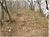 5
5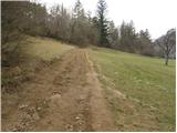 6
6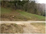 7
7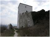 8
8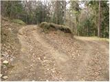 9
9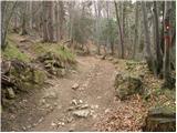 10
10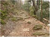 11
11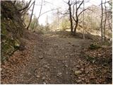 12
12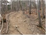 13
13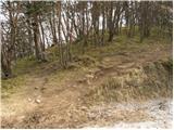 14
14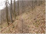 15
15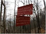 16
16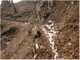 17
17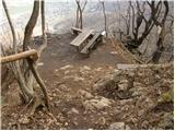 18
18 19
19
Discussion about the trip Slovenske Konjice - Skala (gentle path)
|
| gasilec25. 03. 2009 |
I must praise the caretakers of this path (probably PD Konjice), the path is well marked, new and impeccable protections, new logbook with attached pens, at the bench 2 thermometers (so you know if you're hot or cold). I hope visitors will know how to maintain this condition and thus reward the effort of the path markers.
|
|
|
|
| jan d17. 10. 2011 |
ALL PATHS TO SKALA ARE WORTH IT AND OF COURSE THE CARETAKERS WHO MAINTAIN PATHS TO SKALA ARE AWARE AND SERIOUS PRAISE TO THEM AND PD KONJICE JAN
|
|
|
|
| pohodnik3817. 10. 2011 |
If there's really going to be some nice weather this weekend, I'll come take a look and then up to the very top of Stolpnik
|
|
|
|
| Nastasja26. 11. 2011 |
According to new measurements, Skala is 777 m high.
|
|
|
|
| jany198026. 11. 2011 |
Yeah, the fog lasted a long time... and a lot of moisture... and it grew 17 m impossible impossible
|
|
|
|
| tuna.iris15. 05. 2015 |
My colleagues climb this path in 40 minutes .
|
|
|
|
| jprim15. 05. 2015 |
Nice that you're bragging with your colleagues.
What about you @tuna.iris  ? ?
|
|
|
|
| tuna.iris15. 05. 2015 |
50 minutes, I don't understand why it says the path is 1 hour and 30 minutes long?
|
|
|
|
| T00349781. 06. 2023 08:13:19 |
Hello! I'm interested because I haven't been to those rocks, I plan to go soon. Is the walking time listed as 1.30 hours in both directions or one way? Count on slow walking because I would be looking around. Thanks
|
|
|
|
| lepenatka1. 06. 2023 09:57:00 |
The hiking times refer to one direction, unless a circular path is described/indicated somewhere.
|
|
|
|
| čebejla3. 06. 2023 12:41:09 |
If you start above the church of St. Ana, you have 1 hour, more than enough time to the top. If you choose the starting point from the castle, about 10 min less.
|
|
|
To post a comment you must log in:
If you do not yet have a username, you must first
register.