Slovenske Konjice (sv. Jurij) - Skala (climbing path)
Starting point: Slovenske Konjice (sv. Jurij) (333 m)
| Latitude/Longitude: | 46,33720°N 15,42040°E |
| |
Route name: climbing path
Walking time: 1 h 10 min
Difficulty: very difficult marked way
Elevation gain: 444 m
Elevation difference along the route: 445 m
Map:
Recommended equipment (summer): helmet, self belay set
Recommended equipment (winter): helmet, self belay set, ice axe, crampons
Views: 39.970
 | 7 people like this post |
Access to starting point:
From the Ljubljana - Maribor motorway we turn onto the Slovenske Konjice exit and follow the road to the mentioned town. In the center of Slovenske Konjice we leave the main road (continue left) and head towards the church, near which we park in a large marked parking lot.
Route description:
Due to rockfall and damage to pitons the path is closed until further notice! Information from June 2026.
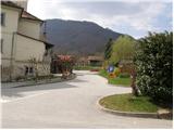
From the parking lot we walk to the eastern side of St. George's Church, where we see mountain markings for Skala. The path initially leads along Ceste pod Goro street, which we soon leave at the triangular intersection, as the markings direct us onto a poorer cart track that gently ascends beside a large field. When the road turns slightly right, we continue straight along the footpath at the edge of the field. The path soon turns into the forest and after a few dozen steps brings us to a cart track, which we follow to the left.
Initially the gentle cart track makes a right turn, then ascends more steeply and gradually changes into a footpath. In a moderate ascent through the forest after a few minutes we reach an asphalt road, which we only cross. The path continues to ascend ever more steeply and after some time brings us to a junction where we choose between two options.
We continue slightly left in the direction of the climbing path (right leads to an easier path), which after a few steps brings us to the entrance into the wall. The path with the help of a cable ascends steeply along its base. After overcoming this section, the key and most difficult part of the path follows. With the help of cables and pegs we ascend a steep transverse gully, after which we cross a rock cleft. A few more pegs await, then the difficulties ease and the path brings us to Skala, from where a beautiful view of Slovenske Konjice opens.
The climbing section is short and lasts only about 5 minutes, but the section is very demanding.

The trip can be extended to the following destinations: Stolpnik
Photos:
 1
1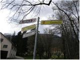 2
2 3
3 4
4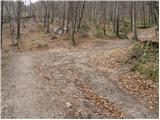 5
5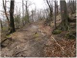 6
6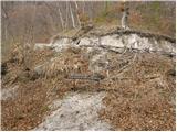 7
7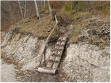 8
8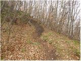 9
9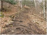 10
10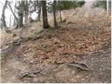 11
11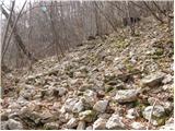 12
12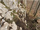 13
13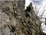 14
14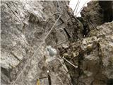 15
15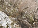 16
16 17
17 18
18
Discussion about the trip Slovenske Konjice (sv. Jurij) - Skala (climbing path)
|
| grega_p14. 11. 2009 |
Nice climbing finish to the path, especially because it's well protected (lots of pegs, pitons and good cable). Still, caution and acclimatization to height and exposure are needed.
Better to start the path in the morning, otherwise the sun hides behind Konjiška gora.
Best regards!
|
|
|
|
| damijanp25. 11. 2009 |
If there wasn't a description on hribi.net, I wouldn't know that I have this short and "sweet"  path just 10 km from home. Thanks for the description. path just 10 km from home. Thanks for the description.
Pictures are at: Skala
|
|
|
|
| Jany25. 11. 2009 |
From SKALA there is a nice view of Kojince!
|
|
|
|
| EUGEN26. 11. 2009 |
I also learned about this trail through hribi.net. Excellent training. The mountaineering club Celje could do something similar in Srebotnik or Grmada. Just a thought
for the club.
l.p.
|
|
|
|
| petruša5. 03. 2010 |
I'm interested in what the snow conditions are like on the path to Skala. Because we would like to go there in these days, on this steep path. Thanks
|
|
|
|
| antik3. 04. 2010 |
and I'm interested in what the snow conditions are like on the path to Skala these days...
|
|
|
|
| petruša4. 04. 2010 |
Yesterday we went to Skala with the family via the climbing path. The path is beautiful and the weather was great too. Very nice path and the kids enjoyed climbing, of course they had self-belaying. We'll come back.
No snow anywhere, just head up.
|
|
|
|
| swen dlakson6. 04. 2010 |
Today I was at Srebotnik via the climbing route. May it remain like that, there are some fixed belay bolts, let the alpinists still have something from Srebotnik... 
|
|
|
|
| kozo25. 04. 2011 |
Hi, today I was at Skala via the steep path, great stuff.Only thing I'd criticize is that there's no stamp or there wasn't as far as I saw.Please PD sort this out.
Regards Bojan
|
|
|
|
| taubee219. 10. 2011 |
Excellent secured climbing section of the trail. Short but nice ascent. Suitable also for children, of course with proper equipment. Caution is still necessary anyway.
|
|
|
|
| SasG22. 11. 2011 |
On 22.11.2011 I was on Skala via the steep path. The path is well marked, the climbing section well secured. The ascent was interesting despite -5°C. Still no stamp at the top or it has the ink pad torn off and is unusable.
|
|
|
|
| CarpeDiem24722. 11. 2011 |
Looks super, need to go up here soon! 
|
|
|
|
| Nastasja26. 11. 2011 |
According to new measurements, Skala is 777 m high.
|
|
|
|
| doberman27. 04. 2012 |
So close to home and I had no idea that something so beautiful with excellent view and super training for longer ascents even exists..Where did the new measurements for as much as 27m more sneak in - antenna!!!
|
|
|
|
| ghost13wolf18. 06. 2012 |
Today I was with a friend on Skala. Wonderful path for training! The climbing section is exemplarily arranged.
|
|
|
|
| jvali14. 07. 2012 |
last summer I first climbed this path with a friend, today I took my husband too. short and sweet! from the top beautiful view. yes, the stamp is still missing. safe to all, val.
|
|
|
|
| anaj2. 08. 2012 |
Does anyone know how long the Skala climbing path is?
|
|
|
|
| Keko2. 08. 2012 |
The climbing section itself is about 30 to 40 meters.
|
|
|
|
| pohodnik3822. 09. 2012 |
Today I didn't feel like going higher anywhere due to the forecast of possible wind so I headed straight to Skala and then to Stolpnik. Video is not the best but the next one will be when there's a suitable holder on the helmet.
Video-Skala climbing path
Best regards
Tone
|
|
|
|
| nincokl23. 09. 2012 |
I'm interested where the nearest trail from Skala continues to Stolpnik and if it's marked, because I was already at Skala and didn't see markings for Stolpnik anywhere... Thanks to anyone who knows for the info.
|
|
|
|
| pohodnik3824. 09. 2012 |
Exactly like that @godlike from Skala back to the gravel road you come out of the forest at the bend, along the road to the right that's the one that descends and you walk quite a while then in the middle of the forest, that path crosses the road and there we join it, it's written Stolpnik on the tree
|
|
|
|
| VanSims24. 03. 2013 |
This ferrata is no small cough! I think 'self-protection kit' should be added to 'Recommended equipment'.
|
|
|
|
| BibaS25. 03. 2013 |
Yup, short and fun secured path. I combined the path to Skala and Stolpnik a week or two ago.
|
|
|
|
| robson31. 05. 2015 |
Last information for those who asked about the stamp - the stamp is attached to the box and is exemplary maintained. It's good to have an ink pad with you.
|
|
|
|
| Hribolazec815. 02. 2016 |
How is the condition of this trail now that it's winter?
|
|
|
|
| garmont5. 02. 2016 |
No problems. It can be slippery, but of course you can expect that for this time of year.
|
|
|
|
| Lisica8. 09. 2020 |
Nice. Just the right length to stretch a bit
|
|
|
|
| ocvirkm3. 10. 2020 |
Hello!
Today I first visited Stolpnik via Zmajčkova pot and then after returning to Slovenske Konjice also Skala via the steep climbing variant.
I would warn about 2 things, namely a small rock slide on the gravel road a little before Grofov štant (there is a larger rock on the road).
I'm wondering why the second half of the steep path to Skala at the gravel road is closed with a blue tape, I checked and everything is ok, the climbing section has impeccable protections.
Best regards
Matevž
|
|
|
|
| čebejla6. 10. 2020 |
That blue ribbon is there because they concreted the foundations for the stairs. If you mean the section where the trail branches off from the macadam road into the forest.
|
|
|
|
| Jocy30. 06. 2023 23:04:28 |
Climbing path suitable only for experienced, otherwise I recommend self-belaying.
At the beginning of the path (steep path) the sign at the church is missing the name Skala, so the start of the path is very poorly marked. Continue in the direction of Dvorca Trebnik, which is marked on the sign.
|
|
|
To post a comment you must log in:
If you do not yet have a username, you must first
register.