Slovenski planinski muzej - Grančišče (Ferata Mojstrana - Blue)
Starting point: Slovenski planinski muzej (658 m)
| Latitude/Longitude: | 46,45810°N 13,93597°E |
| |
Route name: Ferata Mojstrana - Blue
Walking time: 1 h
Difficulty: very difficult marked way
Via ferrata: B
Elevation gain: 186 m
Elevation difference along the route: 186 m
Map:
Recommended equipment (summer): helmet, self belay set
Recommended equipment (winter): helmet, self belay set, ice axe, crampons
Views: 19.060
 | 1 person like this post |
Access to starting point:
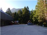
We leave the Gorenjska motorway at the Hrušica exit and follow the road ahead towards Kranjska Gora. Just before the village of Dovje, a road branches off to the left towards Mojstrana (Vrata, Kot and Krma). We follow the road towards the Vrata Valley, but only to the Slovenian Alpine Museum. We park in the parking lot at the museum.
Route description:
From the parking lot at the museum we continue approximately 100 meters along the road towards Vrata, then we turn sharply right onto the road (Pod Grančiščem), which leads towards the cliffs of Grančišče. The road leads us past a few houses and then soon on the left side in the forest we notice an information board about secured climbing paths.
We turn left onto a narrow path that leads past the mentioned boards and after a short ascent we reach the first steel cables. Left leads the more demanding red path, we turn right onto the easier blue path. From the junction we initially continue ascending along the steel cable through sparse forest, then the trees soon end and from the path we have an increasingly beautiful view of Mojstrana. The path here turns left and brings us under a vertical ladder where we cross the harder red path. We do not climb the ladder, but continue crossing the steep slope to the left. At the junctions where the easier and harder paths intersect, we follow the blue colour on the steel cable. The path then begins to ascend somewhat more steeply and in addition to the steel cable we are assisted by quite a few pegs. The blue path is easier than the red one but nevertheless remains exposed throughout. There is also quite a bit of earth and sand on the path, so there is a risk of falling rocks. In the continuation we ascend continuously along a fairly narrow exposed path with a beautiful view of Mojstrana. Higher up we cross the harder path a few more times, then the secured path soon ends and brings us to the logbook box.
From the logbook box only a short ascent through sparse forest to the panoramic summit follows.
For the ascent along the described path, the use of a via ferrata kit and helmet is mandatory.
We descend along the easy path through the forest, which is marked by a „Mojstrana“ sign. The climbing paths are not intended for descent.

Photos:
 1
1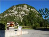 2
2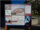 3
3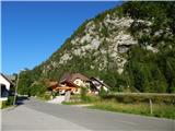 4
4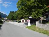 5
5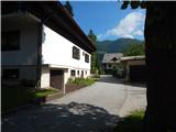 6
6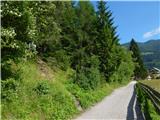 7
7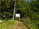 8
8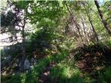 9
9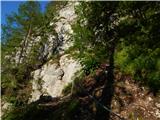 10
10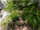 11
11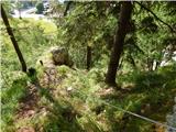 12
12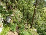 13
13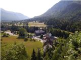 14
14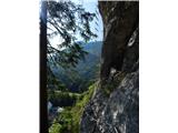 15
15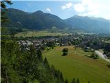 16
16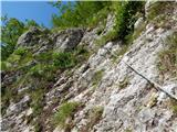 17
17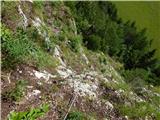 18
18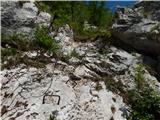 19
19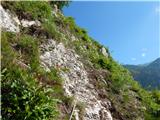 20
20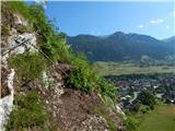 21
21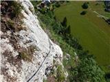 22
22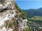 23
23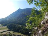 24
24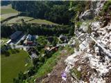 25
25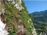 26
26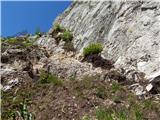 27
27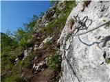 28
28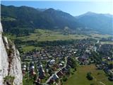 29
29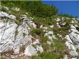 30
30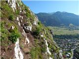 31
31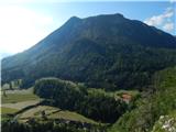 32
32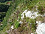 33
33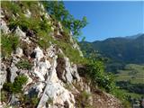 34
34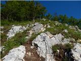 35
35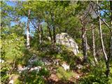 36
36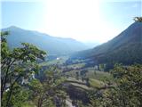 37
37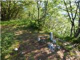 38
38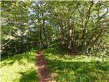 39
39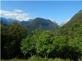 40
40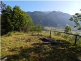 41
41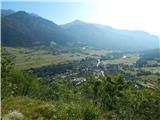 42
42
Discussion about the trip Slovenski planinski muzej - Grančišče (Ferata Mojstrana - Blue)
|
| janez.novak1. 07. 2016 |
Today getting to know the via ferrata - starting with the blue one. I was thrilled. It's not difficult, nicely routed; in short, all praise to the planners and builders. See you more often, of course also on the red one.
|
|
|
|
| kotnk29. 09. 2016 |
and for such ferratas, do you usually go in high boots or low hiking or approach shoes or something similar?
|
|
|
|
| don kihott17. 06. 2020 |
This is an excellent training ground for various beginner via ferrata courses, led by qualified guides..
|
|
|
|
| aljevsnik7. 03. 2021 |
Hello,
Is the via ferrata already open, can it be climbed? Thank you.
Alenka
|
|
|
|
| orchigu5. 07. 2022 21:22:37 |
Nice variant for learning and on the fixed cables also nicely marked with colored ribbons which is blue and which red, so you really can't get lost  and of course there's a sign below. Parking is cheaper about 100m lower from the museum (gravel left by the road). Cool variant also for after work if you're not from far away in these months when it's light long (but keep summer thunderstorms in mind of course ). I think if you've been on some via ferrata before or on a course, you can climb much faster than in 1h, but let that not be encouragement for rushing or thinking "eh this is nothing then". It's still a via ferrata, even if easy pebbles know how to slide and roll down a bit. and of course there's a sign below. Parking is cheaper about 100m lower from the museum (gravel left by the road). Cool variant also for after work if you're not from far away in these months when it's light long (but keep summer thunderstorms in mind of course ). I think if you've been on some via ferrata before or on a course, you can climb much faster than in 1h, but let that not be encouragement for rushing or thinking "eh this is nothing then". It's still a via ferrata, even if easy pebbles know how to slide and roll down a bit.
|
|
|
|
| Kafetarca6. 07. 2022 15:05:29 |
Where is this cheaper parking? As much as I looked, all parkings are 1.2 eur per hour...
|
|
|
|
| MinasTirith13. 05. 2023 21:35:21 |
Information.
Today 13.5.2023 I wanted to go on the mentioned via ferrata but it is closed due to works/repairs/maintenance…so you won't turn back unnecessarily
|
|
|
|
| črow28. 05. 2023 21:55:02 |
It's still closed. Apparently, a rock is threatening to fall. Info from a local.
|
|
|
|
| balon30. 06. 2023 12:45:59 |
I called SPM and got the answer that the via ferrata is open from today (30.6.2023).
|
|
|
|
| Majdag30. 06. 2023 15:19:27 |
There were many visitors on the rock face in the morning...
The red and blue, both were crowded..
|
|
|
To post a comment you must log in:
If you do not yet have a username, you must first
register.