Šmihel - Kopitnik (via Skozno)
Starting point: Šmihel (310 m)
| Latitude/Longitude: | 45,95080°N 13,73930°E |
| |
Route name: via Skozno
Walking time: 3 h
Difficulty: easy unmarked way
Elevation gain: 619 m
Elevation difference along the route: 715 m
Map: Goriška - izletniška karta 1:50.000
Recommended equipment (summer):
Recommended equipment (winter):
Views: 2.170
 | 1 person like this post |
Access to starting point:
A) From the Vipava expressway take the Vogrsko exit, then continue driving in the direction of Tolmin and Ozeljan. When we reach the old road Ajdovščina - Nova Gorica, at the traffic-light intersection continue left, then after a few meters, in the hamlet Tri Hiše, right onto the road, by which we quickly arrive in Ozeljan. Through Ozeljan follow the signs for pizzeria Grad, from the pizzeria onwards follow the main road or right turn-offs, which bring us higher to the settlement Šmihel. When we get to the upper part of the settlement, we notice the first signs for Skozno, which point us to the right, and then we quickly get to the cemetery, next to which we park.
B) From Nova Gorica on the old road drive towards Ajdovščina, then at the hamlet Tri Hiše (the hamlet is located at the traffic-light intersection, where the road towards the settlement Vogrsko branches off to the right) continue left in the direction of pizzeria Grad. On the mentioned road quickly arrive in Ozeljan. Through Ozeljan follow the signs for pizzeria Grad, from the pizzeria onwards follow the main road or right turn-offs, which bring us higher to the settlement Šmihel. When we get to the upper part of the settlement, we notice the first signs for Skozno, which point us to the right, and then we quickly get to the cemetery, next to which we park.
Route description:
From the starting point continue along the left upper side of the cemetery, where we walk on a poorer road which turns left and quickly brings us to a water supply facility. Behind the mentioned facility the path changes into a cart track, turns right and quickly brings us to a marked junction.
From the junction continue on the left cart track in the direction of the natural window Skozno (straight Trpinovšče), which we follow at a few smaller junctions in the direction of the blazes. At the next directional sign for Skozno, leave the cart track and continue the ascent on a steeper mountain path, which mainly ascends transversely to the left. A little higher, at the hunting observation post, at the smaller junction, continue straight, cross a short clearing, then views towards the Vipava valley and Trstelj in the background occasionally begin to open up. A little further the path levels out and we arrive at a pleasant bench, from which a nice view opens towards the valley, Sveta Gora and the Alps in the background.
Behind the bench the path turns semicircularly to the right, where the path from the settlement Ravnica joins from the left.
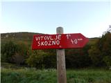
Continue right in the direction of Vitovlje and Skozno, then a few minutes further right down towards the natural window Skozno, where we quickly descend to the logbook box.
From the logbook box return to the marked path which leads towards Vitovlje (also possible on the demanding path which leads through the Skozno cave), then continue towards Vitovlje (meanwhile we can also walk to the natural bridge over the Skozno window). The path ahead leads along the southern slopes of Trnovski gozd and continues without major changes in elevation. Behind the small hunting blind, which we notice on the right side, we arrive at a junction, where on a rock we notice the inscription Vitovlje. Here a path branches off right down to the cemetery in Šmihel, while we continue straight towards Vitovlje. Further on, the otherwise rare blazes are replaced by red lines, and the path leads us south of the weekend settlement - Trpinovšče. Quite overgrown and in the period from early spring to late autumn, the path full of ticks brings us to yet another junction, where the next path branches off right down towards Vitovlje. Again continue straight, first passing a bench which is partly overgrown by tick-infested grass. Behind the bench the path gently to moderately ascends for some time along the southern slopes of Trnovski gozd, aided by still fairly frequent unofficial markings in the form of red lines. After a while the path from the edge of the plateau turns somewhat more to the right, passes onto the slopes, then joins the marked path which leads from Vitovlje towards Kopitnik.
Follow the mentioned path to the left i.e. straight, then quickly reach the cart track. At the nearby junction continue in the direction of the hunting hut, then step onto a wide cart track. At the hunting hut the cart track changes into a road, along which we quickly ascend to the paragliding take-off site Kopitnik, from where a nice view opens onto the lower part of the Vipava valley.
Šmihel - Skozno 1:00, Skozno - Kopitnik 2:00.
Description and pictures refer to the condition in 2016 (October).

Photos:
 1
1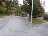 2
2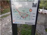 3
3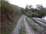 4
4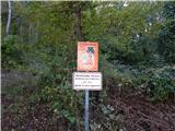 5
5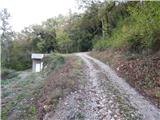 6
6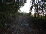 7
7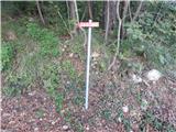 8
8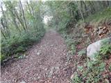 9
9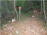 10
10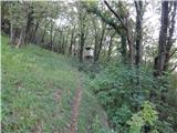 11
11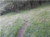 12
12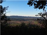 13
13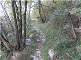 14
14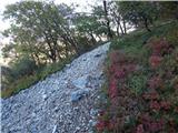 15
15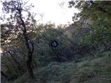 16
16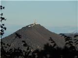 17
17 18
18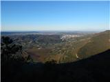 19
19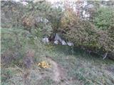 20
20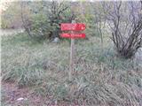 21
21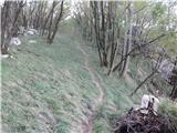 22
22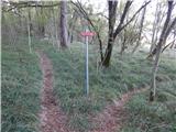 23
23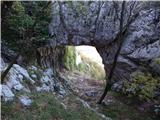 24
24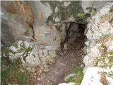 25
25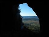 26
26 27
27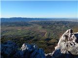 28
28 29
29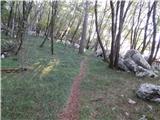 30
30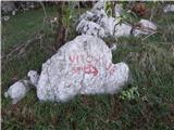 31
31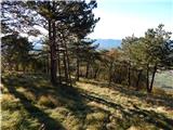 32
32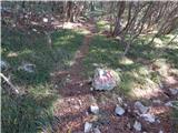 33
33 34
34 35
35 36
36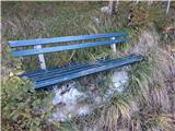 37
37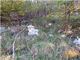 38
38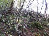 39
39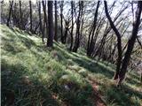 40
40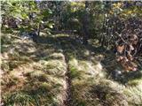 41
41 42
42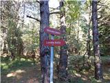 43
43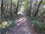 44
44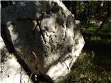 45
45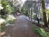 46
46 47
47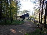 48
48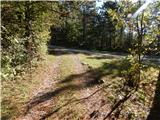 49
49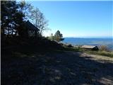 50
50 51
51 52
52
Discussion about the trip Šmihel - Kopitnik (via Skozno)
|
| Hribolazec8117. 06. 2024 23:49:14 |
Hikers familiar with this trail, how is this path marked and visible?
Somewhere it says unmarked path, I haven't hiked here yet, so I don't know these areas 
Thanks 
|
|
|
|
| mirank18. 06. 2024 11:53:00 |
We walked the mentioned trail multiple times during the corona lockdown and it was well-trodden and marked then, which I think it still is. Caution, not suitable for the current period as it can be hot as hell there. We did it to Veliki rob and descended there to srednječavensko, along it to the church above Vitovlje, descended there another 150 elevation meters and via a nice forest path directly to the Šmihel cemetery. Circular tour about 7-8h
|
|
|
To post a comment you must log in:
If you do not yet have a username, you must first
register.