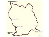
Šmihel nad Mozirjem - Dom na Smrekovcu (circular path)
Starting point: Šmihel nad Mozirjem (712 m)
| Latitude/Longitude: | 46,37690°N 14,95450°E |
| |
Route name: circular path
Walking time: 6 h
Difficulty: easy marked way
Elevation gain: 663 m
Elevation difference along the route: 875 m
Map: Kamniške in Savinjske Alpe 1:50.000
Recommended equipment (summer):
Recommended equipment (winter): ice axe, crampons
Views: 10.866
 | 3 people like this post |
Access to starting point:
First, we drive to Mozirje, and there at the roundabout, we continue in the direction of Golte. After 2 km of driving, we come to a crossroad for Šmihel (at the crossroad you will see inn Gostilna VID) and here we turn right towards Šmihel. Then we drive 6 km uphill and we get to a very nice village Šmihel, where we can see that the entire village breathes for the tidiness of the place. Here park the car in front of the church, where there are enough parking spaces.
Route description:
The path started in Šmihel nad Mozirjem at 8:25 and headed towards Mozirska koča. The path towards Mozirska koča is very well marked and led me past pastures, through the yard of a farm, through the forest, on asphalt and macadam roads. In short, I switched between many different surfaces to reach the cottage.
From the village of Šmihel to Mozirska koča, I needed 1 hour and 30 minutes. I don’t write much, because the attached photos tell more.
From the cottage, go 20 meters uphill on the road and then turn right onto a meadow (you will see the sign). There is also a chapel, and you will be able to see part of the ski slope Golte, then quickly enter the forest. A little before Boskovec, it happened to me for the first time that I got lost. Why? I found a mountain signpost with a curved arrow for Boskovec, and I understood it as taking the path to the left after a few meters, but I should have gone right on a narrow footpath. What misled me: the left path was much wider (it seems tractors or quads drive on it), while the right one had a sign on a stone, which was hidden by tall grass. After a few tens of meters walking in the wrong direction, I returned to the signpost and then found the mark for Boskovec. So, caution at this sign (a comment is also at the photo). To the lookout tower on Boskovec, I arrived after 40 minutes of walking from Mozirska koča.
I didn’t climb the tower because the views weren’t nice (clear day, but hazy views), so there are no photos from the tower into the distance.
From the tower, return back on the same path you came, about 100 meters, whereupon you will reach a crossroad where you can return to Mozirska koča or continue towards the mountain hut Dom na Smrekovcu. I went right towards the mountain hut Dom na Smrekovcu. This path surprised me greatly, as the nature I walked through and the terrain (stone, moss, spruce needles, pasture, meadow, steep slopes, swamp…) changed incredibly quickly again. The path resembles Mariborsko Pohorje. So, I went through Kal to the mountain hut Dom na Smrekovcu. From the lookout tower on Boskovec to Kal, I needed 30 minutes, and from Kal to the mountain hut Dom na Smrekovcu, an additional 45 minutes.
It was 12:15, and I chose the mountain hut Dom na Smrekovcu for rest and lunch. Here, we all laughed at two goats that were lounging on the tables.
At 14:00, I left the mountain hut Dom na Smrekovcu and headed in the direction of "Bele vode, Šoštanj" (the mountain sign is 100 meters below the hut; go left into the forest). I descended again through forests and pastures and also past a larger group of cows that were peacefully grazing. So, after 1 hour and 5 minutes, I arrived at a crossroad with a road and the stream Štajerska Kramarica, where I decided to take the path along the stream.
So, I walked about 2 km along the stream (I passed a water catchment and a house that once had a fish farm; the pools are visible). There are no more mountain signposts here. Then I reached a crossroad where the path continues along the stream, and another goes uphill (at the crossroad on the hill, there is also a house). Here, I went right on the road uphill past this house and into the forest. From here on, I walked only on the macadam road, as there were no mountain signposts anywhere. A kilometer before Šmihel, I reached an asphalt road and continued along it towards Šmihel. From the crossroad for Bele vode to Šmihel, I needed 1 hour and 5 minutes, so I arrived in Šmihel at 17:10.
The path is quite long, as I actively walked for 5 hours and 35 minutes, and I walk faster than the average hill and mountain visitor. It is a very beautiful path, as I’ve already written twice, the surroundings change every few minutes. So, I would recommend this path to families with children, but only certain sections, depending on which ones appeal to you more. This hilly area is crisscrossed with well-maintained macadam roads, so you can choose any parking lot. For easier orientation, take a mountain map with you.

Along the route: Šmihelj nad Mozirjem (712m), Mozirska koča (1356m),
Boskovec (1587m), Kal (prelaz) (1318m), Dom na Smrekovcu (1377m)
The trip can be extended to the following destinations: Smrekovec
Photos:
 1
1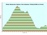 2
2 3
3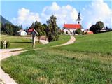 4
4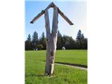 5
5 6
6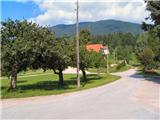 7
7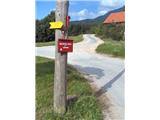 8
8 9
9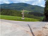 10
10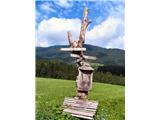 11
11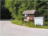 12
12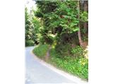 13
13 14
14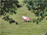 15
15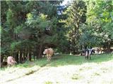 16
16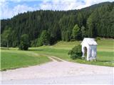 17
17 18
18 19
19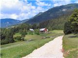 20
20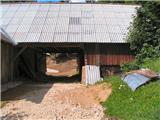 21
21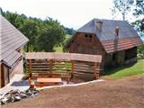 22
22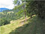 23
23 24
24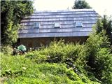 25
25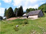 26
26 27
27 28
28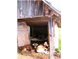 29
29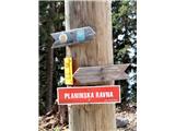 30
30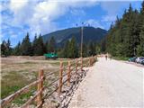 31
31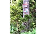 32
32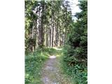 33
33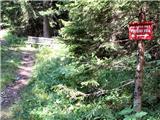 34
34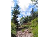 35
35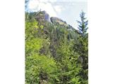 36
36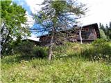 37
37 38
38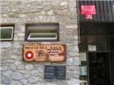 39
39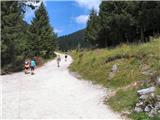 40
40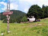 41
41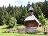 42
42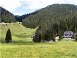 43
43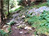 44
44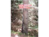 45
45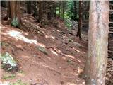 46
46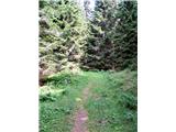 47
47 48
48 49
49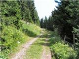 50
50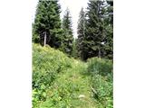 51
51 52
52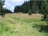 53
53 54
54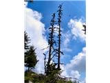 55
55 56
56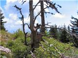 57
57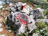 58
58 59
59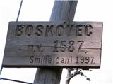 60
60 61
61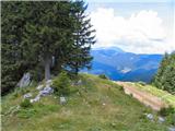 62
62 63
63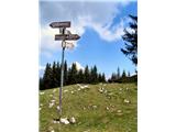 64
64 65
65 66
66 67
67 68
68 69
69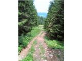 70
70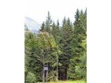 71
71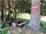 72
72 73
73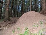 74
74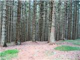 75
75 76
76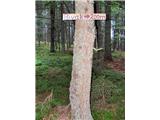 77
77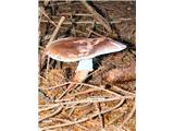 78
78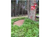 79
79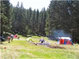 80
80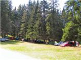 81
81 82
82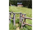 83
83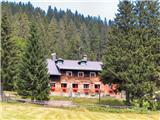 84
84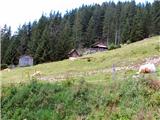 85
85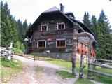 86
86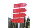 87
87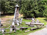 88
88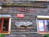 89
89 90
90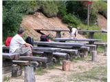 91
91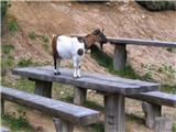 92
92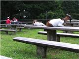 93
93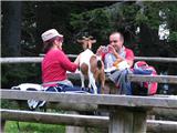 94
94 95
95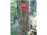 96
96 97
97 98
98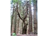 99
99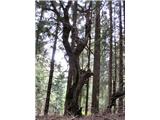 100
100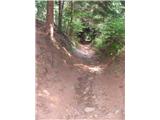 101
101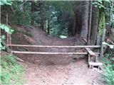 102
102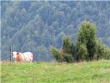 103
103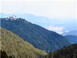 104
104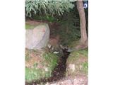 105
105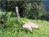 106
106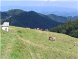 107
107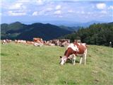 108
108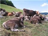 109
109110
 111
111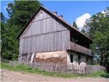 112
112 113
113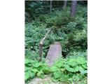 114
114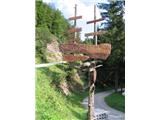 115
115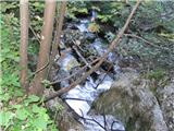 116
116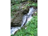 117
117 118
118 119
119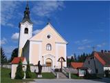 120
120
Discussion about the trip Šmihel nad Mozirjem - Dom na Smrekovcu (circular path)
To post a comment you must log in:
If you do not yet have a username, you must first
register.