Šobčev bajer - Sveti Lambert (Lancovo)
Starting point: Šobčev bajer (426 m)
| Latitude/Longitude: | 46,35560°N 14,15070°E |
| |
Walking time: 1 h 5 min
Difficulty: easy unmarked way
Elevation gain: 89 m
Elevation difference along the route: 125 m
Map: Karavanke - osrednji del 1:50.000
Recommended equipment (summer):
Recommended equipment (winter):
Views: 689
 | 1 person like this post |
Access to starting point:
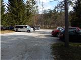
From the highway Ljubljana - Jesenice, we take the Lesce exit, then continue driving towards Bled. Still before Bled, we notice signs for camp Šobec, which direct us left onto the road, along which we quickly arrive at a large parking lot located before the entrance to the camp. The parking lot or the last part of the road is payable during part of the year. During the high summer season, the entrance to the camp or access to Šobčev bajer is also payable.
Route description:
From the parking lot, we continue on the vehicular road that continues left from the fenced area of Šobčev bajer and starts to ascend transversely. When the wider macadam road turns slightly to the left, we continue right onto a side road, alongside which there are signs for the path Pot ob Savi. With a view of Babji zob and the surrounding hills, we quickly arrive at a few beehives, beyond which the road turns into a cart track. A little further on, when we reach a larger meadow, a short path, less than 5 minutes long, branches off to the left to the Lehnjak stream and its source; we continue straight ahead if we do not visit the stream, otherwise we return to the mentioned junction and continue in the direction of Lancovo. When we leave the larger meadow, the path continues alternately through the forest and partly across meadows. When we reach a smaller footbridge, we cross it, then continue along the left bank of the Sava River, where it leads us past fish. After a few minutes of walking along the river, we reach an asphalt road, where we continue right and then cross the Sava River over the bridge.
After the bridge, at the ecological island, we continue right; at the nearby intersection, we go slightly left towards the church of St. Lambert (straight: Sava confluence). This is followed by an ascent along the asphalt road that leads us past occasional houses. When the road higher up flattens out, at the chapel near the Equestrian Society Dalija, we continue left. This is followed by some easy walking; when the road starts ascending again, a nice view of the Karavanke opens up upon looking back. When we reach the small saddle, we go right and arrive at the church of St. Lambert in a few steps.

Along the route: Lancovo (415m)
Photos:
 1
1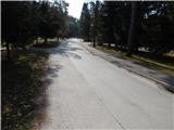 2
2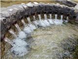 3
3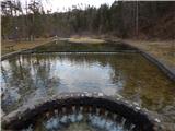 4
4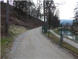 5
5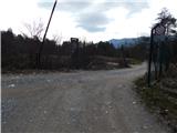 6
6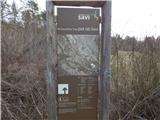 7
7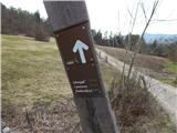 8
8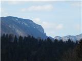 9
9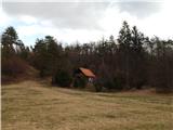 10
10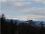 11
11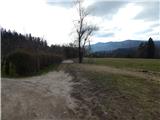 12
12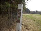 13
13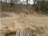 14
14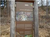 15
15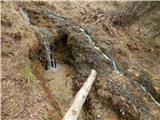 16
16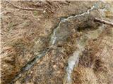 17
17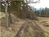 18
18 19
19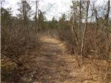 20
20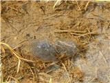 21
21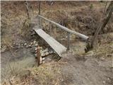 22
22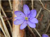 23
23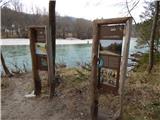 24
24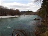 25
25 26
26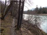 27
27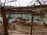 28
28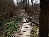 29
29 30
30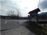 31
31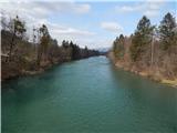 32
32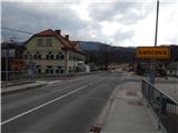 33
33 34
34 35
35 36
36 37
37 38
38 39
39 40
40 41
41 42
42 43
43 44
44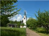 45
45
Discussion about the trip Šobčev bajer - Sveti Lambert (Lancovo)
To post a comment you must log in:
If you do not yet have a username, you must first
register.