Socka - Kozjek (above Socka)
Starting point: Socka (322 m)
| Latitude/Longitude: | 46,34178°N 15,27377°E |
| |
Walking time: 1 h 10 min
Difficulty: easy marked way
Elevation gain: 426 m
Elevation difference along the route: 426 m
Map:
Recommended equipment (summer):
Recommended equipment (winter):
Views: 2.110
 | 3 people like this post |
Access to starting point:
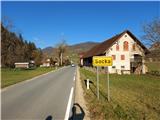
Socka is a settlement in the Municipality of Vojnik. It lies on the road between Nova Cerkev and Vitanje. It got its name from the gorge of the Hudinja River, which is called the same - Socka. We reach Socka from Celje (approx. 13 km), from where we go north through Vojnik, then left through Nova Cerkev and Razdelj. We can park in the very center, where there are enough parking spaces near the bus station, Gostišče Koprivnik, or Bistro Bals.
Route description:
From the starting point, we continue in the same direction towards the north, from where we came from Celje, on the asphalt road into the Socka gorge, through which the Hudinja River flows. The path along the asphalt road is marked and interesting. For most of the path, we will follow the directions towards Špičasti vrh or Strnadov travnik. Approx. 1 km from the starting point, on the left side of the road at the bend, there is a larger parking lot, where we can also drive and park. Here we leave the main road and head across the stream opposite the parking lot, where there is a footbridge and directional signs. The path continues through the forest and upwards; soon we encounter steps, where the signs direct us along the asphalt to the right. A few steps later, we encounter a junction, where we continue sharply left upwards back onto the forest path towards Strnadov travnik. A few steps upwards and another junction awaits us. The signs here can confuse us, but we turn right onto the hardened forest path. From here on, a varied forest path runs, and the blazes and signs excellently guide us throughout towards our goal. After some time, we reach the saddle between Kozjek on the left and Kislica on the right, where we continue left to Strnadov travnik uphill and leave the marked path (we do not follow the sign to the right, we go straight opposite). Soon we arrive at a clearing, where a beautiful view opens towards the south and back towards Kislica. We continue to the forest and step onto a forest path slightly uphill. The forest path narrows more and more until it disappears. A few meters of ascent towards the summit remain on pathless terrain. The summit is not panoramic; for that pleasure, we descend slightly down the SW ridge to the vantage point, where a wonderful view opens towards the west all the way to the Alps themselves.

Photos:
 1
1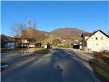 2
2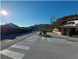 3
3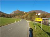 4
4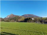 5
5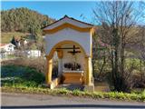 6
6 7
7 8
8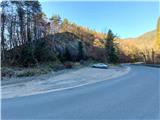 9
9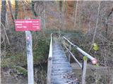 10
10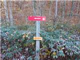 11
11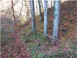 12
12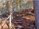 13
13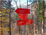 14
14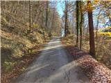 15
15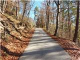 16
16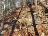 17
17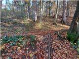 18
18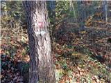 19
19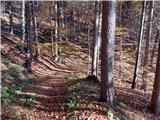 20
20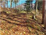 21
21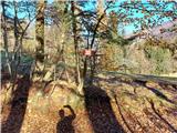 22
22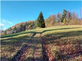 23
23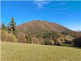 24
24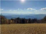 25
25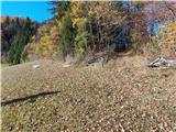 26
26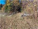 27
27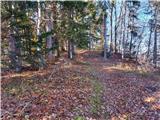 28
28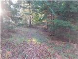 29
29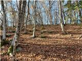 30
30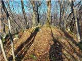 31
31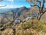 32
32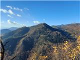 33
33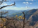 34
34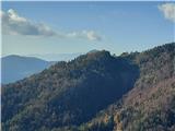 35
35 36
36
Discussion about the trip Socka - Kozjek (above Socka)
|
| garmont27. 11. 2020 |
Interesting, although considerably more demanding is the ascent along the SW ridge, which ends right at the top of Kozjek. Descent then along the path described above.
|
|
|
|
| Hribolazec8128. 09. 2023 20:59:06 |
Beautiful path, the footbridge over the stream unfortunately no longer exists (Picture 10), I had to take off my shoes and go barefoot across 
|
|
|
To post a comment you must log in:
If you do not yet have a username, you must first
register.