Sokoli - Sokolske stijene
Starting point: Sokoli (740 m)
| Latitude/Longitude: | 45,55020°N 14,62400°E |
| |
Walking time: 45 min
Difficulty: easy marked way
Elevation gain: 221 m
Elevation difference along the route: 221 m
Map:
Recommended equipment (summer):
Recommended equipment (winter):
Views: 190
 | 1 person like this post |
Access to starting point:
From the Ljubljana - Koper motorway, take the Unec exit and continue following the road towards Cerknica. Continue driving through Cerknica, Martinjak and Grahovo to the village of Bloška polica, where at the intersection continue right towards the villages of Lož and Babno Polje. Drive through Lož, Stari trg and Igo vas to the Babno Polje border crossing, where we cross into Croatia. Continue the drive through Prezid all the way to the place Tršče, where behind the church of Sv. Andrije turn right onto the narrower road. Drive to the next intersection, where continue left into the village Selo. After the village, the road begins to descend and leads us past the sand pit, a small cross to the junction right for Sokolske stijene. We can drive to the nearby church of Sv. Ivana Krstitelja, where we park in a suitable place by the road.
Route description:
From the church of Sv. Ivana Krstitelja we return back to the junction for Sokolske stijene. We head onto the logging trail which leads to a small stone hut and turns left. We ascend past a small clearing, where the logging trail levels out. From here we nicely see the walls of Sokolskih stijen above us. The logging trail becomes somewhat more overgrown and gradually turns into a path. The path gently ascends. Then we walk through several switchbacks, in between the path is slightly washed out by water. After about half an hour of walking we arrive over the edge, where there is a marked junction. Straight on the path continues towards Crnim stijenam and further to Rudnik, we however continue right towards Sokolskih stijen, from where it is also possible to Rudnik. The path first steeply ascends and in a few minutes we arrive below the small wall of Sokolskih stijen, where there is also a junction. Straight on the path continues to Rudnik, we continue right. The path first climbs over a rocky step and then a few meters of somewhat flatter path await us to the summit. From the summit some views open to the east.
The description and photos refer to the condition in July 2025.

Photos:
 1
1 2
2 3
3 4
4 5
5 6
6 7
7 8
8 9
9 10
10 11
11 12
12 13
13 14
14 15
15 16
16 17
17 18
18 19
19 20
20 21
21 22
22 23
23 24
24 25
25 26
26 27
27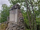 28
28
Discussion about the trip Sokoli - Sokolske stijene
To post a comment you must log in:
If you do not yet have a username, you must first
register.