Starting point: Solarji (952 m)
| Latitude/Longitude: | 46,18030°N 13,66760°E |
| |
Walking time: 30 min
Difficulty: easy marked way
Elevation gain: 163 m
Elevation difference along the route: 175 m
Map: Julijske Alpe - zahodni del 1:50.000
Recommended equipment (summer):
Recommended equipment (winter):
Views: 4.075
 | 1 person like this post |
Access to starting point:
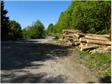
A) From Nova Gorica or Tolmin we drive towards Bovec. Only a little after the roundabout where the roads from Nova Gorica and Tolmin join, we reach a crossroad where the road towards the Solarji saddle and Kolovrat branches off to the left. The road then brings us along the edge of Volče, where a signpost for the Solarji saddle directs us right onto the road which after the last houses starts ascending steeper. Further we drive on an asphalt road which after a few kilometers of ascent brings us to the saddle, where there is also a crossroad of roads. Here we continue on the left lower road, by which already after a few meters we park on a large parking lot (we park in a way that we do not hinder possible forestry work).
B) From Bovec we drive towards Tolmin, but we follow the road to the spot where the road towards Kolovrat branches off to the right (the turn-off is marked and is located only a little before the roundabout where the road splits towards Nova Gorica and Tolmin). The road then brings us along the edge of Volče, where a signpost for the Solarji saddle directs us right onto the road which after the last houses starts ascending steeper. Further we drive on an asphalt road which after a few kilometers of ascent brings us to the saddle, where there is also a crossroad of roads. Here we continue on the left lower road, by which already after a few meters we park on a large parking lot (we park in a way that we do not hinder possible forestry work).
Route description:
From the parking lot, we return to the crossroad, and there at the stop sign we notice the beginning of the path which leads towards the summit Na gradu. The path immediately starts ascending, and it first leads us through shrubbery (in autumn we will notice ripe fruits of hazel here). Further, we quickly ascend to the indistinct summit Platena, from which we descend to the nearby asphalt road. Next follows a short section of the path on the road, and the signs for the summit Na gradu quickly direct us left onto the path which ascends through a belt of low forest. The path further brings us to an old military path, along which beside the defensive embankment we ascend to the grassy slopes of the summit Na gradu. At the edge of the meadow we ascend to a smaller saddle, from there we continue left and after 2 minutes of further walking we step onto the panoramic summit.
Along the route: Platena (1038m)
Photos:
 1
1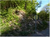 2
2 3
3 4
4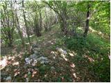 5
5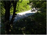 6
6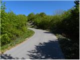 7
7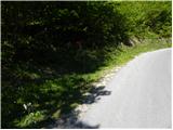 8
8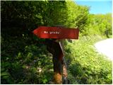 9
9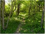 10
10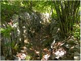 11
11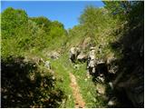 12
12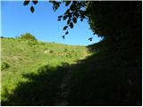 13
13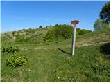 14
14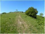 15
15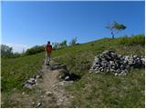 16
16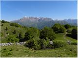 17
17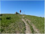 18
18 19
19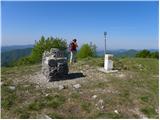 20
20
Discussion about the trip Solarji - Na gradu
To post a comment you must log in:
If you do not yet have a username, you must first
register.