Sora - Brunarica Osovnik (on footpath)
Starting point: Sora (360 m)
| Latitude/Longitude: | 46,14140°N 14,37030°E |
| |
Route name: on footpath
Walking time: 1 h 35 min
Difficulty: easy marked way
Elevation gain: 417 m
Elevation difference along the route: 450 m
Map: Ljubljana - okolica 1:50.000
Recommended equipment (summer):
Recommended equipment (winter): crampons
Views: 3.451
 | 1 person like this post |
Access to starting point:
A) First, we drive to Medvode, then at the Spar store we leave the main road and continue towards the railway station and settlement Sora. In Sora the road towards Katarina first branches off to the left, a little further also towards Osolnik. We drive on the road towards Osolnik and then after a shorter ascent we park on the parking lot below the church of St. Stefan. We can also park a little lower on the parking lot by the presbytery.
B) From Kranj we drive towards Škofja Loka, from the periphery of Škofja Loka then we follow the signs for Gorenjo vas. Before the Sten tunnel from the roundabout we drive onto the exit in the direction of the settlement Sora. Further, we drive through the settlements Hosta, Pungert, Gosteče and Draga, to the settlement Sora, where we turn right towards Osolnik and then after a shorter ascent we park on the parking lot below the church of St. Stefan. We can also park a little lower on the parking lot by the presbytery.
C) From the Poljanska valley we drive towards Škofja Loka and then on the bypass and through the Sten tunnel. After the tunnel we turn right and follow the signs for the settlement Sora. Further, we drive through the settlements Hosta, Pungert, Gosteče and Draga, to the settlement Sora, where we turn right towards Osolnik and then after a shorter ascent we park on the parking lot below the church of St. Stefan. We can also park a little lower on the parking lot by the presbytery.
Route description:
At the beginning of the parking lot a marked footpath branches off to the left, which starts ascending through the forest. After a few minutes we cross an asphalt road which leads towards Osolnik (to here also possible on the road, if we parked on the upper part of the parking lot), and we continue on the marked path. We continue the ascent through the forest, at a few smaller junctions we follow the blazes. Higher the path reaches a side ridge, where it flattens and gets very close to the asphalt road. We continue a little right of the road, and the path quickly splits.
We continue slightly left (right Hom 15 minutes) and further we ascend transversely on mostly southern slopes of Hom. When a little further we reach an indistinct small ridge, from the right the path from the top of Hom joins us, and we continue left and a little further we reach an asphalt road. The path continues on the road, occasionally on a marked path which runs right or left of the road. Further a quite gentle path then brings us to a junction, where from the left the marked path from Ločnica joins us, and we continue straight to the nearby junction and crossing, where at the sign to the right the footpath to Osolnik branches off, and we continue straight, on the left road in the direction of the log cabin Osovnik. Soon after the junction we step out of the forest and for some time continue with nice views and without major changes in elevation. After crossing a shorter strip of forest we ascend to a smaller saddle, where some houses are situated.
We continue straight downhill (right top of Osolnik), then at the first junction left to the nearby log cabin Osovnik, to which only a few 10 steps of walking remain.
Description and pictures refer to the condition in the year 2018 (February and March).

The trip can be extended to the following destinations: Osolnik
Photos:
 1
1 2
2 3
3 4
4 5
5 6
6 7
7 8
8 9
9 10
10 11
11 12
12 13
13 14
14 15
15 16
16 17
17 18
18 19
19 20
20 21
21 22
22 23
23 24
24 25
25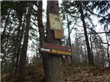 26
26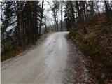 27
27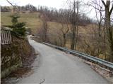 28
28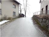 29
29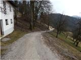 30
30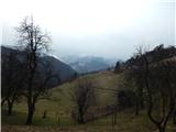 31
31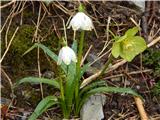 32
32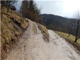 33
33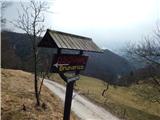 34
34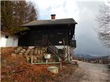 35
35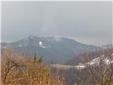 36
36
Discussion about the trip Sora - Brunarica Osovnik (on footpath)
To post a comment you must log in:
If you do not yet have a username, you must first
register.