Soriška peč - Tonderškofel
Starting point: Soriška peč (1207 m)
| Latitude/Longitude: | 46,23690°N 14,02150°E |
| |
Walking time: 20 min
Difficulty: easy unmarked way
Elevation gain: 119 m
Elevation difference along the route: 135 m
Map: Škofjeloško in Cerkljansko hribovje 1:50.000
Recommended equipment (summer):
Recommended equipment (winter): ice axe, crampons
Views: 1.470
 | 1 person like this post |
Access to starting point:
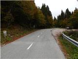
A) From Podrošt or Petrovo Brdo we drive to Sorica, and from there we continue driving towards Soriška planina. When we get to the road sign 6 km, a little before the cross on the left we will notice a cross, and a few meters further, on the right an appropriate place where we park.
B) We drive to Bohinjska Bistrica, then we continue driving in the direction of Tolmin and Soriška planina. When we arrive at the large parking lot by the ski area Soriška planina, we begin to descend towards Sorica. After approximately 1 km of descent, we will get to a more distinct right bend, in the middle of which a marked path to Ratitovec branches off to the left, and we park here on an appropriate place by the intersection, on the left side of the main road.
Route description:
From the starting point, we continue on a marked path in the direction of Ratitovec. At first we walk on a cart track, and on the left we quickly notice a bigger house, which we bypass on the right side. A little further a short footpath branches off to the right towards the hunting cottage, and we continue on a cart track which ascends a little and then flattens and crosses slopes north of the peak Tonderškofel.
A little further, we get to a junction, where we leave the marked path and continue the ascent sharply to the right on an unmarked cart track, on which we continue to its end. A few steps before the end of the cart track, on the left we notice a fainter footpath, on which we ascend to the summit of Tonderškofel in a few dozen steps.
Description and pictures refer to the condition in the year 2016 (October).
Photos:
 1
1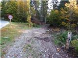 2
2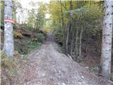 3
3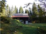 4
4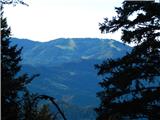 5
5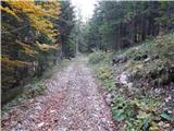 6
6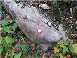 7
7 8
8 9
9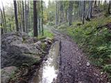 10
10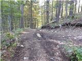 11
11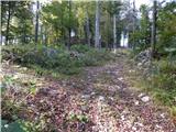 12
12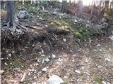 13
13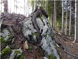 14
14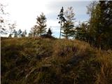 15
15 16
16
Discussion about the trip Soriška peč - Tonderškofel
To post a comment you must log in:
If you do not yet have a username, you must first
register.