Izvir Ljubije - Sveti Križ above Bele Vode
Starting point: Izvir Ljubije (658 m)
| Latitude/Longitude: | 46,40320°N 14,94050°E |
| |
Walking time: 1 h 5 min
Difficulty: easy marked way
Elevation gain: 396 m
Elevation difference along the route: 396 m
Map: Kamniške in Savinjske Alpe 1:50.000
Recommended equipment (summer):
Recommended equipment (winter): ice axe, crampons
Views: 3.120
 | 2 people like this post |
Access to starting point:
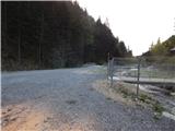
A) From the Ljubljana - Maribor highway, take the exit Šentrupert, then continue driving in the direction of Mozirje and Logarska dolina. At the beginning of Mozirje from the roundabout turn right in the direction of the settlement Bele Vode, then further follow the signs for Ljubijski graben. Higher up, the asphalt ends and after a shorter quite steep part the road flattens and past the homestead Rožman brings us to a water catchment, which is situated near the confluence of the streams Ljubija and Kramarica. Park at an appropriate place by the water catchment.
B) From Ljubno ob Savinji or Gornji Grad drive to Mozirje, from there from the roundabout near the Hofer store continue in the direction of Bele Vode, then further follow the signs for Ljubijski graben. Higher up, the asphalt ends and after a shorter quite steep part the road flattens and past the homestead Rožman brings us to a water catchment, which is situated near the confluence of the streams Ljubija and Kramarica. Park at an appropriate place by the water catchment.
C) Drive to Šoštanj, where from the roundabout by TEŠ continue in the direction of Bele Vode. After the bridge over the river Paka and behind the railway track at the crossroad continue straight in the direction of Bele Vode and also in the following crossroads follow the mentioned direction. Further, drive past the church in Bele Vode, then arrive at a saddle north of Sv. Križ. After the saddle, the road starts descending, then in a transverse descent brings us into the valley of the stream Kramarica, where continue left. Further, descend along the stream Kramarica, then when arriving at the confluence of Kramarica and Ljubija park at an appropriate place by the water catchment.
Route description:
From the starting point by the water catchment continue slightly right on the driving road (left source of Ljubija 3 minutes), which further leads along the stream Kramarica. After a few minutes of walking, arrive at a meadow where a smaller wooden cross stands, and when the road returns into the forest, on the right notice a poorly visible beginning of the footpath which ascends into the forest. Signs for the Šaleška mountain trail quickly lead into dense forest, where the path becomes nicely followable and leads us along the torrent bed. The path soon withdraws more to the left from the bed, then gradually approaches it again and crosses it higher up, so that, as at the beginning, we walk on the right side of the torrent. A nicely maintained path leads for a short time along the edge of the forest, then across a meadow we reach the asphalt road, which we reach a few dozen steps above the smaller road crossing.
Continue on the road which we reached (from the crossing left homesteads Rebršak and Luka, from the crossing slightly right Savinek, from the crossing right on the footpath the Šaleška mountain trail continues) further walk on an unmarked road which leads towards Sv. Križ. The path ahead leads on a steep asphalt road or on a marked shortcut which leads on a steep forest path. Further, the path several times crosses the asphalt road, and after approximately 30 minutes from the crossing Homec we reach the summit of Sv. Križ, where there is a larger number of church buildings and a transmission tower.
Description and pictures refer to the condition in 2016 (April).

Along the route: Homec (817m)
Photos:
 1
1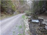 2
2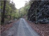 3
3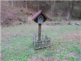 4
4 5
5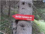 6
6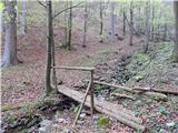 7
7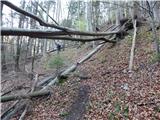 8
8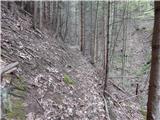 9
9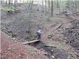 10
10 11
11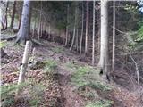 12
12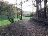 13
13 14
14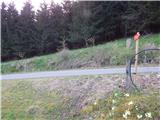 15
15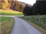 16
16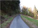 17
17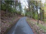 18
18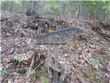 19
19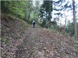 20
20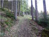 21
21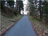 22
22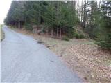 23
23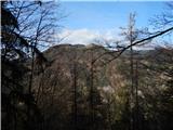 24
24 25
25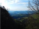 26
26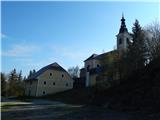 27
27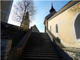 28
28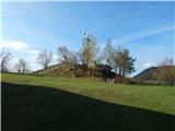 29
29 30
30 31
31 32
32
Discussion about the trip Izvir Ljubije - Sveti Križ above Bele Vode
To post a comment you must log in:
If you do not yet have a username, you must first
register.