Špitalič pri Slovenskih Konjicah - Babček
Starting point: Špitalič pri Slovenskih Konjicah (376 m)
| Latitude/Longitude: | 46,30890°N 15,41300°E |
| |
Walking time: 50 min
Difficulty: easy marked way
Elevation gain: 199 m
Elevation difference along the route: 224 m
Map:
Recommended equipment (summer):
Recommended equipment (winter):
Views: 1.977
 | 2 people like this post |
Access to starting point:
A) From the highway Maribor - Ljubljana we go to the exit Tepanje and follow the road ahead towards Draži vas and Žiče. In Žiče we turn right in the direction of Špitalič and Žička kartuzija. Below the viaduct Škedenj, through the settlement Škedenj we soon reach Špitalič, where we park at the starting point of the path by the presbytery above the church.
B) From Frankolovo through Črešnjice, settlement Sojek, Žička kartuzija to Špitalič.
c) From Poljčane through Loče, Žiče to Špitalič.
Route description:
The beginning of the path is at the parking lot above the church in the center of the settlement Špitalič. We continue downwards by the church, cemetery, which is left by the path and we soon reach the construction site of a new chapel of rest (path surveyed on 17.08.2014). Behind the chapel of rest, we go immediately left and steeply upwards on a meadow path directly by the forest. Soon the path passes a little to the left, short section through the forest. At the exit from the forest, we go left upwards on a steep meadow cart track. Through the yard of an abandoned homestead, the path flattens a little and soon through the yard of another inhabited homestead, access road and we reach the junction Podgranček.
From the junction, we continue left upwards some tens of meters on a meadow path, which soon passes into a typical forest mountain path. We follow the path higher and with good markings we reach an asphalt road and the junction Jankar. We continue sharply left on the asphalt surface. Soon on the left by the path there is an old structure of a typical homestead from decades ago. We follow the asphalt road higher, soon follows a short descent and from the right joins the path from St. Uršula (Dramlje), also the junction Babček at an altitude of 553 meters. We continue higher, right by the path, actually the road, stands a smaller hayrack. From here we already see the destination, we descend a few meters down, left by the path is another homestead and right by the road we reach the summit Babček with height 575 meters. Indistinct summit, also water supply structure practically on the summit and some views, mainly towards the north and east reward the path.
The path measures around 1700 meters, 224 positive altitude meters and 27 negative altitude meters.

Photos:
 1
1 2
2 3
3 4
4 5
5 6
6 7
7 8
8 9
9 10
10 11
11 12
12 13
13 14
14 15
15 16
16 17
17 18
18 19
19 20
20 21
21 22
22 23
23 24
24 25
25 26
26 27
27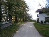 28
28
Discussion about the trip Špitalič pri Slovenskih Konjicah - Babček
To post a comment you must log in:
If you do not yet have a username, you must first
register.