Spodnja Idrija - Gradišče (above Spodnja Idrija) (ridge path)
Starting point: Spodnja Idrija (305 m)
| Latitude/Longitude: | 46,03230°N 14,02570°E |
| |
Route name: ridge path
Walking time: 2 h
Difficulty: partly demanding unmarked way
Elevation gain: 693 m
Elevation difference along the route: 693 m
Map: Idrijsko in Cerkljansko 1: 50.000
Recommended equipment (summer):
Recommended equipment (winter): ice axe, crampons
Views: 4.850
 | 1 person like this post |
Access to starting point:
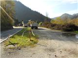
From Ljubljana, we drive towards Idrija. In Idrija, at the second traffic-light intersection, we turn right towards Spodnja Idrija (4 km). We drive through Spodnja Idrija in the direction of Tolmin. Just before the end of Spodnja Idrija, on the left side, we notice the Čarjeva žaga sawmill. We park at the beginning of a large space next to the main road so that we don't hinder the work at the sawmill.
From the direction of Tolmin, we drive towards Ljubljana, through settlements along the Soča and Idrijca (Most na Soči, Slap ob Idrijci, Stopnik, Želin, Travnik etc.) all the way to Spodnja Idrija. At the beginning of Spodnja Idrija, on the right side we see the Čarjeva žaga sawmill, where we park at the end of the large space by the main road.
Route description:
We go past the Čarjeva žaga sawmill towards the bridge by the main road (Kogejeva grapa), we cross it and continue slightly upwards, where we notice a footpath that goes into the forest. Right at the beginning there is a steep ascent in front of us, which after 10 min passes and we are already on the top of a small ridge, where a trim trail also runs. Along the path we notice some tools set up for the trim trail. The path leads us upwards and we are already at the junction, where the path from Melin joins from the right (two turn-offs right). We continue left or straight upwards, and a few steps later, where a provisional bench for resting stands by the path, is our junction, where we go far right above the bench upwards onto an indistinct ridge footpath.
The footpath steadily ascends along a wide ridge and after approximately 30 min from the start of walking we step onto a cart track that runs from the farm Staje towards the abandoned Mrkejci. We calmly cross the cart track and go onto the path that leads straight upwards. After 5 min the path from Mrkejci joins from the left and immediately after we step onto the serpentine of a wider cart track.
Here caution: on the left side of the serpentine there is a poorly visible little path that leads to the ridge, where we also continue walking. For some time we still walk left above the cart track, which we see below us. The footpath on the ridge is poorly visible, so we simply follow the ridge always upwards and look for the footpath where it is more distinct. After the distinct branched beech tree we again ascend steeper onto a shorter ridge flattening and soon after we arrive at the votive chapel, which stands on the edge of Šnitova senožet v Lazu (the chapel belongs to the farm Kladnik). From the cart track to the chapel in Laz it is 30 min of walking.
Our further direction leads behind the chapel directly steeply upwards almost to the edge of the ridge, where the footpath is no longer visible at first (later on some sections the footpath along the edge of the ridge is visible), but our orientation is the ridge edge and we continue. In between there is also a short steep section among rocks upwards, otherwise nothing difficult, and somewhere after 20 min we reach Šnitov rob. Excellent viewpoint towards the Julijci.
From here we continue forward on a well-trodden path, which after just one minute of walking brings us to a junction. We always have the ridge in mind and also here we continue upwards onto the ridge (to the left we come to the farm Kladnik and to Ledine, right along the cart track to the farm pri Šnitu and to Spodnja Idrija). The path fades a little, but the ridge is our ally and so we follow it upwards to the clearing for the power line, where we again follow the ridge path. We join the road from the farm Kladnik, which leads straight to the summit of Gradišče, where a TV transmitter stands.

Along the route: Poklonska kapela pri senožeti v Lazu (750m)
Photos:
 1
1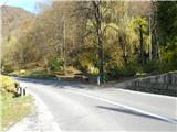 2
2 3
3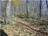 4
4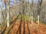 5
5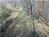 6
6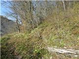 7
7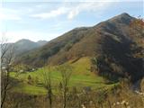 8
8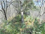 9
9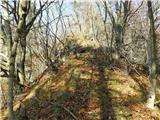 10
10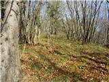 11
11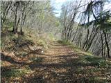 12
12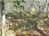 13
13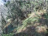 14
14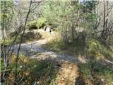 15
15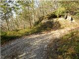 16
16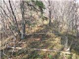 17
17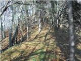 18
18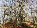 19
19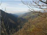 20
20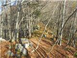 21
21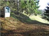 22
22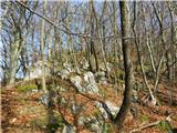 23
23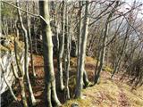 24
24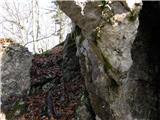 25
25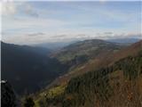 26
26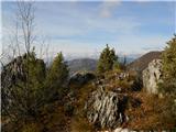 27
27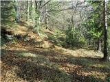 28
28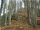 29
29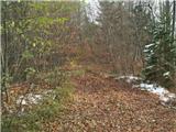 30
30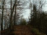 31
31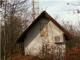 32
32
Discussion about the trip Spodnja Idrija - Gradišče (above Spodnja Idrija) (ridge path)
To post a comment you must log in:
If you do not yet have a username, you must first
register.