Spodnja Idrija - Jelenk (easy way)
Starting point: Spodnja Idrija (305 m)
| Latitude/Longitude: | 46,03430°N 14,01740°E |
| |
Route name: easy way
Walking time: 2 h
Difficulty: easy marked way
Elevation gain: 802 m
Elevation difference along the route: 802 m
Map: Škofjeloško in Cerkljansko hribovje 1:50.000
Recommended equipment (summer):
Recommended equipment (winter):
Views: 18.769
 | 2 people like this post |
Access to starting point:
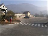
From Logatec we drive towards Tolmin or vice versa. When we come to Spodnja Idrija we turn left (from the direction of Tolmin right) in the direction of the village Kanomlja. Already after a good 100 meters of driving along the road we notice a sign for Jelenk. Near the sign there is also a large parking lot, on which we can park only on non-working days (the parking lot is intended for employees in the nearby company).
Route description:
From the parking lot over the bridge we cross the river Kanomljica and on the other side continue straight on the asphalt road to the intersection, where we continue on the right road, which climbs past houses. After a short ascent the signs for Jelenk direct us left across the meadow upwards. In the middle of the meadow we leave the cart track and continue the ascent left on a footpath upwards (the path is marked). The path then goes into the forest, where it ascends quite steeply. A little higher we reach a lonely farm, where we also step onto the road. We only cross the road as the marks then direct us back onto the footpath, which initially ascends along the slopes of the forest. Already after a few steps of further walking the path goes back into the forest, where it brings us to a path junction.
We continue left on the easier path (right, very demanding path, which in wet conditions is very dangerous for slipping), which gently ascends to the panoramic ridge, where a homestead stands. Here the path turns right and ascends across a panoramic meadow, at the top of which the path turns left into the forest. The path ahead brings us to a pleasant spring, where there is a small path junction. We continue on the marked path in the direction of Jelenk. The path ahead ascends steeply through the forest, where it crosses a forest road and higher brings us to the next farm, where the climbing path also joins.
Here we continue left on the road (poorly marked) to the next house, behind which we continue right upwards. Further we ascend on the cart track, which brings us under the summit of Jelenk across increasingly less vegetated slopes. A little below the summit we notice the signs for Jelenk, which direct us right upwards. We head onto this path, which brings us to the summit in a few steps.

Photos:
 1
1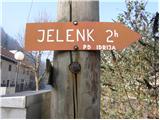 2
2 3
3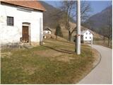 4
4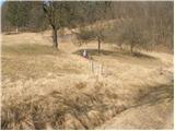 5
5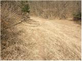 6
6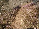 7
7 8
8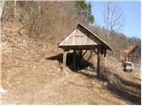 9
9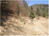 10
10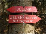 11
11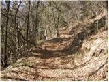 12
12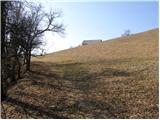 13
13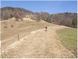 14
14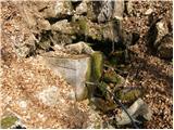 15
15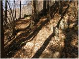 16
16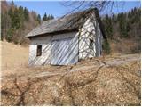 17
17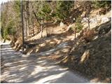 18
18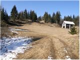 19
19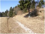 20
20 21
21
Discussion about the trip Spodnja Idrija - Jelenk (easy way)
|
| miri7. 11. 2013 |
Note
From the abandoned homestead just below the summit, the marked trail takes you to the viewpoint in ten minutes, where you have all the mountains from Krn to Grintovci before you.
|
|
|
|
| Loni8. 11. 2013 |
here you could almost list a paraglider as mandatory equipment, countless times I've driven the car back to the valley for our guys
|
|
|
|
| miri8. 11. 2013 |
@Loni, but probably no one thought of taking you on a glider, huh?
|
|
|
|
| Loni11. 11. 2013 |
relax, it was, it was, it was really nice.
|
|
|
|
| miri16. 10. 2019 |
Renovated cistern on Jelenk.
|
|
|
|
| tavzentroza12. 10. 2021 19:05:43 |
this description is probably several years old, because today I visited it and the summit is very panoramic, trees
have been cut down.
I would attach a picture, but don't know how.
|
|
|
|
| miri12. 10. 2021 19:27:09 |
Go to Forum-Conditions. Middle of the page.
The path route is slightly changed. Right at the top of the asphalted slope you need to turn left. And also past the farm, half an hour from the start, turn left.
Otherwise it's excellently marked, our path markers take care of it.
|
|
|
|
| tavzentroza12. 10. 2021 19:48:47 |
yes it's marked, I just wrote as a notice that the summit is bare and panoramic, it's no longer like in the description (picture no.21.now it's no longer like that) How please, upload a new- actual picture.
On forum-conditions it's about another Jelenk (787m) here I write about Jelenk 1107m.
|
|
|
To post a comment you must log in:
If you do not yet have a username, you must first
register.