Spodnja Idrija - Jelenk (via Kendove robe)
Starting point: Spodnja Idrija (305 m)
| Latitude/Longitude: | 46,03430°N 14,01740°E |
| |
Route name: via Kendove robe
Walking time: 2 h 10 min
Difficulty: very difficult marked way
Elevation gain: 802 m
Elevation difference along the route: 825 m
Map: Škofjeloško in Cerkljansko hribovje 1:50.000
Recommended equipment (summer): helmet, self belay set
Recommended equipment (winter): helmet, self belay set, ice axe, crampons
Views: 14.160
 | 1 person like this post |
Access to starting point:
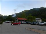
From Logatec we drive towards Tolmin or vice versa. When we come to Spodnja Idrija, we turn left (from the direction of Tolmin, right) in the direction of the village Kanomlja. Already after just over 100 meters of driving along the road we notice a sign for Jelenk. Near the sign there is also a large parking lot, on which we can park only on work-free days (the parking lot is intended for employees in the nearby company).
Route description:
From the parking lot, over the bridge we cross the river Kanomljica and on the other side we continue straight on the asphalt road to the junction, where we continue on the right road, which climbs past the houses. After a short ascent, the signs for Jelenk direct us left across the meadow upwards. In the middle of the meadow we leave the cart track and continue the ascent left on the footpath upwards (the path is marked). The path then goes into the forest, where it ascends quite steeply. A little higher we reach a lonely farm, where we also step onto the road. We only cross the road because then the markings direct us back onto the footpath, which initially ascends along the slopes of the forest. Already after a few steps of further walking the path goes back into the forest, where it brings us to a path junction. At the junction we continue right and an easy path through the forest soon brings us to a wide ridge. Here the path turns left and ascends along the ridge for some time, then withdraws to the right side of the ridge. The slope that we cross on a narrow path becomes increasingly steep and increasingly beautiful views of the surrounding hills begin to open up. Such a path soon brings us to the first fixed safety gear. Instead of with ordinary steel cables, the path is secured with a thick cable. Further on the path turns left and an almost vertical ascent with the help of fixed safety gear follows. Then follow a few shorter traverses and ascents along the fixed safety gear and we are already before the most demanding part of the path, where there is also the logbook box. Here with the help of fixed safety gear we ascend almost vertically upwards. The path on this part is also slightly crumbly, so we must be especially careful. Further on follow some short traverses, then one very short almost vertical ascent. The path then gradually becomes less demanding and soon brings us to a viewpoint, where the fixed safety gear ends. Further the path runs through increasingly dense forest and brings us to the high-mountain farm Kenda. As soon as we come out of the forest we first descend a few tens of meters along the road, then continue right onto the cart track, which leads past the farm. We continue further on the cart track, which through the forest soon brings us to another high-mountain farm, where an easier path joins from the left side. Here we continue left on the road (poorly marked) to the next house, behind which we continue right upwards. Further we ascend on the cart track, which across the increasingly less vegetated slope brings us below the summit of Jelenk. A little below the summit we notice signs for Jelenk, which direct us right upwards. We follow this path, which brings us to the summit in a few steps.

Photos:
 1
1 2
2 3
3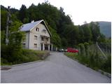 4
4 5
5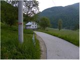 6
6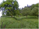 7
7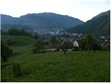 8
8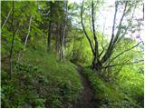 9
9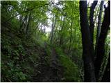 10
10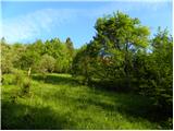 11
11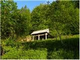 12
12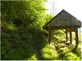 13
13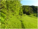 14
14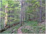 15
15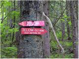 16
16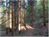 17
17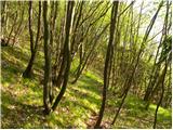 18
18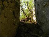 19
19 20
20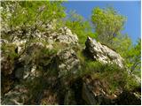 21
21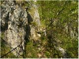 22
22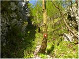 23
23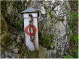 24
24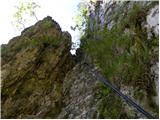 25
25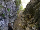 26
26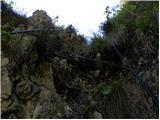 27
27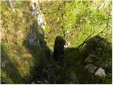 28
28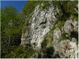 29
29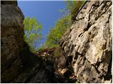 30
30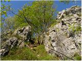 31
31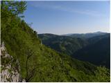 32
32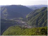 33
33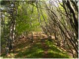 34
34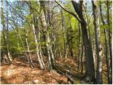 35
35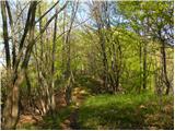 36
36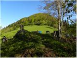 37
37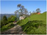 38
38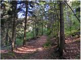 39
39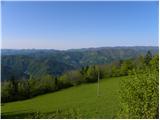 40
40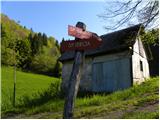 41
41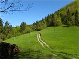 42
42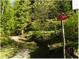 43
43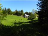 44
44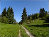 45
45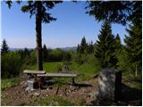 46
46
Discussion about the trip Spodnja Idrija - Jelenk (via Kendove robe)
|
| Tanja3722. 11. 2015 |
no comments about the path via k.robe... I was there recently, nice path, short harder part, two slightly harder ascents, some scree in the middle part... the cable is covered with some kind of plastic, looks like a cable.
|
|
|
|
| valerija11222. 11. 2015 |
Yes, yes, such a cable (if we can even call it that) we find only on Jelenk. When we look at it from Spodnja Idrija upwards, it may not look like anything special. But it's definitely worth a visit! The cable could once, if we forget this note a bit, be a posed riddle. Miri, this is your area.
|
|
|
|
| miri22. 11. 2015 |
 valerija112, maybe covered like that it's even friendlier. So far it hasn't let anyone down. Although the section is short, don't underestimate it. Just come via robe too. valerija112, maybe covered like that it's even friendlier. So far it hasn't let anyone down. Although the section is short, don't underestimate it. Just come via robe too.
|
|
|
|
| Tanja3728. 11. 2015 |
this path is super, as I said... we were there today with a colleague again, but we detached from the cable at the first ascent, made a rope team and climbed directly up (of course we belayed with pitons and nuts) super, then we rappelled down on rope... super... really... also as rock climbing experience, but it's true there's quite a bit to watch out for, it can be gravelly... there was a bit of snow too... but not on the rocks, it was quite dry..... after we got down we went up once more on the cable/steel rope... and past the farm back to the car. I really like this tour over Kendove robe
|
|
|
|
| miri14. 10. 2016 |
Currently there is logging on this trail and caution is needed.
|
|
|
|
| Spelcarocket10. 04. 2023 13:40:10 |
Today I went 'messing around' up there . Really beautiful path, the trail doesn't let up uphill and the section of the path at the now 'stripped' cable is adrenaline-pumping, it livens up the pulse. Some wonderful sections unfold views around, that you'd most like to set up a couch and just look. . Really beautiful path, the trail doesn't let up uphill and the section of the path at the now 'stripped' cable is adrenaline-pumping, it livens up the pulse. Some wonderful sections unfold views around, that you'd most like to set up a couch and just look.
I like coming here🙂
|
|
|
|
| miri10. 04. 2023 17:46:06 |
It's not "stripped", but newly renovated.
|
|
|
|
| Bern741. 10. 2023 21:50:26 |
Super path. Very well renovated, secured. However, the description is outdated in two parts. Namely, the path in the middle section and a little below the summit now avoids crossing the estates of the mentioned farms, so it circles a bit illogically.
|
|
|
|
| miri2. 10. 2023 08:26:42 |
This was done at the request of the property owners.
Instead of arguing, one should take a few more steps.
|
|
|
|
| matic414. 10. 2023 08:00:27 |
Half the path is now a completely different route. At picture 12 go left on the road then right uphill, so you get above the farm. At picture 37 don't go to the farm but right on the road a few hundred meters, then path through forest to the top. Path drags, except some small views in between uninteresting to me. Easier path to the top from the other side, recommend it more, also much shorter.
|
|
|
|
| miri15. 10. 2023 12:06:14 |
One could discuss its uninterestingness. Likewise about the length of the trail.
|
|
|
To post a comment you must log in:
If you do not yet have a username, you must first
register.