Spodnja Kokra - Kopa (Partizanski vrh)
Starting point: Spodnja Kokra (530 m)
| Latitude/Longitude: | 46,30520°N 14,49860°E |
| |
Walking time: 1 h 30 min
Difficulty: easy marked way, easy unmarked way
Elevation gain: 494 m
Elevation difference along the route: 500 m
Map: Karavanke - osrednji del 1:50.000
Recommended equipment (summer):
Recommended equipment (winter): ice axe, crampons
Views: 2.253
 | 2 people like this post |
Access to starting point:
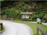
From the highway Ljubljana - Jesenice, we take the exit Kranj - east and follow the road ahead in the direction of Zgornje Jezersko. In the village Kokra, at the road sign between 10.5 and 10 km, the road towards Spodnja Kokra branches off to the right downwards (at the crossroads there are also hiking signs). Immediately after the road crosses the river Kokra, we park on the parking lot by the road.
Route description:
At the beginning of the parking lot, we notice a marking that directs us to the right onto a footpath that ascends on overgrown stairs. The path then flattens and leads us higher to the road, which we follow to the right. After a short ascent, we come to a smaller crossroads, where we continue right, following the road only a few dozen meters to the decaying house. At the decaying house, the markings direct us onto a cart track (the road here turns right), which we follow only for a short time, since the marked path turns right and brings us past a cross to a stream. The path crosses the aforementioned stream and behind it begins to ascend more steeply. The steepness soon eases, and the path, in a moderate ascent that almost entirely runs through the forest, brings us after a good hour of walking to the ridge and the indistinct saddle Davovec, where there is a marked junction.
From the junction, we continue right (left Krvavec), at the nearby junction of cart tracks right from the right cart track, so that we ascend parallel to the upper cart track. Higher up, we temporarily join the cart track, then leave it, and continue the path slightly to the right, at first still parallel to the cart track. A short ascent follows, and the path brings us to the summit of Kopa.
The path is marked to the saddle Davovec, from there onwards it is only signposted.

Along the route: Sedlo Davovec (932m)
Photos:
 1
1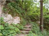 2
2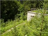 3
3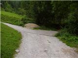 4
4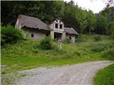 5
5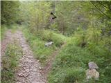 6
6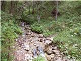 7
7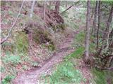 8
8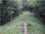 9
9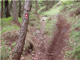 10
10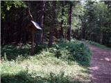 11
11 12
12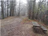 13
13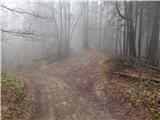 14
14 15
15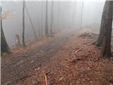 16
16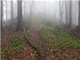 17
17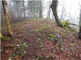 18
18 19
19
Discussion about the trip Spodnja Kokra - Kopa (Partizanski vrh)
|
| Manjuška25. 08. 2019 |
Update 2019: The collapsed house (picture 6) is no longer there, in its place stands a smaller utility building. Caution at Davovec saddle, where the path crosses a bike trail from Krvavec. Otherwise a very nice trip to clear the head.
|
|
|
To post a comment you must log in:
If you do not yet have a username, you must first
register.