Spodnja Kokra - Storžič (via Baba)
Starting point: Spodnja Kokra (530 m)
| Latitude/Longitude: | 46,30270°N 14,47540°E |
| |
Route name: via Baba
Walking time: 5 h 45 min
Difficulty: easy unmarked way, difficult marked way
Elevation gain: 1602 m
Elevation difference along the route: 1700 m
Map: Karavanke - osrednji del 1:50.000
Recommended equipment (summer):
Recommended equipment (winter): ice axe, crampons
Views: 2.399
 | 1 person like this post |
Access to starting point:
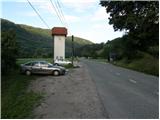
From the Ljubljana-Jesenice motorway, take the Kranj-east exit and continue along the road towards Jezersko. Just a few kilometres after the turn-off for Preddvor, on the right side of the road, we will spot a transformer and a parking lot next to it, where we park. There are also signposts for the Čemšenik hut here.
Route description:
From the parking lot, first carefully cross the road, then head onto the footpath towards the Čemšenik hut. The wide path gently ascends to the Polajnar farmstead, where we join a road and follow it to the right.
The road steeply ascends immediately after the house, but a bit higher it loses its asphalt surface. Further on, the road levels out and turns slightly to the left, approaching the Čemšeniški stream closely. A little further, we cross the mentioned stream and immediately after it reach a marked junction, where we continue on the left road towards the Čemšenik hut. The road then starts to ascend more steeply again and after less than 30 minutes of further walking brings us to the Čemšenik hut.
From the Čemšenik hut, we continue behind the hut on a well-visible but unmarked path that enters the forest and begins gently at first, then more steeply ascending. The path soon brings us to a modest viewpoint, where it turns slightly right and then ascends transversely. Higher up, the path brings us to the main ridge (view of the Gorenjska plain), where it ascends even more steeply and after a few minutes of further walking brings us to a more level section where a wooden hut (weekend cottage) stands.
Just before the hut, the path turns right and after a few more steps brings us to the stamp box on Baba.
From the stamp box, we continue on a well-traceable trail that continues along the occasionally panoramic ridge, from which we first get a nice view towards Cjanovci, Kočna, Grintovec, Kalški greben and other surrounding hills. The path further continues along the left side of the ridge at first, then after an indistinct saddle passes to the right (eastern) slopes of Potoška gora. A few-minute transverse ascent follows, then we join the marked path leading from the Dom Čemšenik.
We continue upwards and relatively quickly arrive at the saddle between Potoška gora on the left and the subpeak of Javorov vrh on the right.
At the saddle there is a marked junction, where we continue right (left to Potoška gora, slightly left to Planinska koča Iskra na Jakobu (we can descend via one of the mentioned paths)) towards Javorov vrh. The path continues along the forested ridge, avoiding the indistinct subpeak to the right. A gentle ascent follows, from where we get some views again, then the path returns to the forest and forks.
Here we continue left towards Srednji vrh, Kališče and Storžič (straight to Javorov vrh 15 minutes) on the path that after a few more steps brings us to a pleasant spring. A half-hour traverse of the slopes below Javorov vrh follows, ending at the saddle between the mentioned peak and Cjanovca.
Here at the marked junction, we continue left towards Hudičev boršt (straight to Srednji vrh and Cjanovca, sharply right to Javorov vrh) on the path that further traverses the slopes to the left, slightly ascending and descending a few times. After about 15 minutes of walking from the last junction, we exit the forest onto the grassy slopes of Zaplate, across which we continue the traverse. The technically undemanding path leads us across occasionally steeper slopes, where it is especially slippery in wet conditions at a few spots. In the final part before entering the forest, a wire cable assists us, and after it the path levels out completely. Once in the forest, we have only a short walk to the shelter.
From the shelter, we continue towards the west, where we quickly reach the spring in Hudičev boršt, and immediately after it a marked junction, where we go straight (left downhill Mačenska pot to Mače). A short traverse of the grassy slope follows, then the path enters the forest and brings us to a junction, where the path to Dolga njiva, Cjanovci, Srednji vrh and Mali Grintovec branches right, and we continue straight. The path further traverses the slopes to the left for a short time, then after crossing a gully brings us to a junction, where we continue right towards Kališče (the lower path leads to Mače).
The path continues to traverse the slopes to the left. During the traverse, we will reach a small scree, from which we get the first view towards the valley. A short traverse follows, and the path brings us to the valley of Suha, where an unmarked path from Mače joins from the left.
We continue towards Kališče and continue the ascent on a gradually steeper path. The path ascends through dense forest for a while longer, then brings us to the foot of rocky cliffs and a bit higher to the ridge, where a small hut is visible just a few meters off the path. Here the path turns right and steeply ascends over a short rocky step. The path levels out here and a few meters further joins the usual path to Kališče.
We continue towards Kališče and ascend on a moderately steep path, arriving at the Planinski dom na Kališču in 5 minutes of further walking.
Behind the Dom na Kališču, we notice a mountaineering signpost with numerous continuation options. We continue on the gentle and panoramic ridge path towards Storžič, Bašeljski vrh..., which continues northwards. After a few minutes of easy walking with beautiful views reaching to the Julian Alps, we arrive at a junction, where the path to the church of sv. Lovrenc nad Bašljem, planina Javornik and Kriška gora branches left, the path to Bašeljski vrh and Mali Grintovec branches right, and we continue straight towards Storžič. A few-minute traverse of mostly the western slopes of Bašeljski vrh follows, then we arrive at the grassy Bašeljski preval, where the path from Jezersko (starting point Jekarica in descriptions) joins from the right.
We continue straight towards Storžič again, this time on a path that begins to ascend steeply through a belt of dwarf pines. After about 30 minutes of ascent from the saddle, we step onto the ridge of Storžič, which we soon leave as the path passes to the southern slopes of the mountain. Across the quite steep southern slopes, we ascend on a steep path that is slippery at several points, especially when wet. Higher up, the path levels slightly and returns to the ridge, along and on which it continues. To the increasingly panoramic path, just below the summit, paths from sv. Lovrenc, planina Javornik, and the path via Psica and through Žrelo join from the left. Here we continue slightly right and in a few steps reach one of the most visited two-thousanders in Slovenia.
Izhodišče - Dom Čemšenik 0:50, Dom Čemšenik - Baba 0:45, Baba - Volčje jame 0:25, Volčje jame - razpotje pod Javorovim vrhom 0:10, razpotje pod Javorovim vrhom - Sedlo nad Skodovnjekom 0:15, Sedlo nad Skodovnjekom - razpotje Skodovnjek 0:10, razpotje Skodovnjek - Zavetišče v Hudičevem borštu 0:30, Zavetišče v Hudičevem borštu - razpotje pod Dolgo njivo 0:10, razpotje pod Dolgo njivo - razpotje na Kozjeku 0:05, razpotje na Kozjeku - dolina Suhe 0:20, dolina Suhe - razpotje pod Kališčem 0:30, razpotje pod Kališčem - Dom na Kališču 0:05, Dom na Kališču - razpotje na Kališčem 0:10, razpotje nad Kališčem - Bašeljski preval 0:10, Bašeljski preval - Storžič 1:10.

Along the route: Dom Čemšenik (835m),
Baba (1098m),
Baba (1119m),
Dom na Kališču (1128m), Vrnitev na markirano pot (1198m), Volčje jame (1245m), Razpotje na grebenu Javorovega vrha (1291m), Izvir pod Javorovim vrhom (1332m), Sedlo nad Skodovnjekom (1336m), Razpotje Skodovnjek (1348m),
Zavetišče v Hudičevem borštu (1328m), Izvir v Hudičevem borštu (1328m), Razpotje pod Dolgo njivo (1282m), Razpotje Kozjek (1281m), Dolina Suhe (1322m), Razpotje pod Kališčem (1509m),
Dom na Kališču (1534m), Razpotje nad Kališčem (1570m), Bašeljski preval (1630m)
Photos:
 1
1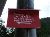 2
2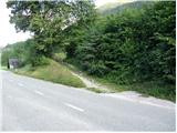 3
3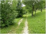 4
4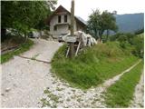 5
5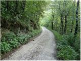 6
6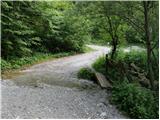 7
7 8
8 9
9 10
10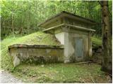 11
11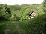 12
12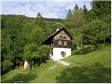 13
13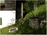 14
14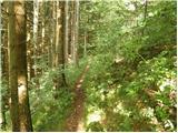 15
15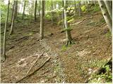 16
16 17
17 18
18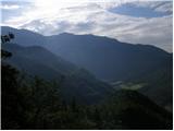 19
19 20
20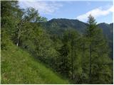 21
21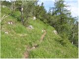 22
22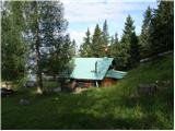 23
23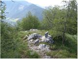 24
24 25
25 26
26 27
27 28
28 29
29 30
30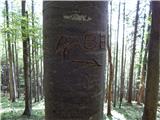 31
31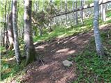 32
32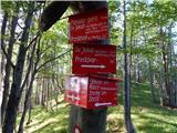 33
33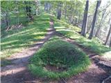 34
34 35
35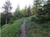 36
36 37
37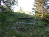 38
38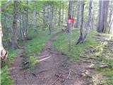 39
39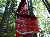 40
40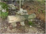 41
41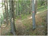 42
42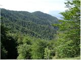 43
43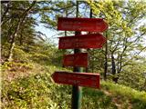 44
44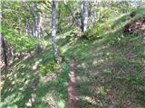 45
45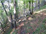 46
46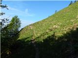 47
47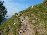 48
48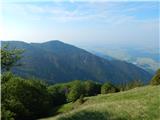 49
49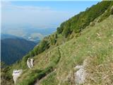 50
50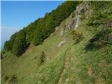 51
51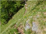 52
52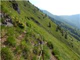 53
53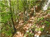 54
54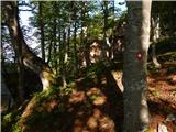 55
55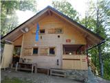 56
56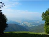 57
57 58
58 59
59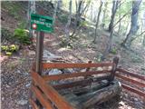 60
60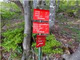 61
61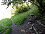 62
62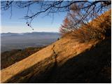 63
63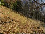 64
64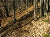 65
65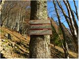 66
66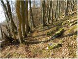 67
67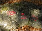 68
68 69
69 70
70 71
71 72
72 73
73 74
74 75
75 76
76 77
77 78
78 79
79 80
80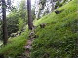 81
81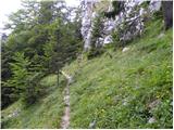 82
82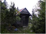 83
83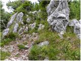 84
84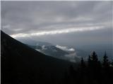 85
85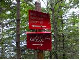 86
86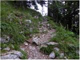 87
87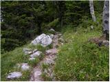 88
88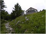 89
89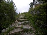 90
90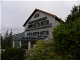 91
91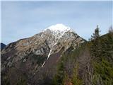 92
92 93
93 94
94 95
95 96
96 97
97 98
98 99
99 100
100 101
101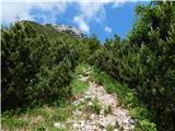 102
102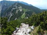 103
103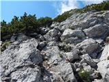 104
104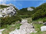 105
105 106
106 107
107 108
108 109
109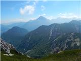 110
110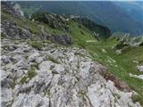 111
111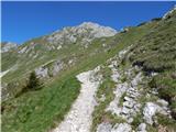 112
112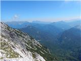 113
113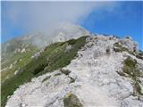 114
114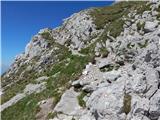 115
115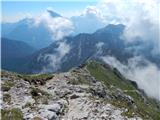 116
116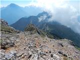 117
117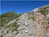 118
118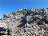 119
119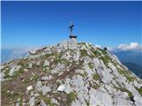 120
120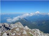 121
121 122
122
Discussion about the trip Spodnja Kokra - Storžič (via Baba)
To post a comment you must log in:
If you do not yet have a username, you must first
register.