Spodnje Danje - Krekova koča na Ratitovcu
Starting point: Spodnje Danje (896 m)
| Latitude/Longitude: | 46,22810°N 14,04440°E |
| |
Walking time: 2 h 45 min
Difficulty: easy unmarked way
Elevation gain: 746 m
Elevation difference along the route: 820 m
Map: Škofjeloško in Cerkljansko hribovje 1:50.000
Recommended equipment (summer):
Recommended equipment (winter): ice axe, crampons
Views: 2.430
 | 1 person like this post |
Access to starting point:
A) First, we drive to Škofja Loka, and then we continue driving in the direction of Železniki and Tolmin. A few kilometers after Zali Log we arrive at a crossroad at Podrošt, where we continue straight in the direction of Sorica and Soriška planina (left Petrovo Brdo and Tolmin). When above Sorica from the left the road from Petrovo Brdo joins, we continue right, and then towards Soriška planina we drive only to the crossroad, where roads towards Zgornje and Spodnje Danje branch off to the right. We continue on the lower road towards Spodnje Danje. After approximately 1 km of additional driving, we arrive in Spodnje Danje, where the described path begins. In the village there are no designated parking spaces. Lately, because of the reconstruction of the road Podrošt - Sorica, it is often closed. In this case, we use the detour, namely by continuing at Podrošt in the direction of Tolmin, and then at the first crossroad to the right. Along a fairly steep road we arrive in Sorica, where we rejoin the main road towards Soriška planina.
B) From the direction of Baška grapa we drive to Petrovo Brdo, and from there we continue left towards Soriška planina. A little after we join the road from Sorica, we arrive at a crossroad, where roads towards Zgornje and Spodnje Danje branch off to the right. We continue on the lower road towards Spodnje Danje. After approximately 1 km of additional driving, we arrive in Spodnje Danje, where the described path begins. In the village there are no designated parking spaces.
C) From Bohinjska Bistrica we continue driving towards Soriška planina, and from there we start descending towards Sorica. When after a few kilometers of descent roads towards Zgornje and Spodnje Danje branch off to the left, we continue on the lower road towards Spodnje Danje. After approximately 1 km of additional driving, we arrive in Spodnje Danje, where the described path begins. In the village there are no designated parking spaces.
Route description:
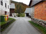
In the middle of the village Spodnje Danje there is a junction, where we continue left (right church of St. Marko), after which the road immediately splits into two parts. One runs along the left side, the other along the right side of an older house. Behind the house both roads join, and past the last house we continue straight onto a cart track, which starts to ascend across a scenic hayfield. The hayfield is slowly replaced by sparse forest, and at several junctions we continue straight. Higher up the path leads past two smaller boulders, then we cross a pasture fence again and step onto the road that leads from Sorica towards Zgornje Danje. We follow the mentioned road to the right; it gradually emerges from the forest onto more scenic slopes. Then follows a left turn, and with views of the cliffs of Ratitovec we reach a smaller junction directly before Zgornje Danje. We continue along the left upper road, which after some tens of meters turns into a rocky cart track, which we follow only to the nearby wooden shack, where on the left side we will notice the start of the marked path that leads to Ratitovec.
The path first ascends through the forest, then crosses a relatively new clearing, where we also cross a cart track. At this spot there are no markers due to fallen trees, so orientation in this section is somewhat more difficult, but if we find the trail that continues in the same direction, we have no major problems. The path ahead returns to the forest for a while, then levels out and takes us to a larger meadow (pasture Spodnji Jirn). On the other side of the meadow, at the watering place for animals, the path turns slightly left and then right into the forest. The path ahead takes us to a rougher cart track, along which we walk only briefly, as poorly visible markers then direct us left onto the mountain trail, which we follow through the forest to a relatively new wooden log cabin.
From the log cabin, where we also exit the forest, we continue in the same direction and continue the ascent along a poorly visible path that ascends diagonally slightly to the right. The increasingly scenic path, from which fine views open up to Blegoš, Črni vrh and Porezen, then takes us higher to an old military bunker, where we can rest or take a nice panoramic photo. From the bunker we continue for a few more minutes along a poorly trodden path, then we join the path Soriška planina - Krekova koča.
Here we continue right and follow the path, which rises and falls slightly several times, to a marked junction, where the path to Altemaver branches off to the right. Here we can continue right over the summit or left along the path that bypasses the summit. On the other side of the summit the paths join again, then we begin to descend towards the watering place for animals, located on a small saddle below Gladki vrh. From the saddle only a short easy ascent remains, and the path quickly takes us past the winter bivouac to Krekova koča na Ratitovcu.
Spodnje Danje - Zgornje Danje 45 minutes, Zgornje Danje - Altemaver 1:45, Altemaver - Krekova koča 15 minutes.

Along the route: Zgornje Danje (1070m), Spodnji Jirn (1334m), Altemaver (Ratitovec) (1667m)
Photos:
 1
1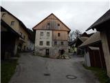 2
2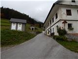 3
3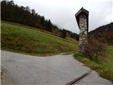 4
4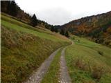 5
5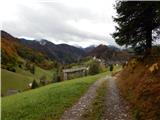 6
6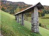 7
7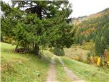 8
8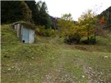 9
9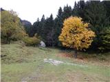 10
10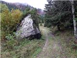 11
11 12
12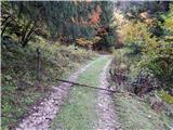 13
13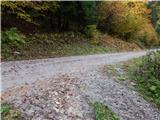 14
14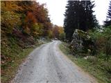 15
15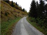 16
16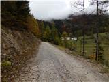 17
17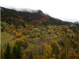 18
18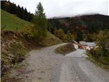 19
19 20
20 21
21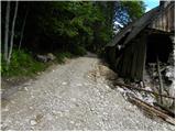 22
22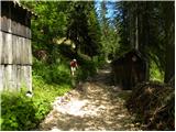 23
23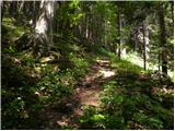 24
24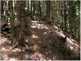 25
25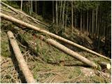 26
26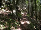 27
27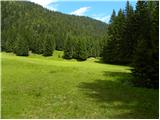 28
28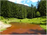 29
29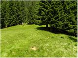 30
30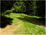 31
31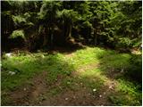 32
32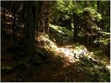 33
33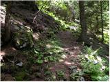 34
34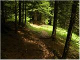 35
35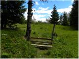 36
36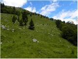 37
37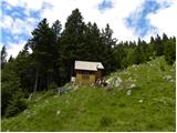 38
38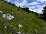 39
39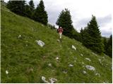 40
40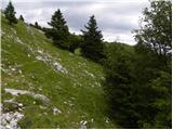 41
41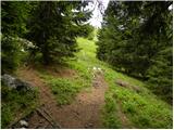 42
42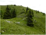 43
43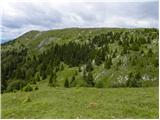 44
44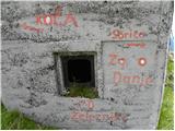 45
45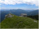 46
46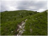 47
47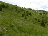 48
48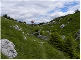 49
49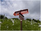 50
50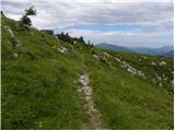 51
51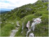 52
52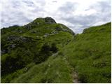 53
53 54
54 55
55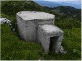 56
56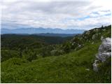 57
57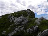 58
58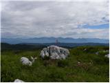 59
59 60
60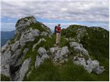 61
61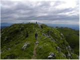 62
62 63
63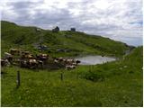 64
64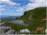 65
65 66
66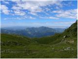 67
67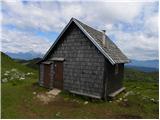 68
68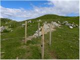 69
69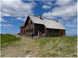 70
70
Discussion about the trip Spodnje Danje - Krekova koča na Ratitovcu
To post a comment you must log in:
If you do not yet have a username, you must first
register.