Spodnje Duplje - Kriva jelka
Starting point: Spodnje Duplje (444 m)
| Latitude/Longitude: | 46,29960°N 14,29700°E |
| |
Walking time: 40 min
Difficulty: easy unmarked way
Elevation gain: 84 m
Elevation difference along the route: 100 m
Map: Karavanke - osrednji del 1:50.000
Recommended equipment (summer):
Recommended equipment (winter):
Views: 1.360
 | 1 person like this post |
Access to starting point:
We leave Gorenjska highway at exit Naklo, and then we follow the signs for Spodnje and Zgornje Duplje. In the settlement Spodnje Duplje we leave the main road and we continue right towards the nearby church and cemetery, where we park on a marked parking lot.
Route description:
From the starting point, we walk to the church of St. Vid, which we bypass, and behind it we reach another road, and further in the reverse direction we follow the signs of the learning trail Kriva jelka. Because the signs are in the opposite direction, the orientation through the village is quite difficult, and we get help from a few marks even in the reverse direction. On the top of the village, the path leads on a cart track, and from there we go slightly right on a beaten footpath which passes into the forest. At first, we ascend steeper, and then we are mostly only gently ascending. Next follows a walk through the forest, where we follow the better beaten path, and we also get help from a few signposts of the learning trail, which are usually a little after the crossing and in the reverse direction. A little further, we reach the macadam road which we follow to the right (left Zgornje Duplje and Zadraga), along which we arrive at the next crossing, where we go straight (right NOB monument in Želin).
We continue on the road and past cottages of brigands we quickly get to Kriva jelka (bent fir tree), where there are some information boards.
Description and pictures refer to the condition in the year 2019 (June).

Photos:
 1
1 2
2 3
3 4
4 5
5 6
6 7
7 8
8 9
9 10
10 11
11 12
12 13
13 14
14 15
15 16
16 17
17 18
18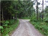 19
19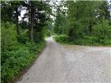 20
20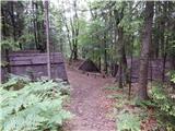 21
21 22
22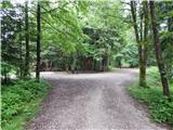 23
23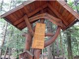 24
24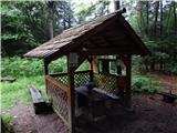 25
25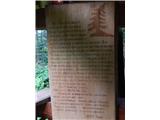 26
26
Discussion about the trip Spodnje Duplje - Kriva jelka
To post a comment you must log in:
If you do not yet have a username, you must first
register.