Spodnje Radvanje - Mariborska koča
Starting point: Spodnje Radvanje (279 m)
| Latitude/Longitude: | 46,53320°N 15,62850°E |
| |
Walking time: 2 h 40 min
Difficulty: easy marked way
Elevation gain: 807 m
Elevation difference along the route: 830 m
Map: Pohorje 1:50 000
Recommended equipment (summer):
Recommended equipment (winter): ice axe, crampons
Views: 23.047
 | 2 people like this post |
Access to starting point:
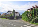
From the direction of Ljubljana on the southern arterial road in Maribor at the crossing, we stick to the direction Maribor-south. Then we follow the signs for Pohorje. At the large shopping center near the customs house, we turn left in the direction of Betnavski grad onto the so-called "Papeževa" road, and at the next crossroad, we turn right. We drive straight to Streliška cesta. The path begins at house number 70. We can park the vehicle at the Tuš shopping center or at one of the inns along the road "Poštela" or "Pri kostanjih," but we must ask for permission.
Route description:
The path starts on Streliška cesta at house number 70, indicated by a trail signpost. The path turns into the street Pot na okope, where after a few steps a large sign indicates that the Slovenian mountain trail starts here. The path leads us through the settlement into the forest.
Through a chestnut forest to a ledge of the eastern ridge to the historically very famous hamlet Habakuk (above it is located Poštela and an Illyrian graveyard from the 6th century B.C.). A well-trodden path in zig-zags avoids deep cart tracks and passes into a mixed forest.
Higher up, the path directs us to the right and after a few minutes we step out of the forest onto a ski slope. We walk on a macadam road upwards towards the upper station of the chairlift. We cross the road and go upwards on the right along a strip of forest in the direction of an electrical transformer. We soon reach the next ski track, where a trail blaze on a power pole directs us straight, again up the ski slope (a chapel is on the right side of the path). Past a restaurant, where we already see the upper station of the funicular, we go straight upwards.
At the upper station of the funicular (1042 m), we head west. On the right, we see the church of St. Bolfenka. On the asphalt road to a footpath turnoff to the right as a signpost directs us. Higher up, we turn to the right again. After a few minutes, we reach the next crossing, where we keep to the left path (the right one goes towards the lookout tower and Areh).
The path descends slightly, and we notice information boards about natural attractions next to it. At the crossings, we keep straight, and the path brings us to the edge of the forest, where a view opens up slightly to the south. The path ahead turns to the right and leads us onto an asphalt road, which we follow for about 5 minutes, or until signs direct us back into the forest. The path then ascends, passes holiday apartments, and transitions to a macadam road.
When we step onto an asphalt road a little further, we turn left and after a few steps turn right at the next crossroad. To the Mariborska koča, it’s 5 more minutes of easy walking.

Photos:
 1
1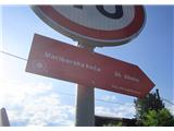 2
2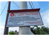 3
3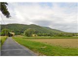 4
4 5
5 6
6 7
7 8
8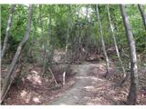 9
9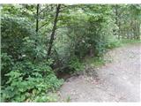 10
10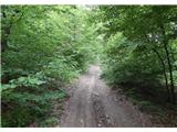 11
11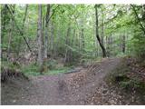 12
12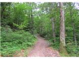 13
13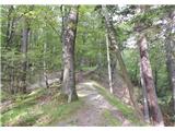 14
14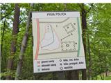 15
15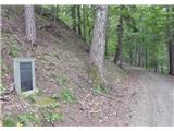 16
16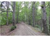 17
17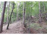 18
18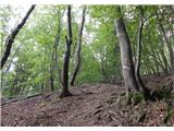 19
19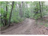 20
20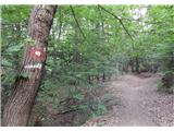 21
21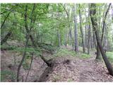 22
22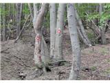 23
23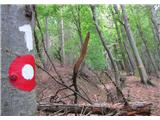 24
24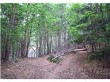 25
25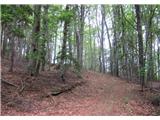 26
26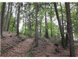 27
27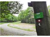 28
28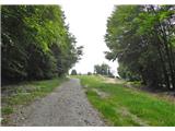 29
29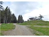 30
30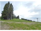 31
31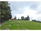 32
32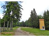 33
33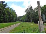 34
34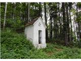 35
35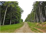 36
36 37
37 38
38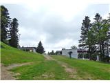 39
39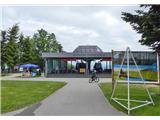 40
40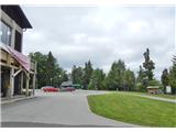 41
41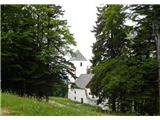 42
42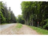 43
43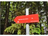 44
44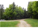 45
45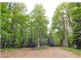 46
46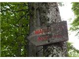 47
47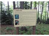 48
48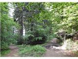 49
49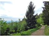 50
50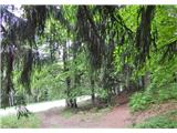 51
51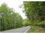 52
52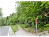 53
53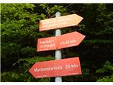 54
54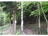 55
55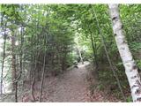 56
56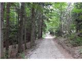 57
57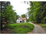 58
58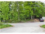 59
59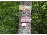 60
60 61
61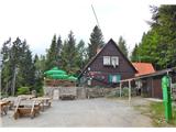 62
62
Discussion about the trip Spodnje Radvanje - Mariborska koča
|
| headstar12. 09. 2015 |
The described trail does not entirely follow the Slovenska planinska pot. Between pictures No. 9 and 15, a shortcut is described that some use.
|
|
|
|
| Enka14. 10. 2017 |
Is there a stamp at the start of SPP (picture 3)?
|
|
|
|
| Ninđa14. 10. 2017 |
@enka Yes 
Best, Nino
|
|
|
|
| Enka14. 10. 2017 |
Thanks Nino! 
|
|
|
|
| piotr14. 10. 2017 |
This won't hold, since from the establishment of SPP it has been that we get the first stamp at Mariborska koča.
|
|
|
|
| garmont14. 10. 2017 |
In the latest edition of the SPP booklet, the first SPP point has been changed.
What can you do, new times...
|
|
|
|
| Enka15. 10. 2017 |
Yes, in my booklet the first point is Spodnje Radvanje
|
|
|
|
| wildjj16. 10. 2017 |
The last point of SPP is no longer Ankaran, but Debeli Rtič. It depends on the year of the logbook edition.
All versions apply. For Spodnje Radvanje this is perfectly fine. The hike across Pohorje must start down in Maribor. Those mere three hours and about 800m of ascent are not too bad. And it's a very nice trail.
|
|
|
|
| ČRIČEK9. 08. 2018 |
In the new Dnevnik of the Slovenian hiking trail under no. 1 there is also the stamp Spodnje Radvanje. Where is this STAMP located.
Nice hiking greeting.
|
|
|
|
| ČRIČEK9. 08. 2018 |
I have walked this trail at least a hundred times in the past 50 years, but really not a few years ago. Now I'm doing the traverse again and didn't want to miss the starting stamp. Thanks everyone for the info.
|
|
|
|
| Enka10. 08. 2018 |
Actually picture 3 is more accurate. On that (or neighboring?) pillar where this sign is, there is a stamp box.
|
|
|
|
| NYG10. 08. 2018 |
On the neighboring one.
stamp
|
|
|
|
| glorija20. 03. 2019 |
Here's my info on where the stamp for the SPP trail start is....From Ljubljana direction J continue towards Pohorje.Later, when arriving via Streliška to the roundabout, take the 2nd exit (i.e. straight). It's written that the trail starts at Streliška 70 (i.e. real trail start picture 2), but the stamp is at (picture no.3)-Trail to the trenches ....or another explanation; when driving along Streliška to the roundabout take the 2nd exit and after ca. 20m turn left to Trail to the trenches picture no.3-Sp Razvanje.I wrote this because some acquaintances were also looking for the stamp and apparently it's hard to find..
|
|
|
|
| karibu22. 03. 2019 |
The stamp is located on the street Pot na okope on the power pole next to the SPP start sign. Nothing to look for
|
|
|
To post a comment you must log in:
If you do not yet have a username, you must first
register.