Spodnje Tinsko - Tinska gora
Starting point: Spodnje Tinsko (227 m)
| Latitude/Longitude: | 46,17545°N 15,55344°E |
| |
Walking time: 30 min
Difficulty: easy marked way
Elevation gain: 182 m
Elevation difference along the route: 182 m
Map:
Recommended equipment (summer):
Recommended equipment (winter):
Views: 108
 | 1 person like this post |
Access to starting point:
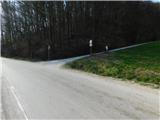
a) Leave the Ljubljana-Maribor motorway at the Dramlje exit, then follow the signs for Šentjur. From the centre of Šentjur, continue briefly towards the settlement of Šmarje pri Jelšah, but soon turn right onto the road to Podsredi and Planina pri Sevnici. When Šentjur ends, soon turn left from the main road in the direction of Podsrede, Kozje and Gorica pri Slivnici. Upon arriving at the settlement of Gorica pri Slivnici, from the roundabout take the exit for Sodno vas and Sv. Štefan. When Gorica pri Slivnici ends, the road leads along Slivniško jezero, but we follow the main road to Loka pri Žusmu and a little further to the settlement of Tinsko. In the settlement of Tinsko, i.e. Spodnje Tinsko, we reach a junction where a road branches off to the left, closed to public traffic in winter, and where we also notice the hiking markers on the same sign. The described trail starts at the junction, but there are no suitable parking spaces at the beginning of the trail.
b) From the Šentjur-Rogaška Slatina road, between the settlements of Šmarje pri Jelšah and Mestinje, turn right (from the direction of Rogaška Slatina, left) towards Podčetrtek. Continue following the road to Podčetrtek; after the settlement of Pristava pri Mestinju, soon turn right towards Gorica and Slivnica. Continue through Roginska Gorca to the settlement of Tinsko, i.e. Spodnje Tinsko, where we reach a junction from which a road branches off to the right, closed to public traffic in winter, and where we notice the hiking markers on the same sign. The described trail starts at the junction, but there are no suitable parking spaces at the beginning of the trail.
Route description:
From the starting point, head onto the side road that branches off the main road to the north and immediately begins to climb. The path leads us in two hairpin turns past a house, after which increasingly beautiful views open up. Higher up, the road becomes quite steep and brings us in a few hairpin turns between two older houses. Above them, the road climbs even more steeply and brings us in a traverse up to the saddle on the ridge of Tinski vrh.
Here, continue right (left to the churches on Tinski vrh – 3 minutes) and in one or two minutes climb to the stamp and logbook box on Tinska gora.
On the way back, it is worth making a short detour to both churches, where you can view the information boards about the history of the place.
Description and photos refer to the condition in March 2026.
Photos:
 1
1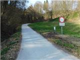 2
2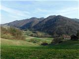 3
3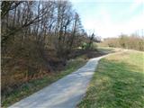 4
4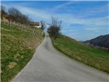 5
5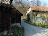 6
6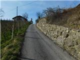 7
7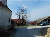 8
8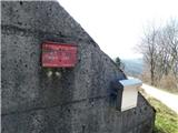 9
9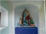 10
10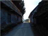 11
11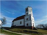 12
12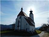 13
13
Discussion about the trip Spodnje Tinsko - Tinska gora
To post a comment you must log in:
If you do not yet have a username, you must first
register.